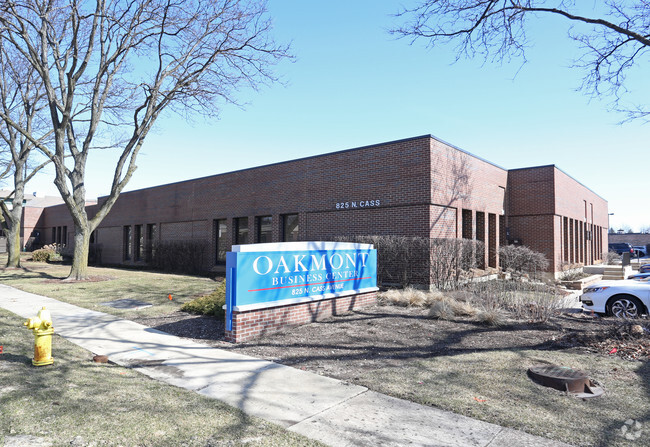
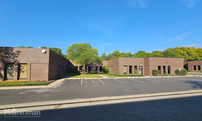
Property Record
708 N Drexel Ave, Aurora, IL 60505

Current Lease Availabilities
Property Detail
708 N Drexel Ave
07-21-200-046
NAPERVILLE CENTER FOR COMMERCE & INDUSTRY UNIT NO 7 ALL
Commercialnec
DUPAGE
C
Illinois
B and X Area of moderate flood hazard, usually the area between the limits of the 100-year and 500-year floods.
1
2024
Eastern East/West Corr
2024
Chicago
846411
Chicago-Naperville-Elgin, IL-IN
NEARBY LISTINGS FOR SALE OR LEASE
DEMOGRAPHICS near 708 N Drexel Ave
1 mile
3 mile
5 mile
2025 Total Population
10,462
99,910
268,491
2030 Population
10,652
102,261
273,453
Pop Growth 2025-2030
+ 1.82%
+ 2.35%
+ 1.85%
Average Age
44
42
43
2025 Total Households
4,219
39,918
105,260
HH Growth 2025-2030
+ 1.66%
+ 2.40%
+ 1.91%
Median Household Inc
$106,872
$113,432
$114,903
Avg Household Size
2.40
2.40
2.50
2025 Avg HH Vehicles
2.00
2.00
2.00
Median Home Value
$452,553
$516,412
$447,462
Median Year Built
1976
1975
1973
Nearby Places
Map Layers
Map Styles
 Street
 Aerial
Layers
 Traffic
 Biking
Places
Listings with unknown addresses are not visible on the map
- Restaurants
- Banks
- Shops
- Fitness
- Groceries
PUBLIC TRANSPORTATION
COMMUTER RAIL
Route 59 Station (Burlington Northern-Santa Fe Railway Line - Northeast Illinois Regional Commuter Railroad (Metra))
Drive
Walk
Distance
Route 59 Station (Burlington Northern-Santa Fe Railway Line - Northeast Illinois Regional Commuter Railroad (Metra))
6 min
2.3 mi
Naperville Station (Burlington Northern-Santa Fe Railway Line - Northeast Illinois Regional Commuter Railroad (Metra))
Drive
Walk
Distance
Naperville Station (Burlington Northern-Santa Fe Railway Line - Northeast Illinois Regional Commuter Railroad (Metra))
11 min
5.0 mi
AIRPORT
Chicago Midway International
Drive
Walk
Distance
Chicago Midway International
45 min
27.4 mi
Chicago O'Hare International
Drive
Walk
Distance
Chicago O'Hare International
48 min
32.3 mi
Freight Ports
Port Milwaukee
Drive
Walk
Distance
Port Milwaukee
129 min
104.1 mi
Nearby Properties
Address
Land Use
TOTAL SIZE
Lot Size
Zoning
Address
Land Use
TOTAL SIZE
Lot Size
Zoning
916,143 SF
32.66 AC
Address
Land Use
TOTAL SIZE
Lot Size
Zoning
28.52 AC
R
Address
Land Use
TOTAL SIZE
Lot Size
Zoning
29.20 AC
C
Address
Land Use
TOTAL SIZE
Lot Size
Zoning
20.60 AC
Address
Land Use
TOTAL SIZE
Lot Size
Zoning
41.42 AC
Address
Land Use
TOTAL SIZE
Lot Size
Zoning
31.66 AC
C
Address
Land Use
TOTAL SIZE
Lot Size
Zoning
19.92 AC
C
Address
Land Use
TOTAL SIZE
Lot Size
Zoning
17.70 AC
Address
Land Use
TOTAL SIZE
Lot Size
Zoning
Address
Land Use
TOTAL SIZE
Lot Size
Zoning
Address
Land Use
TOTAL SIZE
Lot Size
Zoning
797,399 SF
52.38 AC
C
Address
Land Use
TOTAL SIZE
Lot Size
Zoning
829,087 SF
35.83 AC
C
Address
Land Use
TOTAL SIZE
Lot Size
Zoning
272,400 SF
20.94 AC
C
Address
Land Use
TOTAL SIZE
Lot Size
Zoning
315,328 SF
5.06 AC
Address
Land Use
TOTAL SIZE
Lot Size
Zoning
25 AC
M
Address
Land Use
TOTAL SIZE
Lot Size
Zoning
283,844 SF
16.06 AC
M
Address
Land Use
TOTAL SIZE
Lot Size
Zoning
20.97 AC
R
Address
Land Use
TOTAL SIZE
Lot Size
Zoning
17.84 AC
M
Address
Land Use
TOTAL SIZE
Lot Size
Zoning
16.15 AC
M
Address
Land Use
TOTAL SIZE
Lot Size
Zoning
15.61 AC
M
Address
Land Use
TOTAL SIZE
Lot Size
Zoning
239,418 SF
21.27 AC
C
Address
Land Use
TOTAL SIZE
Lot Size
Zoning
505,720 SF
27.67 AC
Address
Land Use
TOTAL SIZE
Lot Size
Zoning
522,457 SF
29.33 AC
I
Address
Land Use
TOTAL SIZE
Lot Size
Zoning
16.86 AC
C
Address
Land Use
TOTAL SIZE
Lot Size
Zoning
397,771 SF
22.12 AC
Address
Land Use
TOTAL SIZE
Lot Size
Zoning
12.70 AC
Address
Land Use
TOTAL SIZE
Lot Size
Zoning
11.02 AC
M
Address
Land Use
TOTAL SIZE
Lot Size
Zoning
9.83 AC
C
Address
Land Use
TOTAL SIZE
Lot Size
Zoning
293,121 SF
9.50 AC
Address
Land Use
TOTAL SIZE
Lot Size
Zoning
594,880 SF
29.15 AC
I
The World's #1 Commercial Real Estate Marketplace
Connect with us
© 2026 CoStar Group
The information above has been obtained from sources believed reliable. While we do not doubt its accuracy we have not verified it and make no guarantee, warranty or representation about it. It is your responsibility to independently confirm its accuracy and completeness. Any projections, opinions, assumptions, or estimates used are for example only and do not represent the current or future performance of the property. The value of this transaction to you depends on tax and other factors which should be evaluated by your tax, financial, and legal advisors. You and your advisors should conduct a careful, independent investigation of the property to determine to your satisfaction the suitability of the property for your needs.