Property Record
708 N Main St, Blacksburg, VA 24060


NEARBY LISTINGS FOR SALE OR LEASE
Property Detail
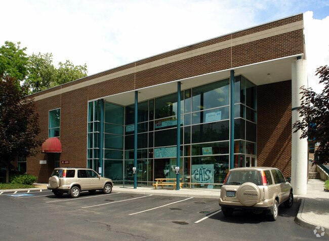
708 N Main St
Blacksburg-Christiansburg-Radford, VA
Y B Keister Add
002426
Y B KEISTER ADD LOTS 1,2 PT 3 SEC 1
Commercialnec
Montgomery
X
Virginia
51121C0131C
1-2
2025
0.51 AC
2025
Downtown Blacksburg
020500
Other Market Areas
13,154 SF
DEMOGRAPHICS near 708 N Main St
1 Mile
3 Mile
5 Mile
2024 Total Population
13,724
38,176
47,185
2029 Population
13,513
37,861
46,782
Pop Growth 2024-2029
(1.54%)
(0.83%)
(0.85%)
Average Age
28
33
35
2024 Total Households
6,081
16,352
20,177
HH Growth 2024-2029
(1.60%)
(0.89%)
(0.91%)
Median Household Inc
$19,497
$39,196
$47,540
Avg Household Size
2.20
2.30
2.30
2024 Avg HH Vehicles
2.00
2.00
2.00
Median Home Value
$357,928
$396,251
$376,546
Median Year Built
1982
1986
1987
Nearby Places
Map Layers
Map Styles
 Street
 Aerial
- Restaurants
- Banks
- Shops
- Fitness
- Groceries
PUBLIC TRANSPORTATION
AIRPORT
Roanoke/Blacksburg Regional (Woodrum Field)
DRIVE
WALK
Distance
Roanoke/Blacksburg Regional (Woodrum Field)
58 min
41.9 mi
SALE & LEASE HISTORY
LISTING DATE
SALE/LEASE

Sep 25, 2016
For Lease
Oct 03, 2016
For Lease
Nearby Properties
Address
Land Use
TOTAL SIZE
Lot Size
Zoning
Address
Land Use
TOTAL SIZE
Lot Size
Zoning
190,465 SF
129.62 AC
RR-1
Address
Land Use
TOTAL SIZE
Lot Size
Zoning
Address
Land Use
TOTAL SIZE
Lot Size
Zoning
41.51 AC
PR
Address
Land Use
TOTAL SIZE
Lot Size
Zoning
120,948 SF
15.28 AC
RM-48
Address
Land Use
TOTAL SIZE
Lot Size
Zoning
134,784 SF
21.21 AC
PR
Address
Land Use
TOTAL SIZE
Lot Size
Zoning
224,316 SF
6.10 AC
RM48
Address
Land Use
TOTAL SIZE
Lot Size
Zoning
31,178 SF
7.33 AC
RM48
Address
Land Use
TOTAL SIZE
Lot Size
Zoning
3.23 AC
DC
Address
Land Use
TOTAL SIZE
Lot Size
Zoning
47,153 SF
30.90 AC
R&D
Address
Land Use
TOTAL SIZE
Lot Size
Zoning
50,000 SF
25.93 AC
R&D
Address
Land Use
TOTAL SIZE
Lot Size
Zoning
230,692 SF
12.90 AC
PR
Address
Land Use
TOTAL SIZE
Lot Size
Zoning
4,332 SF
24.35 AC
RM-48
Address
Land Use
TOTAL SIZE
Lot Size
Zoning
212,497 SF
10.75 AC
PR
Address
Land Use
TOTAL SIZE
Lot Size
Zoning
50,728 SF
14.25 AC
PR
Address
Land Use
TOTAL SIZE
Lot Size
Zoning
125,184 SF
9.12 AC
RM-48
Address
Land Use
TOTAL SIZE
Lot Size
Zoning
7.38 AC
R&D
Address
Land Use
TOTAL SIZE
Lot Size
Zoning
197,024 SF
9.86 AC
PR
Address
Land Use
TOTAL SIZE
Lot Size
Zoning
183,569 SF
8.38 AC
PR
Address
Land Use
TOTAL SIZE
Lot Size
Zoning
33,716 SF
15.72 AC
R&D
Address
Land Use
TOTAL SIZE
Lot Size
Zoning
140,302 SF
1.09 AC
DC
Address
Land Use
TOTAL SIZE
Lot Size
Zoning
7,820 SF
58.14 AC
R&D
Address
Land Use
TOTAL SIZE
Lot Size
Zoning
5.58 AC
MXD
Address
Land Use
TOTAL SIZE
Lot Size
Zoning
150,108 SF
8.19 AC
PR
Address
Land Use
TOTAL SIZE
Lot Size
Zoning
124,356 SF
4.79 AC
RM-48
Address
Land Use
TOTAL SIZE
Lot Size
Zoning
111,728 SF
8.11 AC
PR
Address
Land Use
TOTAL SIZE
Lot Size
Zoning
125,388 SF
5.68 AC
RM-48
Address
Land Use
TOTAL SIZE
Lot Size
Zoning
127,968 SF
5.63 AC
RM-48
Address
Land Use
TOTAL SIZE
Lot Size
Zoning
148,695 SF
7.97 AC
PR
Address
Land Use
TOTAL SIZE
Lot Size
Zoning
147,862 SF
7.73 AC
PR
Address
Land Use
TOTAL SIZE
Lot Size
Zoning
3.47 AC
MXD
The World's #1 Commercial Real Estate Marketplace
Connect with us
© 2025 CoStar Group
The information above has been obtained from sources believed reliable. While we do not doubt its accuracy we have not verified it and make no guarantee, warranty or representation about it. It is your responsibility to independently confirm its accuracy and completeness. Any projections, opinions, assumptions, or estimates used are for example only and do not represent the current or future performance of the property. The value of this transaction to you depends on tax and other factors which should be evaluated by your tax, financial, and legal advisors. You and your advisors should conduct a careful, independent investigation of the property to determine to your satisfaction the suitability of the property for your needs.