Property Record
708 N Nellis Blvd, Las Vegas, NV 89110


NEARBY LISTINGS FOR SALE OR LEASE
Property Detail
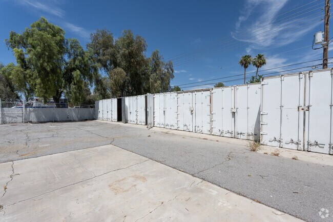
708 N Nellis Blvd
Las Vegas-Henderson-Paradise, NV
Parcel Map File 70 Page 42
140-33-101-010
PARCEL MAP FILE 70 PAGE 42 LOT 1 & LOT 2
Storebuilding
Clark
X
Nevada
32003C2195F
1
2025
1.33 AC
2025
Northeast Las Vegas
004920
Las Vegas
22,561 SF
DEMOGRAPHICS near 708 N Nellis Blvd
1 Mile
3 Mile
5 Mile
2024 Total Population
26,292
212,397
430,348
2029 Population
27,973
226,855
459,717
Pop Growth 2024-2029
+ 6.39%
+ 6.81%
+ 6.82%
Average Age
35
36
36
2024 Total Households
7,879
67,808
143,516
HH Growth 2024-2029
+ 6.35%
+ 6.81%
+ 6.85%
Median Household Inc
$41,579
$42,838
$42,229
Avg Household Size
3.30
3.00
2.90
2024 Avg HH Vehicles
2.00
2.00
2.00
Median Home Value
$246,508
$242,641
$248,243
Median Year Built
1985
1988
1984
Nearby Places
Map Layers
Map Styles
 Street
 Aerial
- Restaurants
- Banks
- Shops
- Fitness
- Groceries
PUBLIC TRANSPORTATION
AIRPORT
Harry Reid International
DRIVE
WALK
Distance
Harry Reid International
20 min
11.9 mi
Boulder City Municipal
DRIVE
WALK
Distance
Boulder City Municipal
34 min
23.2 mi
SALE & LEASE HISTORY
LISTING DATE
SALE/LEASE

Jun 04, 2024
For Sale
Jan 22, 2024
For Lease
Jan 12, 2024
For Sale
Aug 09, 2023
For Sale
Nearby Properties
Address
Land Use
TOTAL SIZE
Lot Size
Zoning
Address
Land Use
TOTAL SIZE
Lot Size
Zoning
345,133 SF
27.01 AC
H1
Address
Land Use
TOTAL SIZE
Lot Size
Zoning
35.95 AC
PF
Address
Land Use
TOTAL SIZE
Lot Size
Zoning
137.65 AC
Address
Land Use
TOTAL SIZE
Lot Size
Zoning
67,649 SF
13.42 AC
CV
Address
Land Use
TOTAL SIZE
Lot Size
Zoning
29.35 AC
CV
Address
Land Use
TOTAL SIZE
Lot Size
Zoning
15.95 AC
PF
Address
Land Use
TOTAL SIZE
Lot Size
Zoning
43.25 AC
PF
Address
Land Use
TOTAL SIZE
Lot Size
Zoning
20.91 AC
PF
Address
Land Use
TOTAL SIZE
Lot Size
Zoning
1,008 SF
31.47 AC
PF
Address
Land Use
TOTAL SIZE
Lot Size
Zoning
58,188 SF
20.04 AC
L:C-V
Address
Land Use
TOTAL SIZE
Lot Size
Zoning
4.34 AC
RE
Address
Land Use
TOTAL SIZE
Lot Size
Zoning
19.30 AC
RE
Address
Land Use
TOTAL SIZE
Lot Size
Zoning
7,908 SF
24.13 AC
R4
Address
Land Use
TOTAL SIZE
Lot Size
Zoning
223,422 SF
18.21 AC
R3
Address
Land Use
TOTAL SIZE
Lot Size
Zoning
9,044 SF
8.62 AC
Address
Land Use
TOTAL SIZE
Lot Size
Zoning
2,926 SF
19.73 AC
R3
Address
Land Use
TOTAL SIZE
Lot Size
Zoning
3,183 SF
18.35 AC
R3
Address
Land Use
TOTAL SIZE
Lot Size
Zoning
307,997 SF
14.01 AC
Address
Land Use
TOTAL SIZE
Lot Size
Zoning
3,424 SF
14.53 AC
R3
Address
Land Use
TOTAL SIZE
Lot Size
Zoning
9.11 AC
PF
Address
Land Use
TOTAL SIZE
Lot Size
Zoning
11.69 AC
CV
Address
Land Use
TOTAL SIZE
Lot Size
Zoning
321,292 SF
16.67 AC
R3
Address
Land Use
TOTAL SIZE
Lot Size
Zoning
8.87 AC
PF
Address
Land Use
TOTAL SIZE
Lot Size
Zoning
231,434 SF
20.31 AC
M
Address
Land Use
TOTAL SIZE
Lot Size
Zoning
8.39 AC
CV
Address
Land Use
TOTAL SIZE
Lot Size
Zoning
11.81 AC
RE
Address
Land Use
TOTAL SIZE
Lot Size
Zoning
4,236 SF
0.61 AC
R4
Address
Land Use
TOTAL SIZE
Lot Size
Zoning
5,425 SF
14.38 AC
C:R-4
Address
Land Use
TOTAL SIZE
Lot Size
Zoning
2,689 SF
11.72 AC
R4
Address
Land Use
TOTAL SIZE
Lot Size
Zoning
3,012 SF
12.80 AC
R3
The World's #1 Commercial Real Estate Marketplace
Connect with us
© 2025 CoStar Group
The information above has been obtained from sources believed reliable. While we do not doubt its accuracy we have not verified it and make no guarantee, warranty or representation about it. It is your responsibility to independently confirm its accuracy and completeness. Any projections, opinions, assumptions, or estimates used are for example only and do not represent the current or future performance of the property. The value of this transaction to you depends on tax and other factors which should be evaluated by your tax, financial, and legal advisors. You and your advisors should conduct a careful, independent investigation of the property to determine to your satisfaction the suitability of the property for your needs.