Property Record
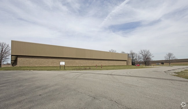
7080 Industrial Rd, Florence, KY 41042


Property Detail
7080 Industrial Rd
005-00-00-007.00
41.884 ACRES NS INDUSTRIAL RD ES OF C & O RR ORIGINAL SIGNODE PROPERTY
Commercialnec
Kenton
B and X Area of moderate flood hazard, usually the area between the limits of the 100-year and 500-year floods.
Kentucky
2025
41.88 AC
2025
Florence/Richwood
063607
Cincinnati/Dayton
390,383 SF
Cincinnati, OH-KY-IN
NEARBY LISTINGS FOR SALE OR LEASE
DEMOGRAPHICS near 7080 Industrial Rd
1 mile
3 mile
5 mile
2025 Total Population
4,743
70,079
155,104
2030 Population
4,865
73,111
161,983
Pop Growth 2025-2030
+ 2.57%
+ 4.33%
+ 4.44%
Average Age
37
38
39
2025 Total Households
1,778
27,103
58,643
HH Growth 2025-2030
+ 2.64%
+ 4.35%
+ 4.47%
Median Household Inc
$61,495
$69,594
$83,432
Avg Household Size
2.50
2.50
2.60
2025 Avg HH Vehicles
2.00
2.00
2.00
Median Home Value
$157,075
$214,236
$256,146
Median Year Built
1978
1982
1990
Nearby Places
Map Layers
Map Styles
 Street
 Aerial
Layers
 Traffic
 Biking
Places
Listings with unknown addresses are not visible on the map
- Restaurants
- Banks
- Shops
- Fitness
- Groceries
PUBLIC TRANSPORTATION
AIRPORT
Cincinnati/Northern Kentucky International
Drive
Walk
Distance
Cincinnati/Northern Kentucky International
18 min
7.0 mi
Freight Ports
Port of Toledo
Drive
Walk
Distance
Port of Toledo
260 min
219.0 mi
Nearby Properties
Address
Land Use
TOTAL SIZE
Lot Size
Zoning
Address
Land Use
TOTAL SIZE
Lot Size
Zoning
672.11 AC
Address
Land Use
TOTAL SIZE
Lot Size
Zoning
Address
Land Use
TOTAL SIZE
Lot Size
Zoning
43.58 AC
Address
Land Use
TOTAL SIZE
Lot Size
Zoning
70.34 AC
Address
Land Use
TOTAL SIZE
Lot Size
Zoning
96.46 AC
Address
Land Use
TOTAL SIZE
Lot Size
Zoning
19.61 AC
Address
Land Use
TOTAL SIZE
Lot Size
Zoning
73,908 SF
94.57 AC
Address
Land Use
TOTAL SIZE
Lot Size
Zoning
13.62 AC
Address
Land Use
TOTAL SIZE
Lot Size
Zoning
Address
Land Use
TOTAL SIZE
Lot Size
Zoning
1,170 SF
41.17 AC
Address
Land Use
TOTAL SIZE
Lot Size
Zoning
775,680 SF
44.84 AC
Address
Land Use
TOTAL SIZE
Lot Size
Zoning
32,250 SF
27.69 AC
Address
Land Use
TOTAL SIZE
Lot Size
Zoning
Address
Land Use
TOTAL SIZE
Lot Size
Zoning
1,824 SF
7.68 AC
Address
Land Use
TOTAL SIZE
Lot Size
Zoning
27.21 AC
Address
Land Use
TOTAL SIZE
Lot Size
Zoning
14.47 AC
Address
Land Use
TOTAL SIZE
Lot Size
Zoning
112 SF
41.40 AC
Address
Land Use
TOTAL SIZE
Lot Size
Zoning
107,125 SF
12.49 AC
Address
Land Use
TOTAL SIZE
Lot Size
Zoning
24.28 AC
Address
Land Use
TOTAL SIZE
Lot Size
Zoning
39.05 AC
Address
Land Use
TOTAL SIZE
Lot Size
Zoning
4.62 AC
Address
Land Use
TOTAL SIZE
Lot Size
Zoning
57,030 SF
7 AC
Address
Land Use
TOTAL SIZE
Lot Size
Zoning
Address
Land Use
TOTAL SIZE
Lot Size
Zoning
17.20 AC
Address
Land Use
TOTAL SIZE
Lot Size
Zoning
20,320 SF
10.33 AC
Address
Land Use
TOTAL SIZE
Lot Size
Zoning
1,540 SF
19.04 AC
Address
Land Use
TOTAL SIZE
Lot Size
Zoning
78,848 SF
6.82 AC
Address
Land Use
TOTAL SIZE
Lot Size
Zoning
17.16 AC
Address
Land Use
TOTAL SIZE
Lot Size
Zoning
Address
Land Use
TOTAL SIZE
Lot Size
Zoning
341,388 SF
21.76 AC
The World's #1 Commercial Real Estate Marketplace
Connect with us
© 2026 CoStar Group
The information above has been obtained from sources believed reliable. While we do not doubt its accuracy we have not verified it and make no guarantee, warranty or representation about it. It is your responsibility to independently confirm its accuracy and completeness. Any projections, opinions, assumptions, or estimates used are for example only and do not represent the current or future performance of the property. The value of this transaction to you depends on tax and other factors which should be evaluated by your tax, financial, and legal advisors. You and your advisors should conduct a careful, independent investigation of the property to determine to your satisfaction the suitability of the property for your needs.