Property Record
7080 W Highway 290, Dripping Springs, TX 78620


Current Lease Availabilities
NEARBY LISTINGS FOR SALE OR LEASE
-
-
View all Dripping Springs listings for lease on LoopNet.com
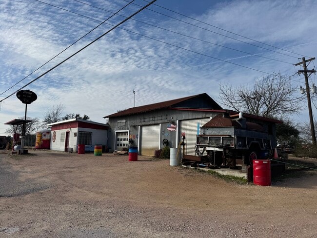
Property Detail
7080 W Highway 290
R10963
William H Haggard Survey
Vacantlandnec
A0008 WILLIAM H HAGGARD SURVEY, ACRES 1.07
X
Hays
48209C0100F
Texas
2024
1.07 AC
2025
Hays County
010817
Austin
3,068 SF
Austin-Round Rock-San Marcos, TX
DEMOGRAPHICS near 7080 W Highway 290
1 mile
3 mile
5 mile
2024 Total Population
295
1,312
3,058
2029 Population
382
1,694
3,966
Pop Growth 2024-2029
+ 29.49%
+ 29.12%
+ 29.69%
Average Age
43
43
44
2024 Total Households
111
503
1,160
HH Growth 2024-2029
+ 30.63%
+ 30.02%
+ 30.34%
Median Household Inc
$114,583
$111,887
$114,663
Avg Household Size
2.70
2.60
2.60
2024 Avg HH Vehicles
2.00
2.00
2.00
Median Home Value
$615,000
$617,924
$634,979
Median Year Built
1998
1998
1998
Nearby Places
Map Layers
Map Styles
 Street
 Aerial
Transit
 Traffic
 Biking
Places
Listings with unknown addresses are not visible on the map
- Restaurants
- Banks
- Shops
- Fitness
- Groceries
Nearby Properties
Address
Land Use
TOTAL SIZE
Lot Size
Zoning
Address
Land Use
TOTAL SIZE
Lot Size
Zoning
2,328 SF
105.35 AC
Address
Land Use
TOTAL SIZE
Lot Size
Zoning
888 SF
5.93 AC
Address
Land Use
TOTAL SIZE
Lot Size
Zoning
6,298 SF
4.16 AC
Address
Land Use
TOTAL SIZE
Lot Size
Zoning
3,000 SF
10.40 AC
Address
Land Use
TOTAL SIZE
Lot Size
Zoning
7,836 SF
589.22 AC
Address
Land Use
TOTAL SIZE
Lot Size
Zoning
48,097 SF
5 AC
Address
Land Use
TOTAL SIZE
Lot Size
Zoning
6,226 SF
5.01 AC
Address
Land Use
TOTAL SIZE
Lot Size
Zoning
4,274 SF
35.31 AC
Address
Land Use
TOTAL SIZE
Lot Size
Zoning
7,760 SF
3.14 AC
Address
Land Use
TOTAL SIZE
Lot Size
Zoning
4,937 SF
3 AC
Address
Land Use
TOTAL SIZE
Lot Size
Zoning
344,392 SF
18.21 AC
Address
Land Use
TOTAL SIZE
Lot Size
Zoning
4,763 SF
5.01 AC
Address
Land Use
TOTAL SIZE
Lot Size
Zoning
3,021 SF
5.01 AC
Address
Land Use
TOTAL SIZE
Lot Size
Zoning
19,069 SF
104.04 AC
Address
Land Use
TOTAL SIZE
Lot Size
Zoning
Address
Land Use
TOTAL SIZE
Lot Size
Zoning
3,181 SF
6.50 AC
Address
Land Use
TOTAL SIZE
Lot Size
Zoning
10,053 SF
8 AC
Address
Land Use
TOTAL SIZE
Lot Size
Zoning
4,375 SF
9.50 AC
Address
Land Use
TOTAL SIZE
Lot Size
Zoning
4,490 SF
10.01 AC
Address
Land Use
TOTAL SIZE
Lot Size
Zoning
3,354 SF
6.01 AC
Address
Land Use
TOTAL SIZE
Lot Size
Zoning
5,000 SF
28.01 AC
Address
Land Use
TOTAL SIZE
Lot Size
Zoning
2,262 SF
7.47 AC
Address
Land Use
TOTAL SIZE
Lot Size
Zoning
5,329 SF
10.51 AC
Address
Land Use
TOTAL SIZE
Lot Size
Zoning
4,002 SF
5.02 AC
Address
Land Use
TOTAL SIZE
Lot Size
Zoning
4,553 SF
5.69 AC
Address
Land Use
TOTAL SIZE
Lot Size
Zoning
4,418 SF
5.01 AC
Address
Land Use
TOTAL SIZE
Lot Size
Zoning
4,630 SF
3.50 AC
Address
Land Use
TOTAL SIZE
Lot Size
Zoning
3,209 SF
10.41 AC
Address
Land Use
TOTAL SIZE
Lot Size
Zoning
6,566 SF
15 AC
Address
Land Use
TOTAL SIZE
Lot Size
Zoning
6,456 SF
7.36 AC
The World's #1 Commercial Real Estate Marketplace
Connect with us
© 2026 CoStar Group
The information above has been obtained from sources believed reliable. While we do not doubt its accuracy we have not verified it and make no guarantee, warranty or representation about it. It is your responsibility to independently confirm its accuracy and completeness. Any projections, opinions, assumptions, or estimates used are for example only and do not represent the current or future performance of the property. The value of this transaction to you depends on tax and other factors which should be evaluated by your tax, financial, and legal advisors. You and your advisors should conduct a careful, independent investigation of the property to determine to your satisfaction the suitability of the property for your needs.