Property Record
7081 Feder Rd, Galloway, OH 43119
NEARBY LISTINGS FOR SALE OR LEASE
Property Detail
7081 Feder Rd
Columbus, OH
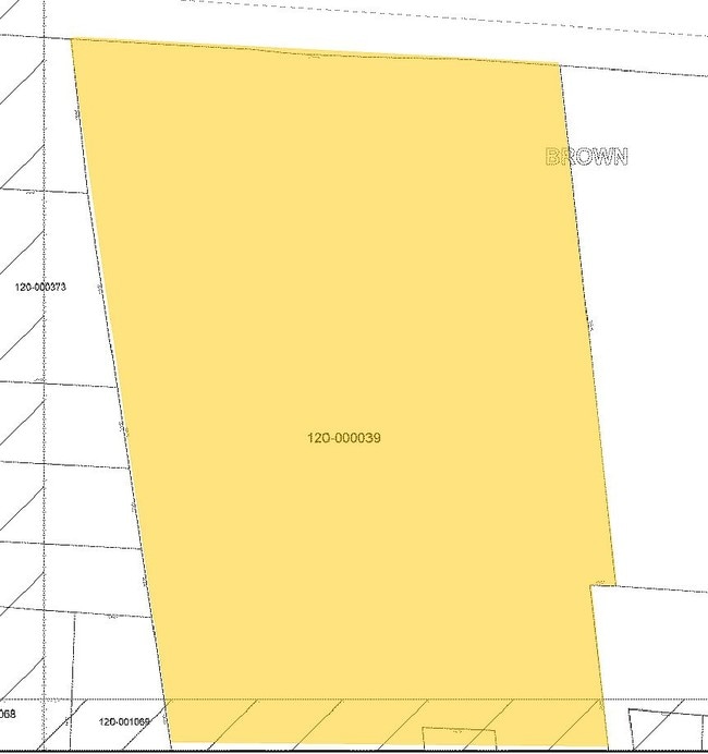
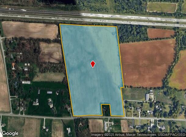
Virginia Military Survey #7071
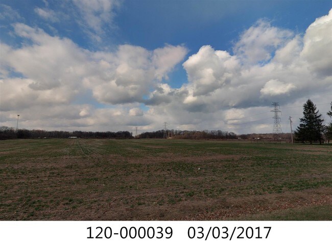
120-000039
FEDER RD OQ 340 ENTRY 7071 42.898 ACRES
Recreationalacreage
Franklin
2024
Ohio
2024
42.90 AC
008170
Southwest
2,698 SF
Columbus
DEMOGRAPHICS near 7081 Feder Rd
1 Mile
3 Mile
5 Mile
2024 Total Population
458
42,244
119,210
2029 Population
457
41,792
118,631
Pop Growth 2024-2029
(0.22%)
(1.07%)
(0.49%)
Average Age
38
35
36
2024 Total Households
160
16,415
45,627
HH Growth 2024-2029
(0.63%)
(1.08%)
(0.52%)
Median Household Inc
$135,227
$84,607
$74,415
Avg Household Size
2.80
2.50
2.60
2024 Avg HH Vehicles
2.00
2.00
2.00
Median Home Value
$451,851
$247,785
$235,727
Median Year Built
1994
1995
1991
Nearby Places
Map Layers
Map Styles
 Street
 Aerial
- Restaurants
- Banks
- Shops
- Fitness
- Groceries
PUBLIC TRANSPORTATION
AIRPORT
John Glenn Columbus International
DRIVE
WALK
Distance
John Glenn Columbus International
25 min
17.7 mi
Rickenbacker International
DRIVE
WALK
Distance
Rickenbacker International
32 min
22.4 mi
Freight Ports
Port of Toledo
DRIVE
WALK
Distance
Port of Toledo
185 min
133.7 mi
SALE & LEASE HISTORY
LISTING DATE
SALE/LEASE

Oct 12, 2022
For Sale
Jun 13, 2018
For Sale
Nearby Properties
Address
Land Use
TOTAL SIZE
Lot Size
Zoning
Address
Land Use
TOTAL SIZE
Lot Size
Zoning
417,762 SF
119.53 AC
Address
Land Use
TOTAL SIZE
Lot Size
Zoning
538,680 SF
32.49 AC
Address
Land Use
TOTAL SIZE
Lot Size
Zoning
155,280 SF
9.42 AC
Address
Land Use
TOTAL SIZE
Lot Size
Zoning
25,368 SF
27.23 AC
Address
Land Use
TOTAL SIZE
Lot Size
Zoning
96,602 SF
10.78 AC
Address
Land Use
TOTAL SIZE
Lot Size
Zoning
24,736 SF
29.55 AC
Address
Land Use
TOTAL SIZE
Lot Size
Zoning
62,400 SF
9.02 AC
Address
Land Use
TOTAL SIZE
Lot Size
Zoning
40,500 SF
20.91 AC
Address
Land Use
TOTAL SIZE
Lot Size
Zoning
131,116 SF
15.30 AC
Address
Land Use
TOTAL SIZE
Lot Size
Zoning
149,424 SF
39.15 AC
Address
Land Use
TOTAL SIZE
Lot Size
Zoning
137,350 SF
11.01 AC
Address
Land Use
TOTAL SIZE
Lot Size
Zoning
249,644 SF
7.15 AC
Address
Land Use
TOTAL SIZE
Lot Size
Zoning
55,758 SF
7.83 AC
Address
Land Use
TOTAL SIZE
Lot Size
Zoning
121,403 SF
50.93 AC
Address
Land Use
TOTAL SIZE
Lot Size
Zoning
204,787 SF
11.88 AC
Address
Land Use
TOTAL SIZE
Lot Size
Zoning
199,790 SF
25.99 AC
Address
Land Use
TOTAL SIZE
Lot Size
Zoning
111,493 SF
16.05 AC
Address
Land Use
TOTAL SIZE
Lot Size
Zoning
81,516 SF
15.16 AC
Address
Land Use
TOTAL SIZE
Lot Size
Zoning
465,256 SF
21.58 AC
Address
Land Use
TOTAL SIZE
Lot Size
Zoning
114,040 SF
16.32 AC
Address
Land Use
TOTAL SIZE
Lot Size
Zoning
210,584 SF
24.58 AC
Address
Land Use
TOTAL SIZE
Lot Size
Zoning
117,722 SF
13.71 AC
Address
Land Use
TOTAL SIZE
Lot Size
Zoning
85,047 SF
17.34 AC
Address
Land Use
TOTAL SIZE
Lot Size
Zoning
89,220 SF
3.18 AC
Address
Land Use
TOTAL SIZE
Lot Size
Zoning
85,328 SF
11.82 AC
Address
Land Use
TOTAL SIZE
Lot Size
Zoning
87,080 SF
6.51 AC
Address
Land Use
TOTAL SIZE
Lot Size
Zoning
114,535 SF
13.88 AC
Address
Land Use
TOTAL SIZE
Lot Size
Zoning
30,456 SF
14.70 AC
Address
Land Use
TOTAL SIZE
Lot Size
Zoning
30,456 SF
9.70 AC
Address
Land Use
TOTAL SIZE
Lot Size
Zoning
226,000 SF
12.09 AC
The World's #1 Commercial Real Estate Marketplace
Connect with us
© 2025 CoStar Group
The information above has been obtained from sources believed reliable. While we do not doubt its accuracy we have not verified it and make no guarantee, warranty or representation about it. It is your responsibility to independently confirm its accuracy and completeness. Any projections, opinions, assumptions, or estimates used are for example only and do not represent the current or future performance of the property. The value of this transaction to you depends on tax and other factors which should be evaluated by your tax, financial, and legal advisors. You and your advisors should conduct a careful, independent investigation of the property to determine to your satisfaction the suitability of the property for your needs.