Property Record
7084 Chestnut Ridge Rd, Lockport, NY 14094


NEARBY LISTINGS FOR SALE OR LEASE
Property Detail
7084 Chestnut Ridge Rd
292600-110-001-0001-033-000
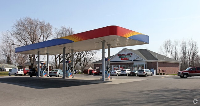
SCAPELETTI'S
Servicestationmarket
Niagara
X
New York
36063C0242E
33.000
2025
1.40 AC
2024
Outlying Niagara County
023402
Buffalo/Niagara Falls
4,448 SF
Buffalo-Cheektowaga, NY
DEMOGRAPHICS near 7084 Chestnut Ridge Rd
1 Mile
3 Mile
5 Mile
2024 Total Population
1,246
24,370
42,071
2029 Population
1,230
23,948
41,447
Pop Growth 2024-2029
(1.28%)
(1.73%)
(1.48%)
Average Age
47
42
42
2024 Total Households
532
10,728
18,232
HH Growth 2024-2029
(1.13%)
(1.74%)
(1.48%)
Median Household Inc
$90,848
$62,654
$62,310
Avg Household Size
2.30
2.20
2.20
2024 Avg HH Vehicles
2.00
2.00
2.00
Median Home Value
$172,580
$151,445
$148,431
Median Year Built
1973
1951
1963
Nearby Places
Map Layers
Map Styles
 Street
 Aerial
- Restaurants
- Banks
- Shops
- Fitness
- Groceries
PUBLIC TRANSPORTATION
AIRPORT
Niagara Falls International
DRIVE
WALK
Distance
Niagara Falls International
27 min
18.7 mi
Buffalo Niagara International
DRIVE
WALK
Distance
Buffalo Niagara International
28 min
19.9 mi
Freight Ports
Albany, NY Port
DRIVE
WALK
Distance
Albany, NY Port
336 min
284.7 mi
Nearby Properties
Address
Land Use
TOTAL SIZE
Lot Size
Zoning
Address
Land Use
TOTAL SIZE
Lot Size
Zoning
Address
Land Use
TOTAL SIZE
Lot Size
Zoning
259,393 SF
33.74 AC
RA
Address
Land Use
TOTAL SIZE
Lot Size
Zoning
90.60 AC
AR
Address
Land Use
TOTAL SIZE
Lot Size
Zoning
660 SF
0.99 AC
R3
Address
Land Use
TOTAL SIZE
Lot Size
Zoning
111,617 SF
16.83 AC
RA
Address
Land Use
TOTAL SIZE
Lot Size
Zoning
108,630 SF
0.77 AC
B2
Address
Land Use
TOTAL SIZE
Lot Size
Zoning
760 SF
7.82 AC
R1
Address
Land Use
TOTAL SIZE
Lot Size
Zoning
67,111 SF
3.22 AC
B2
Address
Land Use
TOTAL SIZE
Lot Size
Zoning
Address
Land Use
TOTAL SIZE
Lot Size
Zoning
24,103 SF
74.12 AC
Address
Land Use
TOTAL SIZE
Lot Size
Zoning
16,282 SF
4.90 AC
R3
Address
Land Use
TOTAL SIZE
Lot Size
Zoning
62,310 SF
6.39 AC
R3
Address
Land Use
TOTAL SIZE
Lot Size
Zoning
7,692 SF
3.82 AC
R3
Address
Land Use
TOTAL SIZE
Lot Size
Zoning
8,160 SF
4.22 AC
R3
Address
Land Use
TOTAL SIZE
Lot Size
Zoning
81,875 SF
8.67 AC
RA
Address
Land Use
TOTAL SIZE
Lot Size
Zoning
67,960 SF
8.51 AC
B3
Address
Land Use
TOTAL SIZE
Lot Size
Zoning
154,300 SF
5.93 AC
RA
Address
Land Use
TOTAL SIZE
Lot Size
Zoning
13,904 SF
2.02 AC
B2
Address
Land Use
TOTAL SIZE
Lot Size
Zoning
16,380 SF
3.68 AC
R3
Address
Land Use
TOTAL SIZE
Lot Size
Zoning
72.75 AC
R-1
Address
Land Use
TOTAL SIZE
Lot Size
Zoning
4,948 SF
6.30 AC
R1
Address
Land Use
TOTAL SIZE
Lot Size
Zoning
16,368 SF
44 AC
AR
Address
Land Use
TOTAL SIZE
Lot Size
Zoning
54,071 SF
2.78 AC
RA
Address
Land Use
TOTAL SIZE
Lot Size
Zoning
62,491 SF
10.74 AC
RA
Address
Land Use
TOTAL SIZE
Lot Size
Zoning
29,649 SF
2.94 AC
07 - MIXED
Address
Land Use
TOTAL SIZE
Lot Size
Zoning
14,940 SF
5.36 AC
R3
Address
Land Use
TOTAL SIZE
Lot Size
Zoning
13,846 SF
5.14 AC
R1
Address
Land Use
TOTAL SIZE
Lot Size
Zoning
06 - INDUS
Address
Land Use
TOTAL SIZE
Lot Size
Zoning
93,053 SF
0.82 AC
B2
Address
Land Use
TOTAL SIZE
Lot Size
Zoning
14,596 SF
2.38 AC
R1
The World's #1 Commercial Real Estate Marketplace
Connect with us
© 2026 CoStar Group
The information above has been obtained from sources believed reliable. While we do not doubt its accuracy we have not verified it and make no guarantee, warranty or representation about it. It is your responsibility to independently confirm its accuracy and completeness. Any projections, opinions, assumptions, or estimates used are for example only and do not represent the current or future performance of the property. The value of this transaction to you depends on tax and other factors which should be evaluated by your tax, financial, and legal advisors. You and your advisors should conduct a careful, independent investigation of the property to determine to your satisfaction the suitability of the property for your needs.