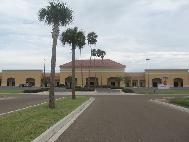
Property Record
709 Angelita Dr, Weslaco, TX 78599

NEARBY LISTINGS FOR SALE OR LEASE
Property Detail
709 Angelita Dr
McAllen/Edinburg/Pharr
Pueblo Amistad Sub
McAllen-Edinburg-Mission, TX
PUEBLO AMISTAD LOTS 23-25
P9275-00-000-0023-01
Hidalgo
Commercialnec
Texas
2024
23-25
2025
1.50 AC
022401
Outlying Hidalgo County
15,133 SF
DEMOGRAPHICS near 709 Angelita Dr
1 Mile
3 Mile
5 Mile
2024 Total Population
10,860
62,094
115,711
2029 Population
11,537
66,309
123,100
Pop Growth 2024-2029
+ 6.23%
+ 6.79%
+ 6.39%
Average Age
35
36
35
2024 Total Households
3,386
19,642
34,747
HH Growth 2024-2029
+ 6.05%
+ 7.12%
+ 6.77%
Median Household Inc
$35,484
$46,537
$41,461
Avg Household Size
3.00
3.10
3.20
2024 Avg HH Vehicles
2.00
2.00
2.00
Median Home Value
$84,870
$91,145
$80,278
Median Year Built
1991
1995
1995
Nearby Places
Map Layers
Map Styles
 Street
 Aerial
- Restaurants
- Banks
- Shops
- Fitness
- Groceries
PUBLIC TRANSPORTATION
AIRPORT
McAllen International
DRIVE
WALK
Distance
McAllen International
18 min
16.8 mi
Valley International
DRIVE
WALK
Distance
Valley International
29 min
26.3 mi
Freight Ports
Port of Brownsville
DRIVE
WALK
Distance
Port of Brownsville
1 min
39.7 mi
SALE & LEASE HISTORY
LISTING DATE
SALE/LEASE

Jul 12, 2022
For Sale
Jan 17, 2018
For Sale
Aug 23, 2023
For Lease
Nearby Properties
Address
Land Use
TOTAL SIZE
Lot Size
Zoning
Address
Land Use
TOTAL SIZE
Lot Size
Zoning
401,046 SF
13.97 AC
Address
Land Use
TOTAL SIZE
Lot Size
Zoning
307,987 SF
39.11 AC
Address
Land Use
TOTAL SIZE
Lot Size
Zoning
415,762 SF
56.31 AC
CO
Address
Land Use
TOTAL SIZE
Lot Size
Zoning
258,111 SF
51.09 AC
Address
Land Use
TOTAL SIZE
Lot Size
Zoning
205,544 SF
20.48 AC
C
Address
Land Use
TOTAL SIZE
Lot Size
Zoning
113,449 SF
19.01 AC
Address
Land Use
TOTAL SIZE
Lot Size
Zoning
197,394 SF
14.28 AC
CO
Address
Land Use
TOTAL SIZE
Lot Size
Zoning
44,220 SF
107.38 AC
Address
Land Use
TOTAL SIZE
Lot Size
Zoning
2 SF
48.88 AC
GT
Address
Land Use
TOTAL SIZE
Lot Size
Zoning
109,578 SF
7.61 AC
Address
Land Use
TOTAL SIZE
Lot Size
Zoning
108,541 SF
16.50 AC
Address
Land Use
TOTAL SIZE
Lot Size
Zoning
5 SF
46.56 AC
GT
Address
Land Use
TOTAL SIZE
Lot Size
Zoning
79,517 SF
16.26 AC
Address
Land Use
TOTAL SIZE
Lot Size
Zoning
108.55 AC
MP
Address
Land Use
TOTAL SIZE
Lot Size
Zoning
76,552 SF
19.48 AC
CO
Address
Land Use
TOTAL SIZE
Lot Size
Zoning
28,768 SF
3.20 AC
Address
Land Use
TOTAL SIZE
Lot Size
Zoning
122,491 SF
28.72 AC
Address
Land Use
TOTAL SIZE
Lot Size
Zoning
137,414 SF
10 AC
Address
Land Use
TOTAL SIZE
Lot Size
Zoning
240,421 SF
22.59 AC
Address
Land Use
TOTAL SIZE
Lot Size
Zoning
4,174 SF
19.70 AC
Address
Land Use
TOTAL SIZE
Lot Size
Zoning
57,032 SF
1.82 AC
CO
Address
Land Use
TOTAL SIZE
Lot Size
Zoning
112,706 SF
10.13 AC
Address
Land Use
TOTAL SIZE
Lot Size
Zoning
135,639 SF
40 AC
Address
Land Use
TOTAL SIZE
Lot Size
Zoning
97,698 SF
10.73 AC
CO
Address
Land Use
TOTAL SIZE
Lot Size
Zoning
61,420 SF
5.01 AC
CO
Address
Land Use
TOTAL SIZE
Lot Size
Zoning
13 SF
29 AC
Address
Land Use
TOTAL SIZE
Lot Size
Zoning
49,538 SF
8 AC
Address
Land Use
TOTAL SIZE
Lot Size
Zoning
9 SF
15.24 AC
Address
Land Use
TOTAL SIZE
Lot Size
Zoning
63,469 SF
37.86 AC
CO
Address
Land Use
TOTAL SIZE
Lot Size
Zoning
70,035 SF
16.46 AC
The World's #1 Commercial Real Estate Marketplace
Connect with us
© 2026 CoStar Group
The information above has been obtained from sources believed reliable. While we do not doubt its accuracy we have not verified it and make no guarantee, warranty or representation about it. It is your responsibility to independently confirm its accuracy and completeness. Any projections, opinions, assumptions, or estimates used are for example only and do not represent the current or future performance of the property. The value of this transaction to you depends on tax and other factors which should be evaluated by your tax, financial, and legal advisors. You and your advisors should conduct a careful, independent investigation of the property to determine to your satisfaction the suitability of the property for your needs.