Property Record
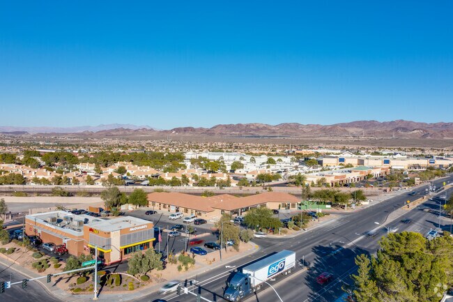
709 E Horizon Dr, Henderson, NV 89015


Property Detail
709 E Horizon Dr
179-20-816-004
MCDONALDS CORPORATION COML SUB PLAT BOOK 81 PAGE 25 PT LOT 1
Storebuilding
CLARK
CN
Nevada
B and X Area of moderate flood hazard, usually the area between the limits of the 100-year and 500-year floods.
1
2026
0.99 AC
2026
Southeast Las Vegas
005335
Las Vegas
9,973 SF
Las Vegas-Henderson-North Las Vegas, NV
NEARBY LISTINGS FOR SALE OR LEASE
DEMOGRAPHICS near 709 E Horizon Dr
1 mile
3 mile
5 mile
2025 Total Population
16,783
85,614
139,703
2030 Population
17,816
90,305
148,462
Pop Growth 2025-2030
+ 6.16%
+ 5.48%
+ 6.27%
Average Age
42
41
41
2025 Total Households
6,517
31,706
52,582
HH Growth 2025-2030
+ 6.21%
+ 5.58%
+ 6.36%
Median Household Inc
$82,241
$86,316
$92,665
Avg Household Size
2.50
2.60
2.60
2025 Avg HH Vehicles
2.00
2.00
2.00
Median Home Value
$412,373
$441,562
$469,764
Median Year Built
1995
1996
2001
Nearby Places
Map Layers
Map Styles
 Street
 Aerial
Transit
 Traffic
 Biking
Places
Listings with unknown addresses are not visible on the map
- Restaurants
- Banks
- Shops
- Fitness
- Groceries
PUBLIC TRANSPORTATION
AIRPORT
Boulder City Municipal
Drive
Walk
Distance
Boulder City Municipal
15 min
9.4 mi
Harry Reid International
Drive
Walk
Distance
Harry Reid International
20 min
14.8 mi
Freight Ports
Port of Long Beach
Drive
Walk
Distance
Port of Long Beach
318 min
283.4 mi
SALE & LEASE HISTORY
LISTING DATE
SALE/LEASE

Mar 21, 2022
For Sale
Mar 07, 2019
For Lease
Jan 16, 2024
For Sale
Feb 07, 2018
For Lease
Nearby Properties
Address
Land Use
TOTAL SIZE
Lot Size
Zoning
Address
Land Use
TOTAL SIZE
Lot Size
Zoning
100 SF
320 AC
DH
Address
Land Use
TOTAL SIZE
Lot Size
Zoning
Address
Land Use
TOTAL SIZE
Lot Size
Zoning
917,210 SF
60.42 AC
Address
Land Use
TOTAL SIZE
Lot Size
Zoning
46.75 AC
PS
Address
Land Use
TOTAL SIZE
Lot Size
Zoning
81,485 SF
160.06 AC
PS
Address
Land Use
TOTAL SIZE
Lot Size
Zoning
1,500 SF
25.08 AC
Address
Land Use
TOTAL SIZE
Lot Size
Zoning
26.83 AC
PS
Address
Land Use
TOTAL SIZE
Lot Size
Zoning
40,031 SF
21.25 AC
Address
Land Use
TOTAL SIZE
Lot Size
Zoning
78,760 SF
1.23 AC
Address
Land Use
TOTAL SIZE
Lot Size
Zoning
23,087 SF
71.36 AC
PS
Address
Land Use
TOTAL SIZE
Lot Size
Zoning
239,288 SF
14.10 AC
Address
Land Use
TOTAL SIZE
Lot Size
Zoning
295,238 SF
23.49 AC
IP
Address
Land Use
TOTAL SIZE
Lot Size
Zoning
71,133 SF
7.56 AC
DP
Address
Land Use
TOTAL SIZE
Lot Size
Zoning
13.05 AC
PS
Address
Land Use
TOTAL SIZE
Lot Size
Zoning
19,753 SF
10.21 AC
DP
Address
Land Use
TOTAL SIZE
Lot Size
Zoning
213,472 SF
7.46 AC
Address
Land Use
TOTAL SIZE
Lot Size
Zoning
3,664 SF
16.09 AC
RH20
Address
Land Use
TOTAL SIZE
Lot Size
Zoning
168,361 SF
10.84 AC
Address
Land Use
TOTAL SIZE
Lot Size
Zoning
320 AC
PS
Address
Land Use
TOTAL SIZE
Lot Size
Zoning
292,375 SF
39.22 AC
M2
Address
Land Use
TOTAL SIZE
Lot Size
Zoning
4,627 SF
7.01 AC
MC
Address
Land Use
TOTAL SIZE
Lot Size
Zoning
4,148 SF
4.38 AC
MC
Address
Land Use
TOTAL SIZE
Lot Size
Zoning
2,650 SF
11.93 AC
H:RM-16-MP
Address
Land Use
TOTAL SIZE
Lot Size
Zoning
10.01 AC
PS
Address
Land Use
TOTAL SIZE
Lot Size
Zoning
416 SF
320 AC
PS
Address
Land Use
TOTAL SIZE
Lot Size
Zoning
320 AC
DH
Address
Land Use
TOTAL SIZE
Lot Size
Zoning
20 AC
PS
Address
Land Use
TOTAL SIZE
Lot Size
Zoning
166,180 SF
10.99 AC
M1
The World's #1 Commercial Real Estate Marketplace
Connect with us
© 2026 CoStar Group
The information above has been obtained from sources believed reliable. While we do not doubt its accuracy we have not verified it and make no guarantee, warranty or representation about it. It is your responsibility to independently confirm its accuracy and completeness. Any projections, opinions, assumptions, or estimates used are for example only and do not represent the current or future performance of the property. The value of this transaction to you depends on tax and other factors which should be evaluated by your tax, financial, and legal advisors. You and your advisors should conduct a careful, independent investigation of the property to determine to your satisfaction the suitability of the property for your needs.