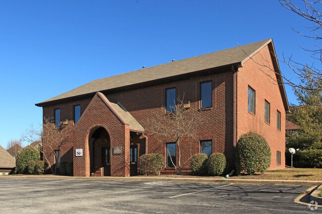
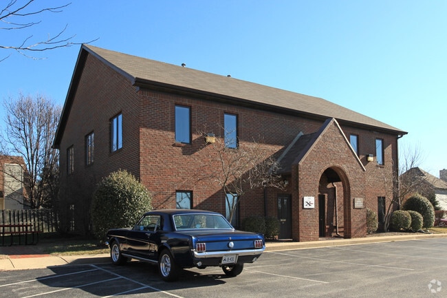
Property Record
709 Millpond Rd, Lexington, KY 40514
NEARBY LISTINGS FOR SALE OR LEASE
Property Detail
709 Millpond Rd
19972740
K-200 LOT 2; BOOK: 2568 PAGE: 263
Officebuilding
Fayette
X
Kentucky
21113C0060D
2
2025
0.40 AC
2025
West Lexington/Fayette
004210
Lexington/Fayette
4,346 SF
Lexington-Fayette, KY
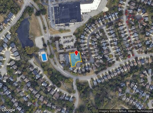
DEMOGRAPHICS near 709 Millpond Rd
1 Mile
3 Mile
5 Mile
2024 Total Population
12,086
74,542
164,006
2029 Population
11,902
74,210
163,640
Pop Growth 2024-2029
(1.52%)
(0.45%)
(0.22%)
Average Age
38
40
39
2024 Total Households
4,790
31,587
68,851
HH Growth 2024-2029
(1.63%)
(0.51%)
(0.28%)
Median Household Inc
$78,059
$74,289
$65,071
Avg Household Size
2.50
2.30
2.30
2024 Avg HH Vehicles
2.00
2.00
2.00
Median Home Value
$237,803
$265,411
$272,790
Median Year Built
1993
1986
1981
Nearby Places
Map Layers
Map Styles
 Street
 Aerial
- Restaurants
- Banks
- Shops
- Fitness
- Groceries
PUBLIC TRANSPORTATION
AIRPORT
Blue Grass
DRIVE
WALK
Distance
Blue Grass
16 min
8.7 mi
Freight Ports
Port of Toledo
DRIVE
WALK
Distance
Port of Toledo
345 min
294.6 mi
SALE & LEASE HISTORY
LISTING DATE
SALE/LEASE

Nov 14, 2016
For Lease
May 25, 2017
For Lease
Nearby Properties
Address
Land Use
TOTAL SIZE
Lot Size
Zoning
Address
Land Use
TOTAL SIZE
Lot Size
Zoning
318,370 SF
17.79 AC
B-6P
Address
Land Use
TOTAL SIZE
Lot Size
Zoning
4,299 SF
18.43 AC
R-4
Address
Land Use
TOTAL SIZE
Lot Size
Zoning
8,001 SF
32.59 AC
MU-3
Address
Land Use
TOTAL SIZE
Lot Size
Zoning
144,866 SF
14.83 AC
B-6P
Address
Land Use
TOTAL SIZE
Lot Size
Zoning
238,393 SF
9.83 AC
B-6P
Address
Land Use
TOTAL SIZE
Lot Size
Zoning
22.10 AC
R-3
Address
Land Use
TOTAL SIZE
Lot Size
Zoning
41,040 SF
14.77 AC
R-4
Address
Land Use
TOTAL SIZE
Lot Size
Zoning
184,756 SF
4.43 AC
MU-3
Address
Land Use
TOTAL SIZE
Lot Size
Zoning
91,484 SF
14.72 AC
B-6P
Address
Land Use
TOTAL SIZE
Lot Size
Zoning
7,402 SF
18.83 AC
R-4
Address
Land Use
TOTAL SIZE
Lot Size
Zoning
137,905 SF
23.79 AC
B-6P
Address
Land Use
TOTAL SIZE
Lot Size
Zoning
97,729 SF
4.22 AC
P-1
Address
Land Use
TOTAL SIZE
Lot Size
Zoning
10.41 AC
R-3
Address
Land Use
TOTAL SIZE
Lot Size
Zoning
6.25 AC
A-U
Address
Land Use
TOTAL SIZE
Lot Size
Zoning
123,221 SF
17.32 AC
R-1B
Address
Land Use
TOTAL SIZE
Lot Size
Zoning
33,996 SF
2 AC
Address
Land Use
TOTAL SIZE
Lot Size
Zoning
222,168 SF
26.49 AC
B-6P
Address
Land Use
TOTAL SIZE
Lot Size
Zoning
160,800 SF
74.22 AC
R-1C
Address
Land Use
TOTAL SIZE
Lot Size
Zoning
178,160 SF
14.62 AC
R-3
Address
Land Use
TOTAL SIZE
Lot Size
Zoning
156,350 SF
18.83 AC
B-6P
Address
Land Use
TOTAL SIZE
Lot Size
Zoning
219,320 SF
8.35 AC
R-4
Address
Land Use
TOTAL SIZE
Lot Size
Zoning
4,992 SF
32.12 AC
Address
Land Use
TOTAL SIZE
Lot Size
Zoning
9,186 SF
12 AC
R-3
Address
Land Use
TOTAL SIZE
Lot Size
Zoning
4,452 SF
20.28 AC
R-4
Address
Land Use
TOTAL SIZE
Lot Size
Zoning
88,276 SF
10.97 AC
A-U
Address
Land Use
TOTAL SIZE
Lot Size
Zoning
145,547 SF
12.75 AC
R-4
Address
Land Use
TOTAL SIZE
Lot Size
Zoning
8,933 SF
4.98 AC
P-1
Address
Land Use
TOTAL SIZE
Lot Size
Zoning
118,794 SF
16.05 AC
B-6P
Address
Land Use
TOTAL SIZE
Lot Size
Zoning
2,760 SF
11.05 AC
R-3
Address
Land Use
TOTAL SIZE
Lot Size
Zoning
74,908 SF
15.06 AC
A-U
The World's #1 Commercial Real Estate Marketplace
Connect with us
© 2026 CoStar Group
The information above has been obtained from sources believed reliable. While we do not doubt its accuracy we have not verified it and make no guarantee, warranty or representation about it. It is your responsibility to independently confirm its accuracy and completeness. Any projections, opinions, assumptions, or estimates used are for example only and do not represent the current or future performance of the property. The value of this transaction to you depends on tax and other factors which should be evaluated by your tax, financial, and legal advisors. You and your advisors should conduct a careful, independent investigation of the property to determine to your satisfaction the suitability of the property for your needs.