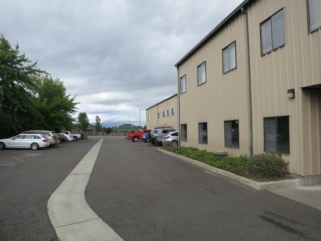
Property Record
709 N Phoenix Rd, Medford, OR 97504


NEARBY LISTINGS FOR SALE OR LEASE
-
-
-
-
-
No Photo
-
View all Medford listings for sale on LoopNet.com
Property Detail
709 N Phoenix Rd
10614763
Fair Oaks Orchard Tracts
Commercialbuilding
Jackson
X
Oregon
41029C1979F
701
2024
5.07 AC
2025
Medford/Grants Pass
000603
Other Market Areas
55,076 SF
Medford, OR
DEMOGRAPHICS near 709 N Phoenix Rd
1 Mile
3 Mile
5 Mile
2024 Total Population
7,748
47,409
95,164
2029 Population
7,856
47,530
94,594
Pop Growth 2024-2029
+ 1.39%
+ 0.26%
(0.60%)
Average Age
47
44
41
2024 Total Households
3,204
19,672
38,024
HH Growth 2024-2029
+ 1.28%
+ 0.15%
(0.67%)
Median Household Inc
$86,366
$67,379
$61,077
Avg Household Size
2.30
2.30
2.40
2024 Avg HH Vehicles
2.00
2.00
2.00
Median Home Value
$469,015
$390,933
$345,411
Median Year Built
1994
1984
1981
Nearby Places
Map Layers
Map Styles
 Street
 Aerial
- Restaurants
- Banks
- Shops
- Fitness
- Groceries
PUBLIC TRANSPORTATION
AIRPORT
Rogue Valley International - Medford
DRIVE
WALK
Distance
Rogue Valley International - Medford
14 min
7.0 mi
Freight Ports
Port of Coos Bay, OR
DRIVE
WALK
Distance
Port of Coos Bay, OR
223 min
168.8 mi
SALE & LEASE HISTORY
LISTING DATE
SALE/LEASE

Sep 23, 2016
For Sale
Dec 21, 2016
For Sale
Nearby Properties
Address
Land Use
TOTAL SIZE
Lot Size
Zoning
Address
Land Use
TOTAL SIZE
Lot Size
Zoning
674,760 SF
104.26 AC
SFR-4
Address
Land Use
TOTAL SIZE
Lot Size
Zoning
762,720 SF
16.25 AC
C-S/P
Address
Land Use
TOTAL SIZE
Lot Size
Zoning
249,867 SF
61.31 AC
SFR-4
Address
Land Use
TOTAL SIZE
Lot Size
Zoning
Address
Land Use
TOTAL SIZE
Lot Size
Zoning
77,354 SF
8.28 AC
SFR-4
Address
Land Use
TOTAL SIZE
Lot Size
Zoning
30.50 AC
SFR-4
Address
Land Use
TOTAL SIZE
Lot Size
Zoning
2,762 SF
6.81 AC
C-S/P
Address
Land Use
TOTAL SIZE
Lot Size
Zoning
85,610 SF
1.78 AC
C-C
Address
Land Use
TOTAL SIZE
Lot Size
Zoning
147,839 SF
15.43 AC
C-R
Address
Land Use
TOTAL SIZE
Lot Size
Zoning
81.70 AC
LI
Address
Land Use
TOTAL SIZE
Lot Size
Zoning
1,126 SF
4.89 AC
SFR-4
Address
Land Use
TOTAL SIZE
Lot Size
Zoning
31,338 SF
4.41 AC
C-R
Address
Land Use
TOTAL SIZE
Lot Size
Zoning
212,477 SF
13.74 AC
I-L
Address
Land Use
TOTAL SIZE
Lot Size
Zoning
3.54 AC
MFR-20
Address
Land Use
TOTAL SIZE
Lot Size
Zoning
12,544 SF
16.70 AC
C-R
Address
Land Use
TOTAL SIZE
Lot Size
Zoning
5.22 AC
MFR-30
Address
Land Use
TOTAL SIZE
Lot Size
Zoning
3,600 SF
0.50 AC
I-G
Address
Land Use
TOTAL SIZE
Lot Size
Zoning
74,724 SF
7.56 AC
C-R
Address
Land Use
TOTAL SIZE
Lot Size
Zoning
77,365 SF
3.25 AC
SFR-10
Address
Land Use
TOTAL SIZE
Lot Size
Zoning
9,216 SF
1.66 AC
C-R
Address
Land Use
TOTAL SIZE
Lot Size
Zoning
245,754 SF
5.33 AC
MFR-30
Address
Land Use
TOTAL SIZE
Lot Size
Zoning
127.94 AC
SFR-4
Address
Land Use
TOTAL SIZE
Lot Size
Zoning
46,774 SF
4.29 AC
SFR-6
Address
Land Use
TOTAL SIZE
Lot Size
Zoning
12,944 SF
21.34 AC
SFR-4
Address
Land Use
TOTAL SIZE
Lot Size
Zoning
106,312 SF
3.87 AC
SFR-10
Address
Land Use
TOTAL SIZE
Lot Size
Zoning
218,142 SF
8.36 AC
MFR-20
Address
Land Use
TOTAL SIZE
Lot Size
Zoning
146,994 SF
13.59 AC
C-R
Address
Land Use
TOTAL SIZE
Lot Size
Zoning
207,048 SF
2.49 AC
MFR-30
Address
Land Use
TOTAL SIZE
Lot Size
Zoning
92,000 SF
3.39 AC
MFR-30
Address
Land Use
TOTAL SIZE
Lot Size
Zoning
59,785 SF
7.83 AC
MFR-30
The World's #1 Commercial Real Estate Marketplace
Connect with us
© 2025 CoStar Group
The information above has been obtained from sources believed reliable. While we do not doubt its accuracy we have not verified it and make no guarantee, warranty or representation about it. It is your responsibility to independently confirm its accuracy and completeness. Any projections, opinions, assumptions, or estimates used are for example only and do not represent the current or future performance of the property. The value of this transaction to you depends on tax and other factors which should be evaluated by your tax, financial, and legal advisors. You and your advisors should conduct a careful, independent investigation of the property to determine to your satisfaction the suitability of the property for your needs.