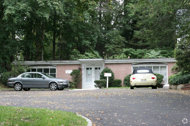
Property Record
709 Springfield Ave, Summit, NJ 07901


NEARBY LISTINGS FOR SALE OR LEASE
Property Detail
709 Springfield Ave
18-01702-0000-00049
Union
Taxexempt
New Jersey
X
49
34039C0008F
0.62 AC
2024
Short Hills/Millburn
2025
Northern New Jersey
037800
Newark, NJ
2,401 SF
DEMOGRAPHICS near 709 Springfield Ave
1 Mile
3 Mile
5 Mile
2024 Total Population
13,819
81,629
212,849
2029 Population
13,693
81,440
211,817
Pop Growth 2024-2029
(0.91%)
(0.23%)
(0.48%)
Average Age
39
40
41
2024 Total Households
4,846
28,682
73,886
HH Growth 2024-2029
(1.13%)
(0.47%)
(0.63%)
Median Household Inc
$180,840
$173,311
$161,523
Avg Household Size
2.80
2.80
2.80
2024 Avg HH Vehicles
2.00
2.00
2.00
Median Home Value
$876,968
$819,026
$747,347
Median Year Built
1956
1959
1957
Nearby Places
Map Layers
Map Styles
 Street
 Aerial
- Restaurants
- Banks
- Shops
- Fitness
- Groceries
PUBLIC TRANSPORTATION
COMMUTER RAIL
New Providence (Morris & Essex Gladstone Branch - NJ Transit Commuter Rail (NJ Transit))
DRIVE
WALK
Distance
New Providence (Morris & Essex Gladstone Branch - NJ Transit Commuter Rail (NJ Transit))
2 min
9 min
0.5 mi
Summit (Morris & Essex Gladstone Branch - NJ Transit Commuter Rail (NJ Transit), Morris & Essex Morristown Line - NJ Transit Commuter Rail (NJ Transit))
DRIVE
WALK
Distance
Summit (Morris & Essex Gladstone Branch - NJ Transit Commuter Rail (NJ Transit), Morris & Essex Morristown Line - NJ Transit Commuter Rail (NJ Transit))
4 min
1.3 mi
AIRPORT
Newark Liberty International
DRIVE
WALK
Distance
Newark Liberty International
22 min
14.2 mi
LaGuardia
DRIVE
WALK
Distance
LaGuardia
58 min
33.4 mi
John F Kennedy International
DRIVE
WALK
Distance
John F Kennedy International
69 min
41.7 mi
Freight Ports
Maher Terminal
DRIVE
WALK
Distance
Maher Terminal
27 min
15.3 mi
Nearby Properties
Address
Land Use
TOTAL SIZE
Lot Size
Zoning
Address
Land Use
TOTAL SIZE
Lot Size
Zoning
46.18 AC
Address
Land Use
TOTAL SIZE
Lot Size
Zoning
1,968 SF
88.85 AC
PROD
Address
Land Use
TOTAL SIZE
Lot Size
Zoning
Address
Land Use
TOTAL SIZE
Lot Size
Zoning
64.30 AC
MF-4
Address
Land Use
TOTAL SIZE
Lot Size
Zoning
151,088 SF
26.48 AC
CCRC
Address
Land Use
TOTAL SIZE
Lot Size
Zoning
4,595 SF
4.57 AC
M-3
Address
Land Use
TOTAL SIZE
Lot Size
Zoning
7.19 AC
PI
Address
Land Use
TOTAL SIZE
Lot Size
Zoning
153.40 AC
OR
Address
Land Use
TOTAL SIZE
Lot Size
Zoning
4.30 AC
OR-3
Address
Land Use
TOTAL SIZE
Lot Size
Zoning
31,905 SF
0.18 AC
Address
Land Use
TOTAL SIZE
Lot Size
Zoning
19.05 AC
R-2
Address
Land Use
TOTAL SIZE
Lot Size
Zoning
Address
Land Use
TOTAL SIZE
Lot Size
Zoning
439.33 AC
Address
Land Use
TOTAL SIZE
Lot Size
Zoning
296,578 SF
15 AC
Address
Land Use
TOTAL SIZE
Lot Size
Zoning
Address
Land Use
TOTAL SIZE
Lot Size
Zoning
0.42 AC
R-1
Address
Land Use
TOTAL SIZE
Lot Size
Zoning
Address
Land Use
TOTAL SIZE
Lot Size
Zoning
7.52 AC
OR-3
Address
Land Use
TOTAL SIZE
Lot Size
Zoning
2,806 SF
22.79 AC
Address
Land Use
TOTAL SIZE
Lot Size
Zoning
144.37 AC
Address
Land Use
TOTAL SIZE
Lot Size
Zoning
17,988 SF
301.08 AC
Address
Land Use
TOTAL SIZE
Lot Size
Zoning
8.32 AC
Address
Land Use
TOTAL SIZE
Lot Size
Zoning
140,732 SF
42.73 AC
OR
Address
Land Use
TOTAL SIZE
Lot Size
Zoning
40.90 AC
MF-4
Address
Land Use
TOTAL SIZE
Lot Size
Zoning
9.44 AC
Address
Land Use
TOTAL SIZE
Lot Size
Zoning
22,488 SF
7.67 AC
Address
Land Use
TOTAL SIZE
Lot Size
Zoning
19.14 AC
Address
Land Use
TOTAL SIZE
Lot Size
Zoning
Address
Land Use
TOTAL SIZE
Lot Size
Zoning
128.98 AC
Address
Land Use
TOTAL SIZE
Lot Size
Zoning
28.09 AC
R-3
The World's #1 Commercial Real Estate Marketplace
Connect with us
© 2026 CoStar Group
The information above has been obtained from sources believed reliable. While we do not doubt its accuracy we have not verified it and make no guarantee, warranty or representation about it. It is your responsibility to independently confirm its accuracy and completeness. Any projections, opinions, assumptions, or estimates used are for example only and do not represent the current or future performance of the property. The value of this transaction to you depends on tax and other factors which should be evaluated by your tax, financial, and legal advisors. You and your advisors should conduct a careful, independent investigation of the property to determine to your satisfaction the suitability of the property for your needs.