Property Record
709 State Rd, Plymouth, MA 02360


NEARBY LISTINGS FOR SALE OR LEASE
-
-
View all Plymouth listings for lease on LoopNet.com
Property Detail
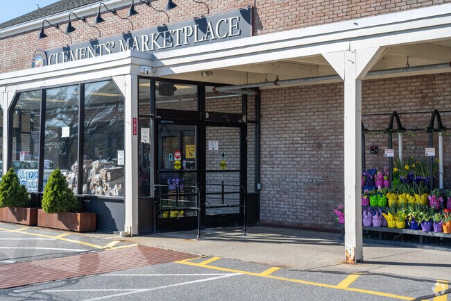
709 State Rd
PLYM-000048-000000-000001-000009
Plymouth
Regionalshoppingcenterormallwithanchorstore
Massachusetts
X
1-9
25023C0391L
4.35 AC
2025
Route 3 South
2025
Boston
530801
Boston-Cambridge-Newton, MA-NH
34,228 SF
DEMOGRAPHICS near 709 State Rd
1 Mile
3 Mile
5 Mile
2024 Total Population
3,584
13,951
23,741
2029 Population
3,651
14,256
24,192
Pop Growth 2024-2029
+ 1.87%
+ 2.19%
+ 1.90%
Average Age
44
47
48
2024 Total Households
1,454
5,930
9,667
HH Growth 2024-2029
+ 1.86%
+ 2.16%
+ 2.03%
Median Household Inc
$114,713
$115,699
$114,273
Avg Household Size
2.40
2.30
2.30
2024 Avg HH Vehicles
2.00
2.00
2.00
Median Home Value
$459,444
$499,260
$532,059
Median Year Built
1969
1983
1986
Nearby Places
Map Layers
Map Styles
 Street
 Aerial
- Restaurants
- Banks
- Shops
- Fitness
- Groceries
SALE & LEASE HISTORY
LISTING DATE
SALE/LEASE

Oct 29, 2018
For Lease
Jun 08, 2021
For Lease
Dec 14, 2021
For Lease
Aug 22, 2017
For Lease
Nearby Properties
Address
Land Use
TOTAL SIZE
Lot Size
Zoning
Address
Land Use
TOTAL SIZE
Lot Size
Zoning
8,936 SF
248.34 AC
OSMU
Address
Land Use
TOTAL SIZE
Lot Size
Zoning
61,536 SF
20 AC
R25
Address
Land Use
TOTAL SIZE
Lot Size
Zoning
5.91 AC
R25
Address
Land Use
TOTAL SIZE
Lot Size
Zoning
43,242 SF
10 AC
R20S
Address
Land Use
TOTAL SIZE
Lot Size
Zoning
95.90 AC
RR
Address
Land Use
TOTAL SIZE
Lot Size
Zoning
44.09 AC
R25
Address
Land Use
TOTAL SIZE
Lot Size
Zoning
16.17 AC
R20S
Address
Land Use
TOTAL SIZE
Lot Size
Zoning
7.87 AC
R25
Address
Land Use
TOTAL SIZE
Lot Size
Zoning
18,014 SF
1.29 AC
R25
Address
Land Use
TOTAL SIZE
Lot Size
Zoning
5,428 SF
2.63 AC
R20M
Address
Land Use
TOTAL SIZE
Lot Size
Zoning
9,184 SF
0.52 AC
R20S
Address
Land Use
TOTAL SIZE
Lot Size
Zoning
10,608 SF
1.62 AC
NC
Address
Land Use
TOTAL SIZE
Lot Size
Zoning
250.78 AC
RR
Address
Land Use
TOTAL SIZE
Lot Size
Zoning
4,628 SF
1.87 AC
R20S
Address
Land Use
TOTAL SIZE
Lot Size
Zoning
4.69 AC
GC
Address
Land Use
TOTAL SIZE
Lot Size
Zoning
3.02 AC
GC
Address
Land Use
TOTAL SIZE
Lot Size
Zoning
768 SF
126.23 AC
R25
Address
Land Use
TOTAL SIZE
Lot Size
Zoning
163.39 AC
RR
Address
Land Use
TOTAL SIZE
Lot Size
Zoning
0.75 AC
R20S
Address
Land Use
TOTAL SIZE
Lot Size
Zoning
2,661 SF
1.60 AC
R20S
Address
Land Use
TOTAL SIZE
Lot Size
Zoning
15,309 SF
1.33 AC
R25
Address
Land Use
TOTAL SIZE
Lot Size
Zoning
1.27 AC
R20S
Address
Land Use
TOTAL SIZE
Lot Size
Zoning
7.14 AC
RR
Address
Land Use
TOTAL SIZE
Lot Size
Zoning
16.62 AC
RR
Address
Land Use
TOTAL SIZE
Lot Size
Zoning
6,866 SF
0.77 AC
R20S
Address
Land Use
TOTAL SIZE
Lot Size
Zoning
12,286 SF
0.87 AC
GC
Address
Land Use
TOTAL SIZE
Lot Size
Zoning
72.01 AC
RR
Address
Land Use
TOTAL SIZE
Lot Size
Zoning
1,890 SF
307.32 AC
RR
Address
Land Use
TOTAL SIZE
Lot Size
Zoning
5,766 SF
0.48 AC
GC
The World's #1 Commercial Real Estate Marketplace
Connect with us
© 2026 CoStar Group
The information above has been obtained from sources believed reliable. While we do not doubt its accuracy we have not verified it and make no guarantee, warranty or representation about it. It is your responsibility to independently confirm its accuracy and completeness. Any projections, opinions, assumptions, or estimates used are for example only and do not represent the current or future performance of the property. The value of this transaction to you depends on tax and other factors which should be evaluated by your tax, financial, and legal advisors. You and your advisors should conduct a careful, independent investigation of the property to determine to your satisfaction the suitability of the property for your needs.