Property Record
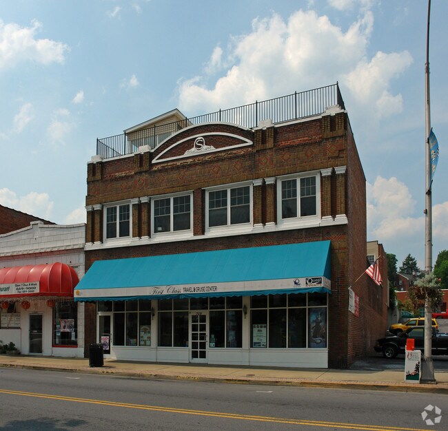
709 State St, Bristol, VA 24201


Property Detail
709 State St
37-1-I-3
TRACT 2 REPLAT STONEMAN,FAMILY SQUARE 0.166 ACRE
Commercialnec
BRISTOL CITY
AE The base floodplain where base flood elevations are provided. AE Zones are now used on new format FIRMs instead of A1-A30 Zones.
Virginia
2025
0.17 AC
2025
Downtown Bristol
020201
Kingsport/Bristol/Bristol
7,747 SF
Kingsport-Bristol, TN-VA
NEARBY LISTINGS FOR SALE OR LEASE
DEMOGRAPHICS near 709 State St
1 mile
3 mile
5 mile
2025 Total Population
8,508
34,859
51,722
2030 Population
8,505
34,810
51,781
Pop Growth 2025-2030
(0.04%)
(0.14%)
+ 0.11%
Average Age
42
43
43
2025 Total Households
3,934
15,444
22,617
HH Growth 2025-2030
+ 0.03%
(0.17%)
+ 0.08%
Median Household Inc
$38,613
$48,518
$53,756
Avg Household Size
2.00
2.20
2.20
2025 Avg HH Vehicles
1.00
2.00
2.00
Median Home Value
$159,134
$174,383
$191,224
Median Year Built
1954
1964
1969
Nearby Places
Map Layers
Map Styles
 Street
 Aerial
Layers
 Traffic
 Biking
Places
Listings with unknown addresses are not visible on the map
- Restaurants
- Banks
- Shops
- Fitness
- Groceries
PUBLIC TRANSPORTATION
AIRPORT
Tri-Cities
Drive
Walk
Distance
Tri-Cities
26 min
17.8 mi
Freight Ports
Virginia Port Authority - Richmond
Drive
Walk
Distance
Virginia Port Authority - Richmond
368 min
330.6 mi
Nearby Properties
Address
Land Use
TOTAL SIZE
Lot Size
Zoning
Address
Land Use
TOTAL SIZE
Lot Size
Zoning
571,262 SF
37.48 AC
Address
Land Use
TOTAL SIZE
Lot Size
Zoning
296,552 SF
22.10 AC
Address
Land Use
TOTAL SIZE
Lot Size
Zoning
98,152 SF
33.16 AC
Address
Land Use
TOTAL SIZE
Lot Size
Zoning
16.10 AC
Address
Land Use
TOTAL SIZE
Lot Size
Zoning
53,840 SF
2.86 AC
Address
Land Use
TOTAL SIZE
Lot Size
Zoning
415,624 SF
28.41 AC
Address
Land Use
TOTAL SIZE
Lot Size
Zoning
29,760 SF
0.69 AC
Address
Land Use
TOTAL SIZE
Lot Size
Zoning
43,121 SF
0.34 AC
Address
Land Use
TOTAL SIZE
Lot Size
Zoning
56,822 SF
5.09 AC
Address
Land Use
TOTAL SIZE
Lot Size
Zoning
53,350 SF
1.25 AC
Address
Land Use
TOTAL SIZE
Lot Size
Zoning
81,150 SF
6.18 AC
Address
Land Use
TOTAL SIZE
Lot Size
Zoning
13,316 SF
6.45 AC
Address
Land Use
TOTAL SIZE
Lot Size
Zoning
97,932 SF
9.88 AC
Address
Land Use
TOTAL SIZE
Lot Size
Zoning
91,313 SF
40.52 AC
Address
Land Use
TOTAL SIZE
Lot Size
Zoning
89,804 SF
10.20 AC
Address
Land Use
TOTAL SIZE
Lot Size
Zoning
12.04 AC
Address
Land Use
TOTAL SIZE
Lot Size
Zoning
116,100 SF
1.73 AC
Address
Land Use
TOTAL SIZE
Lot Size
Zoning
93,509 SF
1.58 AC
Address
Land Use
TOTAL SIZE
Lot Size
Zoning
16,228 SF
7.92 AC
Address
Land Use
TOTAL SIZE
Lot Size
Zoning
43,483 SF
1.25 AC
Address
Land Use
TOTAL SIZE
Lot Size
Zoning
32,722 SF
5.21 AC
B2 BUSINES
Address
Land Use
TOTAL SIZE
Lot Size
Zoning
25,670 SF
0.62 AC
Address
Land Use
TOTAL SIZE
Lot Size
Zoning
26,696 SF
2.38 AC
Address
Land Use
TOTAL SIZE
Lot Size
Zoning
31,269 SF
1.22 AC
Address
Land Use
TOTAL SIZE
Lot Size
Zoning
108,832 SF
4.63 AC
Address
Land Use
TOTAL SIZE
Lot Size
Zoning
11,640 SF
6.19 AC
Address
Land Use
TOTAL SIZE
Lot Size
Zoning
68,719 SF
12.63 AC
Address
Land Use
TOTAL SIZE
Lot Size
Zoning
59,506 SF
10.41 AC
Address
Land Use
TOTAL SIZE
Lot Size
Zoning
22,336 SF
0.26 AC
Address
Land Use
TOTAL SIZE
Lot Size
Zoning
44,142 SF
3.31 AC
The World's #1 Commercial Real Estate Marketplace
Connect with us
© 2026 CoStar Group
The information above has been obtained from sources believed reliable. While we do not doubt its accuracy we have not verified it and make no guarantee, warranty or representation about it. It is your responsibility to independently confirm its accuracy and completeness. Any projections, opinions, assumptions, or estimates used are for example only and do not represent the current or future performance of the property. The value of this transaction to you depends on tax and other factors which should be evaluated by your tax, financial, and legal advisors. You and your advisors should conduct a careful, independent investigation of the property to determine to your satisfaction the suitability of the property for your needs.