Property Record
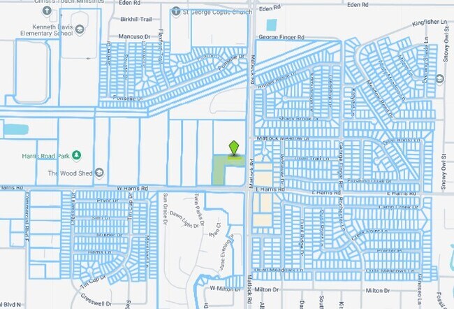
709 W Harris Rd, Arlington, TX 76001


Property Detail
709 W Harris Rd
Dallas-Fort Worth-Arlington, TX
Q.T. 950 ADDITION BLOCK A LOT 2
41474910
TARRANT
Commercialnec
Texas
B and X Area of moderate flood hazard, usually the area between the limits of the 100-year and 500-year floods.
2
2024
2.95 AC
2025
Arlington/Mansfield
111409
Dallas/Ft Worth
6,630 SF
NEARBY LISTINGS FOR SALE OR LEASE
-
-
View all Arlington listings for sale on LoopNet.com
DEMOGRAPHICS near 709 W Harris Rd
1 mile
3 mile
5 mile
2025 Total Population
18,023
127,075
273,365
2030 Population
18,812
132,881
286,907
Pop Growth 2025-2030
+ 4.38%
+ 4.57%
+ 4.95%
Average Age
36
37
37
2025 Total Households
5,299
40,344
90,772
HH Growth 2025-2030
+ 4.55%
+ 4.71%
+ 5.15%
Median Household Inc
$95,998
$103,761
$97,619
Avg Household Size
3.30
3.10
3.00
2025 Avg HH Vehicles
2.00
2.00
2.00
Median Home Value
$324,204
$344,238
$349,222
Median Year Built
2000
1998
1997
Nearby Places
Map Layers
Map Styles
 Street
 Aerial
Layers
 Traffic
 Biking
Places
Listings with unknown addresses are not visible on the map
- Restaurants
- Banks
- Shops
- Fitness
- Groceries
PUBLIC TRANSPORTATION
AIRPORT
Dallas-Fort Worth International
Drive
Walk
Distance
Dallas-Fort Worth International
37 min
23.8 mi
Dallas Love Field
Drive
Walk
Distance
Dallas Love Field
46 min
32.6 mi
SALE & LEASE HISTORY
LISTING DATE
SALE/LEASE

Mar 04, 2025
For Sale
Nearby Properties
Address
Land Use
TOTAL SIZE
Lot Size
Zoning
Address
Land Use
TOTAL SIZE
Lot Size
Zoning
399,570 SF
75.21 AC
Address
Land Use
TOTAL SIZE
Lot Size
Zoning
453,257 SF
121.21 AC
Address
Land Use
TOTAL SIZE
Lot Size
Zoning
326,267 SF
13.11 AC
Address
Land Use
TOTAL SIZE
Lot Size
Zoning
352,649 SF
17.16 AC
Address
Land Use
TOTAL SIZE
Lot Size
Zoning
260,008 SF
139.37 AC
Address
Land Use
TOTAL SIZE
Lot Size
Zoning
419,875 SF
108.14 AC
Address
Land Use
TOTAL SIZE
Lot Size
Zoning
270,214 SF
17.85 AC
Address
Land Use
TOTAL SIZE
Lot Size
Zoning
246,204 SF
15.16 AC
Address
Land Use
TOTAL SIZE
Lot Size
Zoning
258,908 SF
22.41 AC
Address
Land Use
TOTAL SIZE
Lot Size
Zoning
255,134 SF
21.62 AC
Address
Land Use
TOTAL SIZE
Lot Size
Zoning
209,307 SF
15.34 AC
Address
Land Use
TOTAL SIZE
Lot Size
Zoning
77,038 SF
11.46 AC
Address
Land Use
TOTAL SIZE
Lot Size
Zoning
208,630 SF
8.62 AC
Address
Land Use
TOTAL SIZE
Lot Size
Zoning
231,551 SF
25.69 AC
Address
Land Use
TOTAL SIZE
Lot Size
Zoning
171,820 SF
59.63 AC
Address
Land Use
TOTAL SIZE
Lot Size
Zoning
258,465 SF
8.99 AC
Address
Land Use
TOTAL SIZE
Lot Size
Zoning
177,384 SF
28.68 AC
Address
Land Use
TOTAL SIZE
Lot Size
Zoning
182,763 SF
10.54 AC
Address
Land Use
TOTAL SIZE
Lot Size
Zoning
165,842 SF
9.48 AC
Address
Land Use
TOTAL SIZE
Lot Size
Zoning
399,496 SF
23.29 AC
Address
Land Use
TOTAL SIZE
Lot Size
Zoning
157,094 SF
9.09 AC
Address
Land Use
TOTAL SIZE
Lot Size
Zoning
276,267 SF
16.10 AC
Address
Land Use
TOTAL SIZE
Lot Size
Zoning
427,622 SF
24.26 AC
Address
Land Use
TOTAL SIZE
Lot Size
Zoning
365,000 SF
9.81 AC
Address
Land Use
TOTAL SIZE
Lot Size
Zoning
111,764 SF
10.34 AC
Address
Land Use
TOTAL SIZE
Lot Size
Zoning
160,000 SF
37.89 AC
Address
Land Use
TOTAL SIZE
Lot Size
Zoning
302,278 SF
20.61 AC
Address
Land Use
TOTAL SIZE
Lot Size
Zoning
82,343 SF
8.14 AC
Address
Land Use
TOTAL SIZE
Lot Size
Zoning
88,679 SF
23.10 AC
Address
Land Use
TOTAL SIZE
Lot Size
Zoning
86,342 SF
12.15 AC
The World's #1 Commercial Real Estate Marketplace
Connect with us
© 2026 CoStar Group
The information above has been obtained from sources believed reliable. While we do not doubt its accuracy we have not verified it and make no guarantee, warranty or representation about it. It is your responsibility to independently confirm its accuracy and completeness. Any projections, opinions, assumptions, or estimates used are for example only and do not represent the current or future performance of the property. The value of this transaction to you depends on tax and other factors which should be evaluated by your tax, financial, and legal advisors. You and your advisors should conduct a careful, independent investigation of the property to determine to your satisfaction the suitability of the property for your needs.