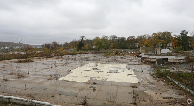
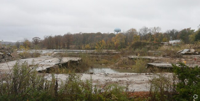
Property Record
71 Charles St, Glen Cove, NY 11542
NEARBY LISTINGS FOR SALE OR LEASE
Property Detail
71 Charles St
Nassau County-Suffolk County, NY
601,603-604
0600-31-G-00-0003-0
Nassau
Industrialacreage
New York
X
601
36059C0107G
6.19 AC
2025
Northern Nassau
2025
Long Island (New York)
517201
DEMOGRAPHICS near 71 Charles St
1 Mile
3 Mile
5 Mile
2024 Total Population
19,529
51,144
108,283
2029 Population
19,559
50,486
106,818
Pop Growth 2024-2029
+ 0.15%
(1.29%)
(1.35%)
Average Age
43
43
43
2024 Total Households
7,115
18,318
37,726
HH Growth 2024-2029
+ 0.31%
(1.30%)
(1.38%)
Median Household Inc
$67,630
$104,239
$129,227
Avg Household Size
2.60
2.70
2.80
2024 Avg HH Vehicles
2.00
2.00
2.00
Median Home Value
$650,402
$769,085
$876,298
Median Year Built
1959
1957
1958
Nearby Places
- Restaurants
- Banks
- Shops
- Fitness
- Groceries
PUBLIC TRANSPORTATION
COMMUTER RAIL
Glen Street Station (Oyster Bay Branch - Long Island Rail Road)
DRIVE
WALK
Distance
Glen Street Station (Oyster Bay Branch - Long Island Rail Road)
3 min
1.4 mi
Sea Cliff Station (Oyster Bay Branch - Long Island Rail Road)
DRIVE
WALK
Distance
Sea Cliff Station (Oyster Bay Branch - Long Island Rail Road)
4 min
1.7 mi
AIRPORT
LaGuardia
DRIVE
WALK
Distance
LaGuardia
34 min
22.2 mi
John F Kennedy International
DRIVE
WALK
Distance
John F Kennedy International
36 min
25.0 mi
Westchester County
DRIVE
WALK
Distance
Westchester County
63 min
41.1 mi
Freight Ports
NY - Red Hook Container Terminal
DRIVE
WALK
Distance
NY - Red Hook Container Terminal
45 min
30.3 mi
Nearby Properties
Address
Land Use
TOTAL SIZE
Lot Size
Zoning
Address
Land Use
TOTAL SIZE
Lot Size
Zoning
5,039 SF
92.07 AC
Address
Land Use
TOTAL SIZE
Lot Size
Zoning
20,000 SF
58.45 AC
Address
Land Use
TOTAL SIZE
Lot Size
Zoning
8,564 SF
38.71 AC
Address
Land Use
TOTAL SIZE
Lot Size
Zoning
121,473 SF
10.34 AC
Address
Land Use
TOTAL SIZE
Lot Size
Zoning
232,700 SF
42.75 AC
Address
Land Use
TOTAL SIZE
Lot Size
Zoning
26,200 SF
186 AC
Address
Land Use
TOTAL SIZE
Lot Size
Zoning
164,742 SF
3.54 AC
Address
Land Use
TOTAL SIZE
Lot Size
Zoning
387,645 SF
7.21 AC
Address
Land Use
TOTAL SIZE
Lot Size
Zoning
237,994 SF
3.98 AC
Address
Land Use
TOTAL SIZE
Lot Size
Zoning
98,439 SF
8.94 AC
Address
Land Use
TOTAL SIZE
Lot Size
Zoning
409,120 SF
20.85 AC
Address
Land Use
TOTAL SIZE
Lot Size
Zoning
195,812 SF
2.30 AC
Address
Land Use
TOTAL SIZE
Lot Size
Zoning
161,595 SF
29.91 AC
Address
Land Use
TOTAL SIZE
Lot Size
Zoning
267,367 SF
23.05 AC
Address
Land Use
TOTAL SIZE
Lot Size
Zoning
114,248 SF
80.99 AC
Address
Land Use
TOTAL SIZE
Lot Size
Zoning
18,626 SF
21.37 AC
Address
Land Use
TOTAL SIZE
Lot Size
Zoning
95,147 SF
207.90 AC
Address
Land Use
TOTAL SIZE
Lot Size
Zoning
2,103 SF
20.11 AC
Address
Land Use
TOTAL SIZE
Lot Size
Zoning
18.03 AC
Address
Land Use
TOTAL SIZE
Lot Size
Zoning
858 SF
73.93 AC
Address
Land Use
TOTAL SIZE
Lot Size
Zoning
487,862 SF
21.75 AC
Address
Land Use
TOTAL SIZE
Lot Size
Zoning
20.61 AC
Address
Land Use
TOTAL SIZE
Lot Size
Zoning
11,813 SF
20.87 AC
Address
Land Use
TOTAL SIZE
Lot Size
Zoning
1,500 SF
24.12 AC
Address
Land Use
TOTAL SIZE
Lot Size
Zoning
4,000 SF
49.55 AC
Address
Land Use
TOTAL SIZE
Lot Size
Zoning
28,885 SF
1.32 AC
Address
Land Use
TOTAL SIZE
Lot Size
Zoning
6,278 SF
25.30 AC
Address
Land Use
TOTAL SIZE
Lot Size
Zoning
6,469 SF
27.15 AC
Address
Land Use
TOTAL SIZE
Lot Size
Zoning
40,795 SF
14.09 AC
Address
Land Use
TOTAL SIZE
Lot Size
Zoning
123,337 SF
11 AC
The World's #1 Commercial Real Estate Marketplace
Connect with us
© 2025 CoStar Group
The information above has been obtained from sources believed reliable. While we do not doubt its accuracy we have not verified it and make no guarantee, warranty or representation about it. It is your responsibility to independently confirm its accuracy and completeness. Any projections, opinions, assumptions, or estimates used are for example only and do not represent the current or future performance of the property. The value of this transaction to you depends on tax and other factors which should be evaluated by your tax, financial, and legal advisors. You and your advisors should conduct a careful, independent investigation of the property to determine to your satisfaction the suitability of the property for your needs.