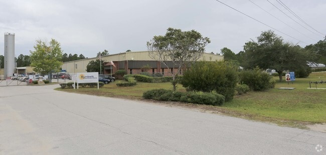
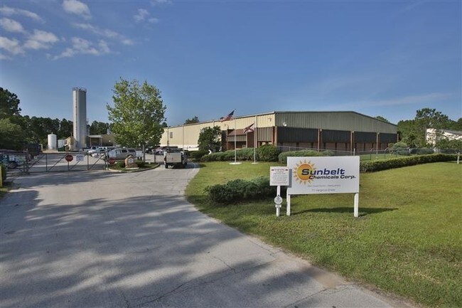
Property Record
71 Hargrove Grade, Palm Coast, FL 32137


NEARBY LISTINGS FOR SALE OR LEASE
Property Detail
71 Hargrove Grade
16-11-30-0000-01010-0030
PT OF N 1/2 OF SEC E OF FEC RR & S OF HARGROVE RD OR 231 PG224 OR393 PG205 PARCEL IS 451.06 E OF FEC RR ALONG SLY BDRY HARGROVE RD 369.88 ALONG HARGROVE RD,PARCEL 56.01SLONG FEC RR OR 435 PG 733 OR 444 PG 1462 OR 435 PG 735 OR 576 PG 913 OR 2227/679
Lightindustrial
Flagler
X
Florida
12035C0120E
3
2024
6 AC
2025
Daytona Area
060206
Other Market Areas
54,510 SF
Deltona-Daytona Beach-Ormond Beach, FL
DEMOGRAPHICS near 71 Hargrove Grade
1 Mile
3 Mile
5 Mile
2024 Total Population
43
19,747
71,052
2029 Population
53
23,883
86,694
Pop Growth 2024-2029
+ 23.26%
+ 20.94%
+ 22.01%
Average Age
43
47
46
2024 Total Households
16
7,793
27,993
HH Growth 2024-2029
+ 25.00%
+ 20.15%
+ 21.22%
Median Household Inc
$65,000
$62,414
$62,716
Avg Household Size
2.40
2.50
2.50
2024 Avg HH Vehicles
2.00
2.00
2.00
Median Home Value
$150,000
$251,479
$255,057
Median Year Built
1989
1996
2000
Nearby Places
Map Layers
Map Styles
 Street
 Aerial
- Restaurants
- Banks
- Shops
- Fitness
- Groceries
PUBLIC TRANSPORTATION
AIRPORT
Daytona Beach International
DRIVE
WALK
Distance
Daytona Beach International
46 min
34.1 mi
Freight Ports
Jacksonville Port
DRIVE
WALK
Distance
Jacksonville Port
80 min
64.6 mi
SALE & LEASE HISTORY
LISTING DATE
SALE/LEASE

Sep 23, 2016
For Sale
Nearby Properties
Address
Land Use
TOTAL SIZE
Lot Size
Zoning
Address
Land Use
TOTAL SIZE
Lot Size
Zoning
76,792 SF
10.05 AC
COM-2
Address
Land Use
TOTAL SIZE
Lot Size
Zoning
298,470 SF
34.44 AC
MFR-2
Address
Land Use
TOTAL SIZE
Lot Size
Zoning
209,585 SF
40 AC
MPD
Address
Land Use
TOTAL SIZE
Lot Size
Zoning
85.89 AC
PSP
Address
Land Use
TOTAL SIZE
Lot Size
Zoning
137,280 SF
64.40 AC
COM-3
Address
Land Use
TOTAL SIZE
Lot Size
Zoning
167,892 SF
76.77 AC
PSP
Address
Land Use
TOTAL SIZE
Lot Size
Zoning
93,891 SF
5 AC
MFR-2
Address
Land Use
TOTAL SIZE
Lot Size
Zoning
85,307 SF
4.31 AC
IND-1
Address
Land Use
TOTAL SIZE
Lot Size
Zoning
75,297 SF
15.55 AC
PSP
Address
Land Use
TOTAL SIZE
Lot Size
Zoning
94,320 SF
22.19 AC
PSP
Address
Land Use
TOTAL SIZE
Lot Size
Zoning
61,313 SF
7.78 AC
COM-2
Address
Land Use
TOTAL SIZE
Lot Size
Zoning
77,816 SF
5.95 AC
COM-3
Address
Land Use
TOTAL SIZE
Lot Size
Zoning
144,642 SF
10 AC
IND-1
Address
Land Use
TOTAL SIZE
Lot Size
Zoning
45,381 SF
7.38 AC
PSP
Address
Land Use
TOTAL SIZE
Lot Size
Zoning
88,704 SF
7.96 AC
Address
Land Use
TOTAL SIZE
Lot Size
Zoning
28,335 SF
19.31 AC
PSP
Address
Land Use
TOTAL SIZE
Lot Size
Zoning
27,218 SF
8.43 AC
COM-3
Address
Land Use
TOTAL SIZE
Lot Size
Zoning
35,189 SF
30.23 AC
PSP
Address
Land Use
TOTAL SIZE
Lot Size
Zoning
45,409 SF
3.90 AC
OFC-2
Address
Land Use
TOTAL SIZE
Lot Size
Zoning
5,264 SF
9.61 AC
PSP
Address
Land Use
TOTAL SIZE
Lot Size
Zoning
48,777 SF
10.31 AC
PSP
Address
Land Use
TOTAL SIZE
Lot Size
Zoning
21,598 SF
6.53 AC
Address
Land Use
TOTAL SIZE
Lot Size
Zoning
42,838 SF
5.34 AC
OFC-2
Address
Land Use
TOTAL SIZE
Lot Size
Zoning
21,512 SF
7.48 AC
PSP
Address
Land Use
TOTAL SIZE
Lot Size
Zoning
91,202 SF
4 AC
COM-2
Address
Land Use
TOTAL SIZE
Lot Size
Zoning
47,878 SF
7.09 AC
IND-1
Address
Land Use
TOTAL SIZE
Lot Size
Zoning
13,600 SF
1.72 AC
COM-2
The World's #1 Commercial Real Estate Marketplace
Connect with us
© 2026 CoStar Group
The information above has been obtained from sources believed reliable. While we do not doubt its accuracy we have not verified it and make no guarantee, warranty or representation about it. It is your responsibility to independently confirm its accuracy and completeness. Any projections, opinions, assumptions, or estimates used are for example only and do not represent the current or future performance of the property. The value of this transaction to you depends on tax and other factors which should be evaluated by your tax, financial, and legal advisors. You and your advisors should conduct a careful, independent investigation of the property to determine to your satisfaction the suitability of the property for your needs.