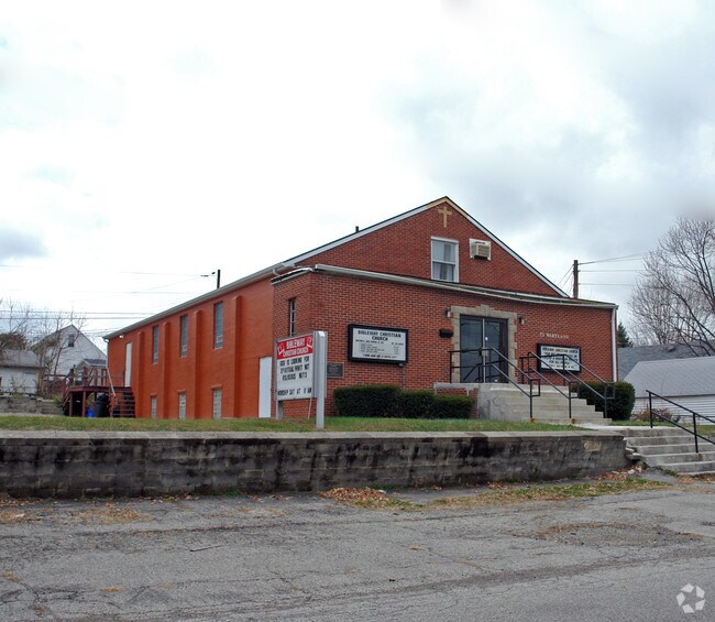
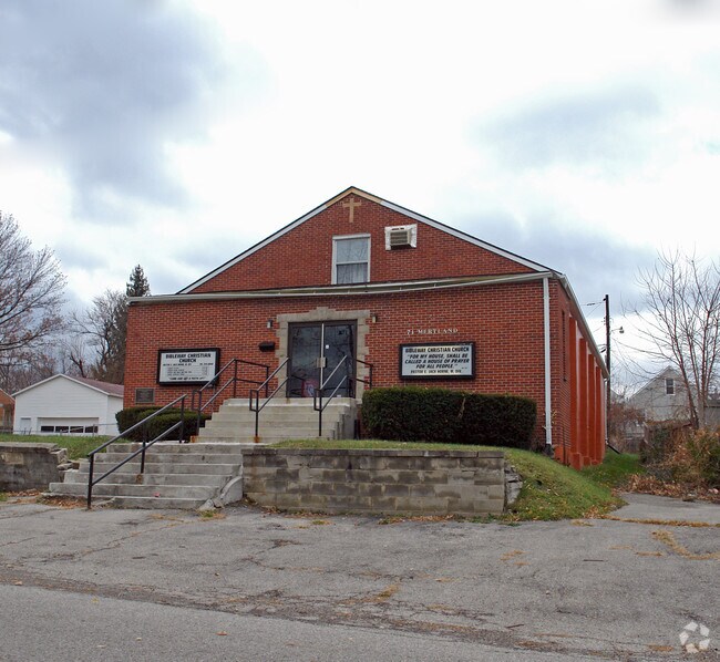
Property Record
71 Mertland Ave, Dayton, OH 45431
NEARBY LISTINGS FOR SALE OR LEASE
-
-
View all Dayton listings for sale on LoopNet.com
Property Detail
71 Mertland Ave
Dayton, OH
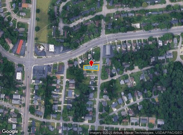
Aerial Pk
I39-01002-0049
50 AERIAL PK EXEMPT
Religious
Montgomery
X
Ohio
39113C0169E
49
2023
0.18 AC
2024
East Dayton
002500
Cincinnati/Dayton
DEMOGRAPHICS near 71 Mertland Ave
1 Mile
3 Mile
5 Mile
2024 Total Population
15,568
91,986
215,977
2029 Population
15,617
92,138
217,803
Pop Growth 2024-2029
+ 0.31%
+ 0.17%
+ 0.85%
Average Age
37
37
38
2024 Total Households
6,379
38,578
91,020
HH Growth 2024-2029
+ 0.24%
+ 0.08%
+ 0.85%
Median Household Inc
$39,046
$45,463
$51,859
Avg Household Size
2.30
2.20
2.20
2024 Avg HH Vehicles
2.00
2.00
2.00
Median Home Value
$63,482
$90,489
$132,952
Median Year Built
1953
1952
1956
Nearby Places
Map Layers
Map Styles
 Street
 Aerial
- Restaurants
- Banks
- Shops
- Fitness
- Groceries
PUBLIC TRANSPORTATION
AIRPORT
James M Cox Dayton International
DRIVE
WALK
Distance
James M Cox Dayton International
23 min
14.2 mi
SALE & LEASE HISTORY
LISTING DATE
SALE/LEASE

Oct 26, 2017
For Sale
Nearby Properties
Address
Land Use
TOTAL SIZE
Lot Size
Zoning
Address
Land Use
TOTAL SIZE
Lot Size
Zoning
634,753 SF
54 AC
Address
Land Use
TOTAL SIZE
Lot Size
Zoning
154,360 SF
19.35 AC
Address
Land Use
TOTAL SIZE
Lot Size
Zoning
316.77 AC
Address
Land Use
TOTAL SIZE
Lot Size
Zoning
23.35 AC
Address
Land Use
TOTAL SIZE
Lot Size
Zoning
222,197 SF
1.80 AC
Address
Land Use
TOTAL SIZE
Lot Size
Zoning
200,150 SF
1.81 AC
Address
Land Use
TOTAL SIZE
Lot Size
Zoning
255,494 SF
4.64 AC
Address
Land Use
TOTAL SIZE
Lot Size
Zoning
133.37 AC
Address
Land Use
TOTAL SIZE
Lot Size
Zoning
4.86 AC
Address
Land Use
TOTAL SIZE
Lot Size
Zoning
304,304 SF
2.44 AC
Address
Land Use
TOTAL SIZE
Lot Size
Zoning
544,935 SF
2.46 AC
Address
Land Use
TOTAL SIZE
Lot Size
Zoning
268,166 SF
2.12 AC
Address
Land Use
TOTAL SIZE
Lot Size
Zoning
46,796 SF
53.05 AC
RPUD038
Address
Land Use
TOTAL SIZE
Lot Size
Zoning
41.38 AC
Address
Land Use
TOTAL SIZE
Lot Size
Zoning
54.85 AC
Address
Land Use
TOTAL SIZE
Lot Size
Zoning
46.32 AC
Address
Land Use
TOTAL SIZE
Lot Size
Zoning
32.30 AC
Address
Land Use
TOTAL SIZE
Lot Size
Zoning
284,989 SF
3.60 AC
Address
Land Use
TOTAL SIZE
Lot Size
Zoning
4.98 AC
Address
Land Use
TOTAL SIZE
Lot Size
Zoning
123,690 SF
1.57 AC
Address
Land Use
TOTAL SIZE
Lot Size
Zoning
96,732 SF
6.73 AC
CPUD002
Address
Land Use
TOTAL SIZE
Lot Size
Zoning
94,608 SF
7.44 AC
Address
Land Use
TOTAL SIZE
Lot Size
Zoning
3.50 AC
Address
Land Use
TOTAL SIZE
Lot Size
Zoning
634,508 SF
24.36 AC
Address
Land Use
TOTAL SIZE
Lot Size
Zoning
9.45 AC
Address
Land Use
TOTAL SIZE
Lot Size
Zoning
8.17 AC
Address
Land Use
TOTAL SIZE
Lot Size
Zoning
23.20 AC
Address
Land Use
TOTAL SIZE
Lot Size
Zoning
180,678 SF
1.04 AC
Address
Land Use
TOTAL SIZE
Lot Size
Zoning
99,601 SF
15.58 AC
Address
Land Use
TOTAL SIZE
Lot Size
Zoning
22.70 AC
The World's #1 Commercial Real Estate Marketplace
Connect with us
© 2025 CoStar Group
The information above has been obtained from sources believed reliable. While we do not doubt its accuracy we have not verified it and make no guarantee, warranty or representation about it. It is your responsibility to independently confirm its accuracy and completeness. Any projections, opinions, assumptions, or estimates used are for example only and do not represent the current or future performance of the property. The value of this transaction to you depends on tax and other factors which should be evaluated by your tax, financial, and legal advisors. You and your advisors should conduct a careful, independent investigation of the property to determine to your satisfaction the suitability of the property for your needs.