Property Record
71 Vanguard Dr, Reading, PA 19606


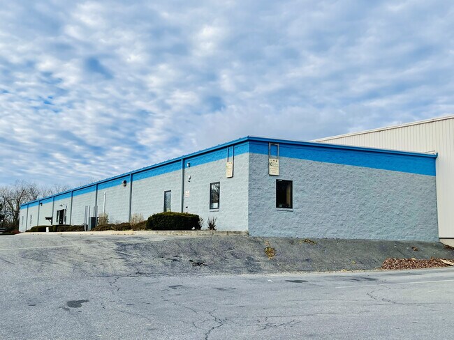

Property Detail
71 Vanguard Dr
43-5335-13-13-4069
Berks
Commercialacreage
Pennsylvania
B and X Area of moderate flood hazard, usually the area between the limits of the 100-year and 500-year floods.
4
2025
7.33 AC
2025
Berks
012001
Philadelphia
75,725 SF
Reading, PA
NEARBY LISTINGS FOR SALE OR LEASE
DEMOGRAPHICS near 71 Vanguard Dr
1 mile
3 mile
5 mile
2025 Total Population
5,200
30,361
69,839
2030 Population
5,348
30,998
71,450
Pop Growth 2025-2030
+ 2.85%
+ 2.10%
+ 2.31%
Average Age
44
42
41
2025 Total Households
2,026
11,518
26,462
HH Growth 2025-2030
+ 2.86%
+ 2.13%
+ 2.33%
Median Household Inc
$86,649
$89,514
$76,163
Avg Household Size
2.40
2.60
2.50
2025 Avg HH Vehicles
2.00
2.00
2.00
Median Home Value
$247,826
$269,534
$248,275
Median Year Built
1984
1981
1971
Nearby Places
Map Layers
Map Styles
 Street
 Aerial
Layers
 Traffic
 Biking
Places
Listings with unknown addresses are not visible on the map
- Restaurants
- Banks
- Shops
- Fitness
- Groceries
SALE & LEASE HISTORY
LISTING DATE
SALE/LEASE

Nov 17, 2021
For Lease
Jun 10, 2021
For Sale
Jun 10, 2021
For Lease
Nearby Properties
Address
Land Use
TOTAL SIZE
Lot Size
Zoning
Address
Land Use
TOTAL SIZE
Lot Size
Zoning
56,536 SF
23.40 AC
Address
Land Use
TOTAL SIZE
Lot Size
Zoning
32,492 SF
39.39 AC
Address
Land Use
TOTAL SIZE
Lot Size
Zoning
47,512 SF
43.18 AC
Address
Land Use
TOTAL SIZE
Lot Size
Zoning
142,239 SF
12.30 AC
Address
Land Use
TOTAL SIZE
Lot Size
Zoning
139,377 SF
12.99 AC
Address
Land Use
TOTAL SIZE
Lot Size
Zoning
270,030 SF
34.56 AC
Address
Land Use
TOTAL SIZE
Lot Size
Zoning
310,014 SF
15.02 AC
Address
Land Use
TOTAL SIZE
Lot Size
Zoning
188,801 SF
14.41 AC
Address
Land Use
TOTAL SIZE
Lot Size
Zoning
220,294 SF
25.86 AC
Address
Land Use
TOTAL SIZE
Lot Size
Zoning
41,449 SF
6.38 AC
Address
Land Use
TOTAL SIZE
Lot Size
Zoning
210,000 SF
28.33 AC
Address
Land Use
TOTAL SIZE
Lot Size
Zoning
330,682 SF
17.35 AC
Address
Land Use
TOTAL SIZE
Lot Size
Zoning
2,106 SF
1,627.69 AC
Address
Land Use
TOTAL SIZE
Lot Size
Zoning
133,430 SF
10.43 AC
Address
Land Use
TOTAL SIZE
Lot Size
Zoning
83,740 SF
3.64 AC
Address
Land Use
TOTAL SIZE
Lot Size
Zoning
36,568 SF
2.99 AC
Address
Land Use
TOTAL SIZE
Lot Size
Zoning
10,376 SF
5.11 AC
Address
Land Use
TOTAL SIZE
Lot Size
Zoning
47,593 SF
9.27 AC
Address
Land Use
TOTAL SIZE
Lot Size
Zoning
135,196 SF
22.41 AC
Address
Land Use
TOTAL SIZE
Lot Size
Zoning
47,633 SF
4.81 AC
Address
Land Use
TOTAL SIZE
Lot Size
Zoning
50,932 SF
4.57 AC
Address
Land Use
TOTAL SIZE
Lot Size
Zoning
89,584 SF
13.52 AC
Address
Land Use
TOTAL SIZE
Lot Size
Zoning
148,088 SF
24.34 AC
Address
Land Use
TOTAL SIZE
Lot Size
Zoning
79,200 SF
8.10 AC
Address
Land Use
TOTAL SIZE
Lot Size
Zoning
36,505 SF
9.65 AC
Address
Land Use
TOTAL SIZE
Lot Size
Zoning
138,398 SF
10.43 AC
Address
Land Use
TOTAL SIZE
Lot Size
Zoning
29,024 SF
1.90 AC
Address
Land Use
TOTAL SIZE
Lot Size
Zoning
80,893 SF
24.68 AC
Address
Land Use
TOTAL SIZE
Lot Size
Zoning
60,902 SF
13.59 AC
Address
Land Use
TOTAL SIZE
Lot Size
Zoning
27,022 SF
3.14 AC
The World's #1 Commercial Real Estate Marketplace
Connect with us
© 2026 CoStar Group
The information above has been obtained from sources believed reliable. While we do not doubt its accuracy we have not verified it and make no guarantee, warranty or representation about it. It is your responsibility to independently confirm its accuracy and completeness. Any projections, opinions, assumptions, or estimates used are for example only and do not represent the current or future performance of the property. The value of this transaction to you depends on tax and other factors which should be evaluated by your tax, financial, and legal advisors. You and your advisors should conduct a careful, independent investigation of the property to determine to your satisfaction the suitability of the property for your needs.