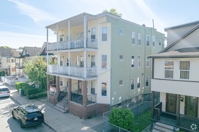
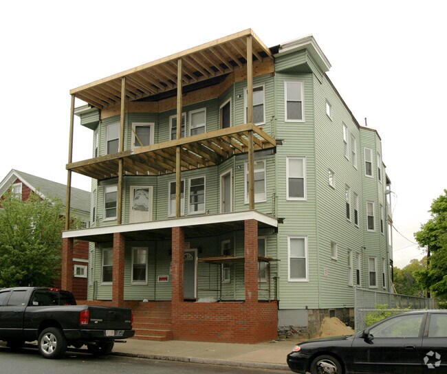
Property Record
71 W Selden St, Mattapan, MA 02126

NEARBY LISTINGS FOR SALE OR LEASE
Property Detail
71 W Selden St
Taxexempt
Suffolk
X
Massachusetts
25021C0064G
0.13 AC
0
Southern Mattapan
2025
Boston
101002
Boston-Cambridge-Newton, MA-NH
5,424 SF
MATT-000000-000018-000765
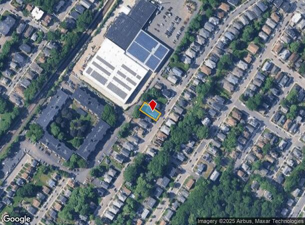
DEMOGRAPHICS near 71 W Selden St
1 Mile
3 Mile
5 Mile
2024 Total Population
39,062
250,900
609,749
2029 Population
36,878
237,695
585,689
Pop Growth 2024-2029
(5.59%)
(5.26%)
(3.95%)
Average Age
39
40
39
2024 Total Households
13,658
92,508
243,229
HH Growth 2024-2029
(6.30%)
(5.86%)
(4.27%)
Median Household Inc
$63,649
$77,850
$84,984
Avg Household Size
2.70
2.60
2.30
2024 Avg HH Vehicles
1.00
1.00
1.00
Median Home Value
$551,328
$647,093
$715,652
Median Year Built
1948
1948
1949
Nearby Places
Map Layers
Map Styles
 Street
 Aerial
- Restaurants
- Banks
- Shops
- Fitness
- Groceries
PUBLIC TRANSPORTATION
TRANSIT/SUBWAY
Morton Street (Fairmount Line - Massachusetts Bay Transportation Authority Commuter Rail (Purple Line))
DRIVE
WALK
Distance
Morton Street (Fairmount Line - Massachusetts Bay Transportation Authority Commuter Rail (Purple Line))
1 min
5 min
0.3 mi
Mattapan Station (Ashmont Mattapan High Speed Line - Massachusetts Bay Transportation Authority Subway (The T))
DRIVE
WALK
Distance
Mattapan Station (Ashmont Mattapan High Speed Line - Massachusetts Bay Transportation Authority Subway (The T))
4 min
20 min
1.0 mi
COMMUTER RAIL
Morton Street (Fairmount Line - Massachusetts Bay Transportation Authority Commuter Rail (Purple Line))
DRIVE
WALK
Distance
Morton Street (Fairmount Line - Massachusetts Bay Transportation Authority Commuter Rail (Purple Line))
1 min
5 min
0.3 mi
DRIVE
WALK
Distance
4 min
17 min
0.9 mi
AIRPORT
General Edward Lawrence Logan International
DRIVE
WALK
Distance
General Edward Lawrence Logan International
18 min
9.4 mi
Freight Ports
Port of Boston
DRIVE
WALK
Distance
Port of Boston
15 min
7.2 mi
Nearby Properties
Address
Land Use
TOTAL SIZE
Lot Size
Zoning
Address
Land Use
TOTAL SIZE
Lot Size
Zoning
262,120 SF
0.62 AC
C
Address
Land Use
TOTAL SIZE
Lot Size
Zoning
251,272 SF
3.77 AC
BUSC
Address
Land Use
TOTAL SIZE
Lot Size
Zoning
152,495 SF
6.51 AC
Address
Land Use
TOTAL SIZE
Lot Size
Zoning
254,856 SF
4.05 AC
BUSC
Address
Land Use
TOTAL SIZE
Lot Size
Zoning
45,000 SF
14.30 AC
E
Address
Land Use
TOTAL SIZE
Lot Size
Zoning
1,660.52 AC
RA
Address
Land Use
TOTAL SIZE
Lot Size
Zoning
1,940 SF
58.17 AC
E
Address
Land Use
TOTAL SIZE
Lot Size
Zoning
681,518 SF
34.52 AC
Address
Land Use
TOTAL SIZE
Lot Size
Zoning
240.18 AC
E
Address
Land Use
TOTAL SIZE
Lot Size
Zoning
332,366 SF
4.86 AC
E
Address
Land Use
TOTAL SIZE
Lot Size
Zoning
728,348 SF
11.71 AC
C
Address
Land Use
TOTAL SIZE
Lot Size
Zoning
228,215 SF
2.44 AC
RC
Address
Land Use
TOTAL SIZE
Lot Size
Zoning
18,070 SF
119.45 AC
E
Address
Land Use
TOTAL SIZE
Lot Size
Zoning
526,040 SF
27.79 AC
E
Address
Land Use
TOTAL SIZE
Lot Size
Zoning
383,811 SF
5.86 AC
RESB
Address
Land Use
TOTAL SIZE
Lot Size
Zoning
270,991 SF
33.25 AC
RA
Address
Land Use
TOTAL SIZE
Lot Size
Zoning
21,830 SF
158.48 AC
E
Address
Land Use
TOTAL SIZE
Lot Size
Zoning
132,321 SF
3.94 AC
RC
Address
Land Use
TOTAL SIZE
Lot Size
Zoning
53.23 AC
E
Address
Land Use
TOTAL SIZE
Lot Size
Zoning
377,249 SF
2.81 AC
RC
Address
Land Use
TOTAL SIZE
Lot Size
Zoning
173,630 SF
4.46 AC
E
Address
Land Use
TOTAL SIZE
Lot Size
Zoning
17.85 AC
BUSC
Address
Land Use
TOTAL SIZE
Lot Size
Zoning
560,065 SF
28.20 AC
Address
Land Use
TOTAL SIZE
Lot Size
Zoning
217,302 SF
13.47 AC
RA
Address
Land Use
TOTAL SIZE
Lot Size
Zoning
221,500 SF
4.99 AC
E
Address
Land Use
TOTAL SIZE
Lot Size
Zoning
247,316 SF
2.75 AC
E
Address
Land Use
TOTAL SIZE
Lot Size
Zoning
475,102 SF
36.81 AC
A
Address
Land Use
TOTAL SIZE
Lot Size
Zoning
108,500 SF
2.38 AC
E
Address
Land Use
TOTAL SIZE
Lot Size
Zoning
2.35 AC
E
Address
Land Use
TOTAL SIZE
Lot Size
Zoning
156,310 SF
9.40 AC
E
The World's #1 Commercial Real Estate Marketplace
Connect with us
© 2025 CoStar Group
The information above has been obtained from sources believed reliable. While we do not doubt its accuracy we have not verified it and make no guarantee, warranty or representation about it. It is your responsibility to independently confirm its accuracy and completeness. Any projections, opinions, assumptions, or estimates used are for example only and do not represent the current or future performance of the property. The value of this transaction to you depends on tax and other factors which should be evaluated by your tax, financial, and legal advisors. You and your advisors should conduct a careful, independent investigation of the property to determine to your satisfaction the suitability of the property for your needs.