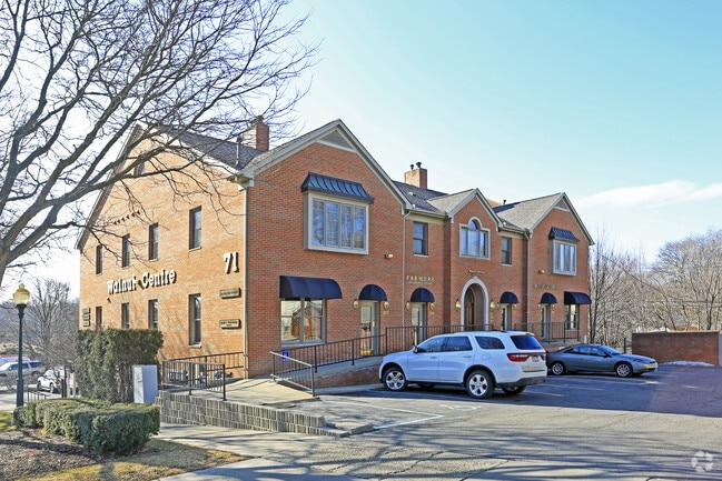
Property Record
71 Walnut Blvd, Rochester, MI 48307


NEARBY LISTINGS FOR SALE OR LEASE
Property Detail
71 Walnut Blvd
Detroit-Warren-Dearborn, MI
Oakland County Condominium
15-15-276-062
Oakland
Condominium
Michigan
X
1 AC
26125C0392F
Rochester
1,304 SF
Detroit
DEMOGRAPHICS near 71 Walnut Blvd
1 Mile
3 Mile
5 Mile
2024 Total Population
10,291
70,068
159,567
2029 Population
10,238
69,390
158,194
Pop Growth 2024-2029
(0.52%)
(0.97%)
(0.86%)
Average Age
41
42
42
2024 Total Households
4,834
28,087
62,996
HH Growth 2024-2029
(0.46%)
(0.92%)
(0.82%)
Median Household Inc
$91,581
$106,274
$103,482
Avg Household Size
2.10
2.40
2.40
2024 Avg HH Vehicles
2.00
2.00
2.00
Median Home Value
$359,413
$360,085
$360,497
Median Year Built
1976
1981
1984
Nearby Places
Map Layers
Map Styles
 Street
 Aerial
- Restaurants
- Banks
- Shops
- Fitness
- Groceries
PUBLIC TRANSPORTATION
AIRPORT
Detroit City
DRIVE
WALK
Distance
Detroit City
39 min
24.6 mi
Bishop International
DRIVE
WALK
Distance
Bishop International
54 min
49.1 mi
SALE & LEASE HISTORY
LISTING DATE
SALE/LEASE

Sep 28, 2016
For Lease
Sep 10, 2020
For Lease
Nov 29, 2016
For Lease
Feb 02, 2019
For Sale
Apr 02, 2021
For Sale
Nearby Properties
Address
Land Use
TOTAL SIZE
Lot Size
Zoning
Address
Land Use
TOTAL SIZE
Lot Size
Zoning
444,087 SF
83.19 AC
II
Address
Land Use
TOTAL SIZE
Lot Size
Zoning
3,529 SF
29.19 AC
BI
Address
Land Use
TOTAL SIZE
Lot Size
Zoning
23.38 AC
BI
Address
Land Use
TOTAL SIZE
Lot Size
Zoning
57.84 AC
AV
Address
Land Use
TOTAL SIZE
Lot Size
Zoning
389,465 SF
30.24 AC
II
Address
Land Use
TOTAL SIZE
Lot Size
Zoning
Address
Land Use
TOTAL SIZE
Lot Size
Zoning
195,413 SF
4.43 AC
Address
Land Use
TOTAL SIZE
Lot Size
Zoning
35.60 AC
R-12
Address
Land Use
TOTAL SIZE
Lot Size
Zoning
22.09 AC
AI
Address
Land Use
TOTAL SIZE
Lot Size
Zoning
134,904 SF
5 AC
Address
Land Use
TOTAL SIZE
Lot Size
Zoning
119.30 AC
Address
Land Use
TOTAL SIZE
Lot Size
Zoning
21.52 AC
AI
Address
Land Use
TOTAL SIZE
Lot Size
Zoning
19.86 AC
AI
Address
Land Use
TOTAL SIZE
Lot Size
Zoning
Address
Land Use
TOTAL SIZE
Lot Size
Zoning
51.98 AC
MHP
Address
Land Use
TOTAL SIZE
Lot Size
Zoning
Address
Land Use
TOTAL SIZE
Lot Size
Zoning
62,495 SF
2.49 AC
MM
Address
Land Use
TOTAL SIZE
Lot Size
Zoning
89,450 SF
0.41 AC
BI
Address
Land Use
TOTAL SIZE
Lot Size
Zoning
29.30 AC
AI
Address
Land Use
TOTAL SIZE
Lot Size
Zoning
26.25 AC
AI
Address
Land Use
TOTAL SIZE
Lot Size
Zoning
96,460 SF
17.50 AC
Address
Land Use
TOTAL SIZE
Lot Size
Zoning
55,651 SF
23.39 AC
II
Address
Land Use
TOTAL SIZE
Lot Size
Zoning
191.40 AC
AI
Address
Land Use
TOTAL SIZE
Lot Size
Zoning
112,300 SF
25.04 AC
The World's #1 Commercial Real Estate Marketplace
Connect with us
© 2026 CoStar Group
The information above has been obtained from sources believed reliable. While we do not doubt its accuracy we have not verified it and make no guarantee, warranty or representation about it. It is your responsibility to independently confirm its accuracy and completeness. Any projections, opinions, assumptions, or estimates used are for example only and do not represent the current or future performance of the property. The value of this transaction to you depends on tax and other factors which should be evaluated by your tax, financial, and legal advisors. You and your advisors should conduct a careful, independent investigation of the property to determine to your satisfaction the suitability of the property for your needs.