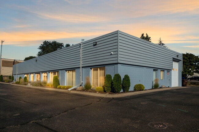
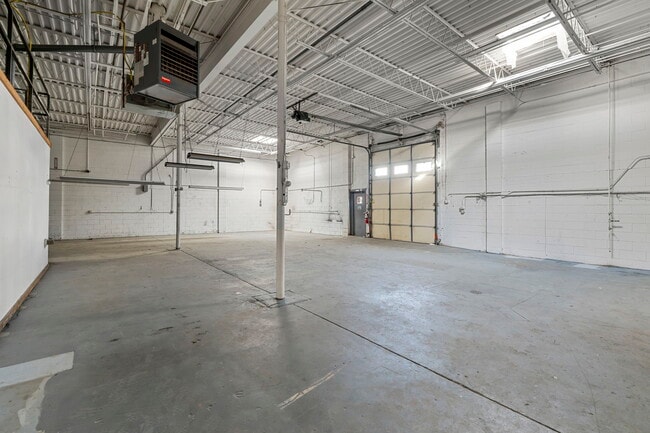
Property Record
710 Hamel Rd, Hamel, MN 55340


Property Detail
710 Hamel Rd
Minneapolis-St. Paul-Bloomington, MN-WI
LOT 005 BLOCK 001 A MEDINA INDUSTRIAL 2ND ADDN LOT 5 AND THAT PART OF LOT 4 LYING SLY OF NLY 66 FT THOF S 192X148X174X121
12-118-23-32-0028
Hennepin
Industrialgeneral
Minnesota
B and X Area of moderate flood hazard, usually the area between the limits of the 100-year and 500-year floods.
5
2024
0.55 AC
2024
Southwest
027101
Minneapolis/St Paul
NEARBY LISTINGS FOR SALE OR LEASE
DEMOGRAPHICS near 710 Hamel Rd
1 mile
3 mile
5 mile
2025 Total Population
3,117
31,958
92,824
2030 Population
3,181
32,521
93,445
Pop Growth 2025-2030
+ 2.05%
+ 1.76%
+ 0.67%
Average Age
38
38
40
2025 Total Households
1,019
10,374
33,545
HH Growth 2025-2030
+ 1.86%
+ 1.65%
+ 0.50%
Median Household Inc
$214,026
$198,561
$161,145
Avg Household Size
3.00
3.00
2.70
2025 Avg HH Vehicles
2.00
2.00
2.00
Median Home Value
$733,974
$660,187
$580,364
Median Year Built
2009
2004
1994
Nearby Places
Map Layers
Map Styles
 Street
 Aerial
Layers
 Traffic
 Biking
Places
Listings with unknown addresses are not visible on the map
- Restaurants
- Banks
- Shops
- Fitness
- Groceries
PUBLIC TRANSPORTATION
AIRPORT
Minneapolis-St Paul International/Wold-Chamberlain
Drive
Walk
Distance
Minneapolis-St Paul International/Wold-Chamberlain
39 min
27.0 mi
Freight Ports
Port Milwaukee
Drive
Walk
Distance
Port Milwaukee
399 min
354.6 mi
SALE & LEASE HISTORY
LISTING DATE
SALE/LEASE

Oct 28, 2025
For Lease
May 10, 2025
For Sale
Nearby Properties
Address
Land Use
TOTAL SIZE
Lot Size
Zoning
Address
Land Use
TOTAL SIZE
Lot Size
Zoning
4.51 AC
Address
Land Use
TOTAL SIZE
Lot Size
Zoning
21.09 AC
Address
Land Use
TOTAL SIZE
Lot Size
Zoning
Address
Land Use
TOTAL SIZE
Lot Size
Zoning
9.54 AC
Address
Land Use
TOTAL SIZE
Lot Size
Zoning
8.81 AC
Address
Land Use
TOTAL SIZE
Lot Size
Zoning
Address
Land Use
TOTAL SIZE
Lot Size
Zoning
25.53 AC
Address
Land Use
TOTAL SIZE
Lot Size
Zoning
Address
Land Use
TOTAL SIZE
Lot Size
Zoning
32.70 AC
Address
Land Use
TOTAL SIZE
Lot Size
Zoning
7.33 AC
Address
Land Use
TOTAL SIZE
Lot Size
Zoning
Address
Land Use
TOTAL SIZE
Lot Size
Zoning
6.75 AC
Address
Land Use
TOTAL SIZE
Lot Size
Zoning
25.11 AC
Address
Land Use
TOTAL SIZE
Lot Size
Zoning
6.43 AC
Address
Land Use
TOTAL SIZE
Lot Size
Zoning
9.04 AC
Address
Land Use
TOTAL SIZE
Lot Size
Zoning
11.19 AC
Address
Land Use
TOTAL SIZE
Lot Size
Zoning
33.02 AC
Address
Land Use
TOTAL SIZE
Lot Size
Zoning
6.89 AC
Address
Land Use
TOTAL SIZE
Lot Size
Zoning
Address
Land Use
TOTAL SIZE
Lot Size
Zoning
Address
Land Use
TOTAL SIZE
Lot Size
Zoning
Address
Land Use
TOTAL SIZE
Lot Size
Zoning
6.06 AC
Address
Land Use
TOTAL SIZE
Lot Size
Zoning
42.54 AC
Address
Land Use
TOTAL SIZE
Lot Size
Zoning
10.70 AC
Address
Land Use
TOTAL SIZE
Lot Size
Zoning
5.45 AC
Address
Land Use
TOTAL SIZE
Lot Size
Zoning
Address
Land Use
TOTAL SIZE
Lot Size
Zoning
11.52 AC
Address
Land Use
TOTAL SIZE
Lot Size
Zoning
10.79 AC
Address
Land Use
TOTAL SIZE
Lot Size
Zoning
9.82 AC
Address
Land Use
TOTAL SIZE
Lot Size
Zoning
3.10 AC
The World's #1 Commercial Real Estate Marketplace
Connect with us
© 2026 CoStar Group
The information above has been obtained from sources believed reliable. While we do not doubt its accuracy we have not verified it and make no guarantee, warranty or representation about it. It is your responsibility to independently confirm its accuracy and completeness. Any projections, opinions, assumptions, or estimates used are for example only and do not represent the current or future performance of the property. The value of this transaction to you depends on tax and other factors which should be evaluated by your tax, financial, and legal advisors. You and your advisors should conduct a careful, independent investigation of the property to determine to your satisfaction the suitability of the property for your needs.