Property Record
710 Laurel Rd, Lindenwold, NJ 08021
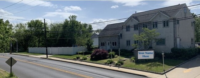
Property Detail
710 Laurel Rd
Philadelphia-Camden-Wilmington, PA-NJ-DE-MD
FACILITY NAME: ABT EXP 12/31/19
22-00238-01-00004
Camden
Commercialnec
New Jersey
B and X Area of moderate flood hazard, usually the area between the limits of the 100-year and 500-year floods.
3
2025
0.32 AC
2025
South Camden County
608600
Philadelphia
2,694 SF
NEARBY LISTINGS FOR SALE OR LEASE
DEMOGRAPHICS near 710 Laurel Rd
1 mile
3 mile
5 mile
2025 Total Population
16,893
101,425
220,596
2030 Population
17,185
103,038
224,743
Pop Growth 2025-2030
+ 1.73%
+ 1.59%
+ 1.88%
Average Age
40
40
41
2025 Total Households
6,941
41,703
86,191
HH Growth 2025-2030
+ 1.71%
+ 1.64%
+ 1.91%
Median Household Inc
$78,648
$77,122
$92,766
Avg Household Size
2.40
2.40
2.50
2025 Avg HH Vehicles
2.00
2.00
2.00
Median Home Value
$241,286
$256,967
$298,863
Median Year Built
1969
1973
1972
Nearby Places
Map Layers
Map Styles
 Street
 Aerial
Layers
 Traffic
 Biking
Places
Listings with unknown addresses are not visible on the map
- Restaurants
- Banks
- Shops
- Fitness
- Groceries
PUBLIC TRANSPORTATION
COMMUTER RAIL
Lindenwold (NJT) (Atlantic City Line - NJ Transit Commuter Rail (NJ Transit))
Drive
Walk
Distance
Lindenwold (NJT) (Atlantic City Line - NJ Transit Commuter Rail (NJ Transit))
4 min
1.7 mi
Atco (Atlantic City Line - NJ Transit Commuter Rail (NJ Transit))
Drive
Walk
Distance
Atco (Atlantic City Line - NJ Transit Commuter Rail (NJ Transit))
12 min
7.9 mi
AIRPORT
Philadelphia International
Drive
Walk
Distance
Philadelphia International
32 min
19.9 mi
Atlantic City International
Drive
Walk
Distance
Atlantic City International
71 min
39.5 mi
Trenton Mercer
Drive
Walk
Distance
Trenton Mercer
61 min
43.9 mi
Freight Ports
Broadway Terminal - Pier 5
Drive
Walk
Distance
Broadway Terminal - Pier 5
17 min
11.4 mi
SALE & LEASE HISTORY
LISTING DATE
SALE/LEASE

Sep 24, 2020
For Sale
Oct 20, 2020
For Sale
Jul 09, 2021
For Lease
Nearby Properties
Address
Land Use
TOTAL SIZE
Lot Size
Zoning
Address
Land Use
TOTAL SIZE
Lot Size
Zoning
Address
Land Use
TOTAL SIZE
Lot Size
Zoning
54.91 AC
Address
Land Use
TOTAL SIZE
Lot Size
Zoning
Address
Land Use
TOTAL SIZE
Lot Size
Zoning
61.94 AC
R3
Address
Land Use
TOTAL SIZE
Lot Size
Zoning
46,360 SF
8.07 AC
Address
Land Use
TOTAL SIZE
Lot Size
Zoning
48 AC
R-3
Address
Land Use
TOTAL SIZE
Lot Size
Zoning
231,652 SF
24.41 AC
B
Address
Land Use
TOTAL SIZE
Lot Size
Zoning
164,434 SF
30.98 AC
TC
Address
Land Use
TOTAL SIZE
Lot Size
Zoning
56,408 SF
11.25 AC
TC
Address
Land Use
TOTAL SIZE
Lot Size
Zoning
48,840 SF
11.04 AC
TC
Address
Land Use
TOTAL SIZE
Lot Size
Zoning
112,443 SF
15.75 AC
TC
Address
Land Use
TOTAL SIZE
Lot Size
Zoning
33.50 AC
INS
Address
Land Use
TOTAL SIZE
Lot Size
Zoning
48,840 SF
9.55 AC
TC
Address
Land Use
TOTAL SIZE
Lot Size
Zoning
36.17 AC
Address
Land Use
TOTAL SIZE
Lot Size
Zoning
86,568 SF
11.30 AC
TC
Address
Land Use
TOTAL SIZE
Lot Size
Zoning
40,116 SF
2.84 AC
TC
Address
Land Use
TOTAL SIZE
Lot Size
Zoning
33.24 AC
INS
Address
Land Use
TOTAL SIZE
Lot Size
Zoning
Address
Land Use
TOTAL SIZE
Lot Size
Zoning
28.40 AC
Address
Land Use
TOTAL SIZE
Lot Size
Zoning
29.87 AC
R-3
Address
Land Use
TOTAL SIZE
Lot Size
Zoning
69,604 SF
11.99 AC
R10
Address
Land Use
TOTAL SIZE
Lot Size
Zoning
Address
Land Use
TOTAL SIZE
Lot Size
Zoning
31.80 AC
Address
Land Use
TOTAL SIZE
Lot Size
Zoning
128,662 SF
15.87 AC
TC-1
Address
Land Use
TOTAL SIZE
Lot Size
Zoning
28.93 AC
Address
Land Use
TOTAL SIZE
Lot Size
Zoning
222,056 SF
25.98 AC
O3
Address
Land Use
TOTAL SIZE
Lot Size
Zoning
126,080 SF
TC-1
Address
Land Use
TOTAL SIZE
Lot Size
Zoning
5.29 AC
Address
Land Use
TOTAL SIZE
Lot Size
Zoning
17.27 AC
Address
Land Use
TOTAL SIZE
Lot Size
Zoning
18.57 AC
RA
The World's #1 Commercial Real Estate Marketplace
Connect with us
© 2026 CoStar Group
The information above has been obtained from sources believed reliable. While we do not doubt its accuracy we have not verified it and make no guarantee, warranty or representation about it. It is your responsibility to independently confirm its accuracy and completeness. Any projections, opinions, assumptions, or estimates used are for example only and do not represent the current or future performance of the property. The value of this transaction to you depends on tax and other factors which should be evaluated by your tax, financial, and legal advisors. You and your advisors should conduct a careful, independent investigation of the property to determine to your satisfaction the suitability of the property for your needs.