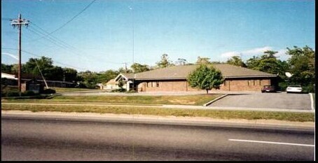
Property Record
710 N Cherry St, Knoxville, TN 37914


NEARBY LISTINGS FOR SALE OR LEASE
Property Detail
710 N Cherry St
Knoxville, TN
Williams Villa Sites Addition S/D
082GG-005
SUBDIVISIONNAME WILLIAMS VILLA SITES ADDITION S/D LOWLO T 31R HIGHLOT LOWBLOCK HIGHBLOCK DIMENSIONS 200.04 X 138.80 X IRR
Medicalbuilding
Knox
X
Tennessee
47009C0050C
31r
0
0.01 AC
2025
North/Broadway
001900
Knoxville
3,928 SF
DEMOGRAPHICS near 710 N Cherry St
1 mile
3 mile
5 mile
2024 Total Population
11,797
74,084
155,322
2029 Population
13,172
81,754
169,942
Pop Growth 2024-2029
+ 11.66%
+ 10.35%
+ 9.41%
Average Age
39
38
37
2024 Total Households
5,293
33,586
66,054
HH Growth 2024-2029
+ 11.90%
+ 10.65%
+ 9.92%
Median Household Inc
$32,678
$38,222
$41,232
Avg Household Size
2.10
2.10
2.10
2024 Avg HH Vehicles
1.00
1.00
2.00
Median Home Value
$138,615
$167,628
$177,412
Median Year Built
1959
1964
1970
Nearby Places
Map Layers
Map Styles
 Street
 Aerial
Transit
 Traffic
 Biking
Places
Listings with unknown addresses are not visible on the map
- Restaurants
- Banks
- Shops
- Fitness
- Groceries
PUBLIC TRANSPORTATION
AIRPORT
McGhee Tyson
Drive
Walk
Distance
McGhee Tyson
34 min
20.0 mi
Freight Ports
North Charleston Terminal
Drive
Walk
Distance
North Charleston Terminal
414 min
361.1 mi
Nearby Properties
Address
Land Use
TOTAL SIZE
Lot Size
Zoning
Address
Land Use
TOTAL SIZE
Lot Size
Zoning
311,042 SF
1.36 AC
Address
Land Use
TOTAL SIZE
Lot Size
Zoning
320,324 SF
2.83 AC
Address
Land Use
TOTAL SIZE
Lot Size
Zoning
210,640 SF
1.90 AC
Address
Land Use
TOTAL SIZE
Lot Size
Zoning
742,968 SF
2.95 AC
Address
Land Use
TOTAL SIZE
Lot Size
Zoning
117,375 SF
1.82 AC
Address
Land Use
TOTAL SIZE
Lot Size
Zoning
120,331 SF
5.62 AC
Address
Land Use
TOTAL SIZE
Lot Size
Zoning
177,685 SF
4.20 AC
Address
Land Use
TOTAL SIZE
Lot Size
Zoning
359,624 SF
60.94 AC
Address
Land Use
TOTAL SIZE
Lot Size
Zoning
210,052 SF
Address
Land Use
TOTAL SIZE
Lot Size
Zoning
173,567 SF
1.10 AC
Address
Land Use
TOTAL SIZE
Lot Size
Zoning
45,702 SF
6.07 AC
Address
Land Use
TOTAL SIZE
Lot Size
Zoning
158,993 SF
Address
Land Use
TOTAL SIZE
Lot Size
Zoning
131,702 SF
0.68 AC
Address
Land Use
TOTAL SIZE
Lot Size
Zoning
180,708 SF
5.26 AC
Address
Land Use
TOTAL SIZE
Lot Size
Zoning
325,704 SF
1.30 AC
Address
Land Use
TOTAL SIZE
Lot Size
Zoning
60,782 SF
6.12 AC
Address
Land Use
TOTAL SIZE
Lot Size
Zoning
201,897 SF
2.07 AC
Address
Land Use
TOTAL SIZE
Lot Size
Zoning
325,704 SF
1.30 AC
Address
Land Use
TOTAL SIZE
Lot Size
Zoning
223,763 SF
2.28 AC
Address
Land Use
TOTAL SIZE
Lot Size
Zoning
79,427 SF
1.74 AC
Address
Land Use
TOTAL SIZE
Lot Size
Zoning
84,171 SF
1.88 AC
Address
Land Use
TOTAL SIZE
Lot Size
Zoning
3,850 SF
23.59 AC
Address
Land Use
TOTAL SIZE
Lot Size
Zoning
1,950 SF
8.60 AC
Address
Land Use
TOTAL SIZE
Lot Size
Zoning
594,455 SF
1.87 AC
Address
Land Use
TOTAL SIZE
Lot Size
Zoning
66,060 SF
1.57 AC
Address
Land Use
TOTAL SIZE
Lot Size
Zoning
6,550 SF
2.01 AC
Address
Land Use
TOTAL SIZE
Lot Size
Zoning
1,134 SF
6.97 AC
Address
Land Use
TOTAL SIZE
Lot Size
Zoning
406,220 SF
3 AC
Address
Land Use
TOTAL SIZE
Lot Size
Zoning
205,588 SF
1.09 AC
Address
Land Use
TOTAL SIZE
Lot Size
Zoning
48,438 SF
1.08 AC
The World's #1 Commercial Real Estate Marketplace
Connect with us
© 2026 CoStar Group
The information above has been obtained from sources believed reliable. While we do not doubt its accuracy we have not verified it and make no guarantee, warranty or representation about it. It is your responsibility to independently confirm its accuracy and completeness. Any projections, opinions, assumptions, or estimates used are for example only and do not represent the current or future performance of the property. The value of this transaction to you depends on tax and other factors which should be evaluated by your tax, financial, and legal advisors. You and your advisors should conduct a careful, independent investigation of the property to determine to your satisfaction the suitability of the property for your needs.