Property Record
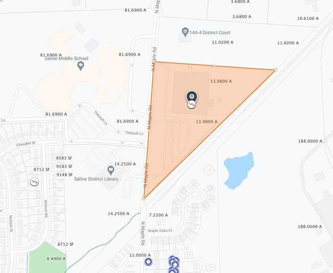
710 N Maple Rd, Saline, MI 48176

Property Detail
710 N Maple Rd
12-31-210-024
OWNER REQUEST SC 1-51B PCL A COM AT N 1/4 COR SEC 31
Industrialgeneral
Washtenaw
I-2
Michigan
B and X Area of moderate flood hazard, usually the area between the limits of the 100-year and 500-year floods.
13.98 AC
2025
Washtenaw W of 23
2025
Detroit
423400
Ann Arbor, MI
111,816 SF
NEARBY LISTINGS FOR SALE OR LEASE
DEMOGRAPHICS near 710 N Maple Rd
1 mile
3 mile
5 mile
2025 Total Population
4,657
21,754
47,608
2030 Population
4,677
21,943
48,191
Pop Growth 2025-2030
+ 0.43%
+ 0.87%
+ 1.22%
Average Age
44
43
42
2025 Total Households
2,064
8,443
18,841
HH Growth 2025-2030
+ 0.97%
+ 1.03%
+ 1.22%
Median Household Inc
$81,639
$116,890
$107,885
Avg Household Size
2.20
2.50
2.40
2025 Avg HH Vehicles
2.00
2.00
2.00
Median Home Value
$315,291
$427,169
$415,134
Median Year Built
1975
1988
1991
Nearby Places
Map Layers
Map Styles
 Street
 Aerial
Layers
 Traffic
 Biking
Places
Listings with unknown addresses are not visible on the map
- Restaurants
- Banks
- Shops
- Fitness
- Groceries
PUBLIC TRANSPORTATION
COMMUTER RAIL
Ann Arbor Amtrak Station (Wolverine - Amtrak)
Drive
Walk
Distance
Ann Arbor Amtrak Station (Wolverine - Amtrak)
17 min
8.6 mi
AIRPORT
Detroit Metro Wayne County
Drive
Walk
Distance
Detroit Metro Wayne County
36 min
27.3 mi
Freight Ports
Port of Toledo
Drive
Walk
Distance
Port of Toledo
73 min
54.9 mi
Nearby Properties
Address
Land Use
TOTAL SIZE
Lot Size
Zoning
Address
Land Use
TOTAL SIZE
Lot Size
Zoning
253,702 SF
30.23 AC
Address
Land Use
TOTAL SIZE
Lot Size
Zoning
167,294 SF
40.67 AC
Address
Land Use
TOTAL SIZE
Lot Size
Zoning
105,615 SF
26.31 AC
Address
Land Use
TOTAL SIZE
Lot Size
Zoning
283,484 SF
22.64 AC
R-3
Address
Land Use
TOTAL SIZE
Lot Size
Zoning
1,562,480 SF
189.08 AC
I-4
Address
Land Use
TOTAL SIZE
Lot Size
Zoning
191,215 SF
30.23 AC
Address
Land Use
TOTAL SIZE
Lot Size
Zoning
99,663 SF
6.89 AC
R-1A
Address
Land Use
TOTAL SIZE
Lot Size
Zoning
88,657 SF
14.98 AC
Address
Land Use
TOTAL SIZE
Lot Size
Zoning
255,838 SF
31.64 AC
II
Address
Land Use
TOTAL SIZE
Lot Size
Zoning
99,000 SF
12.22 AC
I-2
Address
Land Use
TOTAL SIZE
Lot Size
Zoning
76,204 SF
12.41 AC
Address
Land Use
TOTAL SIZE
Lot Size
Zoning
60,362 SF
7.69 AC
Address
Land Use
TOTAL SIZE
Lot Size
Zoning
140,284 SF
6.83 AC
I-2
Address
Land Use
TOTAL SIZE
Lot Size
Zoning
84,415 SF
9.96 AC
II
Address
Land Use
TOTAL SIZE
Lot Size
Zoning
68,866 SF
24.96 AC
II
Address
Land Use
TOTAL SIZE
Lot Size
Zoning
65,899 SF
6.37 AC
R-3
Address
Land Use
TOTAL SIZE
Lot Size
Zoning
60,568 SF
7.69 AC
Address
Land Use
TOTAL SIZE
Lot Size
Zoning
179,324 SF
14.91 AC
I-2
Address
Land Use
TOTAL SIZE
Lot Size
Zoning
105,418 SF
9.47 AC
I-2
Address
Land Use
TOTAL SIZE
Lot Size
Zoning
86,859 SF
12.33 AC
SPA-1
Address
Land Use
TOTAL SIZE
Lot Size
Zoning
53,876 SF
SPA-1
Address
Land Use
TOTAL SIZE
Lot Size
Zoning
47,362 SF
5.70 AC
Address
Land Use
TOTAL SIZE
Lot Size
Zoning
135,417 SF
8.19 AC
I-2
Address
Land Use
TOTAL SIZE
Lot Size
Zoning
8.80 AC
I-2
Address
Land Use
TOTAL SIZE
Lot Size
Zoning
46,698 SF
5.28 AC
Address
Land Use
TOTAL SIZE
Lot Size
Zoning
33,000 SF
I-2
Address
Land Use
TOTAL SIZE
Lot Size
Zoning
51,843 SF
13.35 AC
Address
Land Use
TOTAL SIZE
Lot Size
Zoning
35,084 SF
4.60 AC
II
Address
Land Use
TOTAL SIZE
Lot Size
Zoning
49,311 SF
4.90 AC
SPA-1
Address
Land Use
TOTAL SIZE
Lot Size
Zoning
53,244 SF
8.10 AC
SPA-1
The World's #1 Commercial Real Estate Marketplace
Connect with us
© 2026 CoStar Group
The information above has been obtained from sources believed reliable. While we do not doubt its accuracy we have not verified it and make no guarantee, warranty or representation about it. It is your responsibility to independently confirm its accuracy and completeness. Any projections, opinions, assumptions, or estimates used are for example only and do not represent the current or future performance of the property. The value of this transaction to you depends on tax and other factors which should be evaluated by your tax, financial, and legal advisors. You and your advisors should conduct a careful, independent investigation of the property to determine to your satisfaction the suitability of the property for your needs.