Property Record
7100 Chesapeake Rd, Hyattsville, MD 20784

Current Lease Availabilities
NEARBY LISTINGS FOR SALE OR LEASE
Property Detail
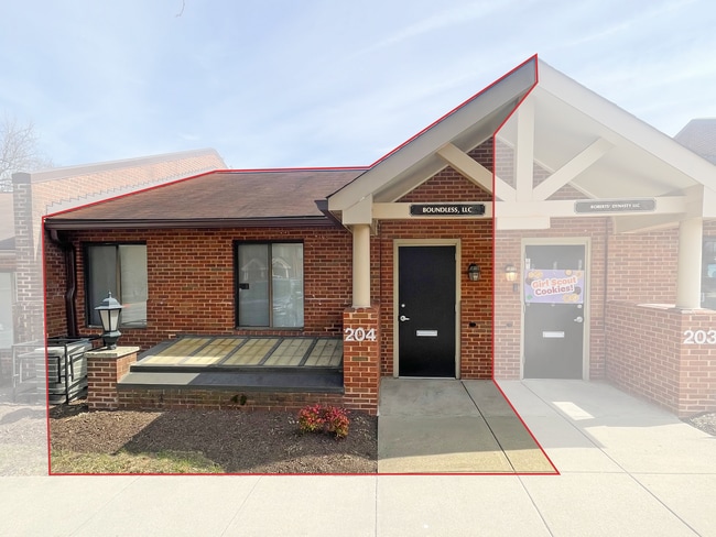
7100 Chesapeake Rd
20-2198422
Chesapeake Office Park
Commercialnec
UNIT 103
X
Prince George's
24033C0134E
Maryland
2024
Lanham
2025
Washington, DC
803612
Washington-Arlington-Alexandria, DC-VA-MD-WV
920 SF
DEMOGRAPHICS near 7100 Chesapeake Rd
1 Mile
3 Mile
5 Mile
2024 Total Population
19,050
137,336
370,595
2029 Population
18,492
134,029
359,801
Pop Growth 2024-2029
(2.93%)
(2.41%)
(2.91%)
Average Age
37
37
38
2024 Total Households
6,299
43,098
126,601
HH Growth 2024-2029
(2.75%)
(2.51%)
(3.19%)
Median Household Inc
$69,750
$78,466
$76,838
Avg Household Size
3.00
3.10
2.70
2024 Avg HH Vehicles
2.00
2.00
2.00
Median Home Value
$299,399
$348,909
$373,492
Median Year Built
1965
1966
1969
Nearby Places
Map Layers
Map Styles
 Street
 Aerial
- Restaurants
- Banks
- Shops
- Fitness
- Groceries
PUBLIC TRANSPORTATION
COMMUTER RAIL
New Carrollton (PENN - WASHINGTON - Maryland Area Regional Commuter Trains (The MARC), Penn Line - Maryland Area Regional Commuter Trains (The MARC))
DRIVE
WALK
Distance
New Carrollton (PENN - WASHINGTON - Maryland Area Regional Commuter Trains (The MARC), Penn Line - Maryland Area Regional Commuter Trains (The MARC))
3 min
1.3 mi
New Carrollton Marc Nb (PENN - WASHINGTON - Maryland Transit Administration)
DRIVE
WALK
Distance
New Carrollton Marc Nb (PENN - WASHINGTON - Maryland Transit Administration)
3 min
1.3 mi
AIRPORT
Ronald Reagan Washington Ntl
DRIVE
WALK
Distance
Ronald Reagan Washington Ntl
24 min
14.9 mi
Baltimore/Washington International Thurgood Marshall
DRIVE
WALK
Distance
Baltimore/Washington International Thurgood Marshall
36 min
24.1 mi
Freight Ports
Port of Baltimore
DRIVE
WALK
Distance
Port of Baltimore
46 min
30.7 mi
Nearby Properties
Address
Land Use
TOTAL SIZE
Lot Size
Zoning
Address
Land Use
TOTAL SIZE
Lot Size
Zoning
1,631,415 SF
24.33 AC
RTOHC
Address
Land Use
TOTAL SIZE
Lot Size
Zoning
177,081 SF
23.22 AC
LCD
Address
Land Use
TOTAL SIZE
Lot Size
Zoning
944,105 SF
23.09 AC
CGO
Address
Land Use
TOTAL SIZE
Lot Size
Zoning
413,915 SF
39.86 AC
IE
Address
Land Use
TOTAL SIZE
Lot Size
Zoning
393,700 SF
1.30 AC
RTOLC
Address
Land Use
TOTAL SIZE
Lot Size
Zoning
337,216 SF
1.18 AC
RTOHC
Address
Land Use
TOTAL SIZE
Lot Size
Zoning
821,240 SF
48.32 AC
IH
Address
Land Use
TOTAL SIZE
Lot Size
Zoning
337,500 SF
12.48 AC
RTOLE
Address
Land Use
TOTAL SIZE
Lot Size
Zoning
290,728 SF
29.27 AC
RSF95
Address
Land Use
TOTAL SIZE
Lot Size
Zoning
395,538 SF
9.89 AC
RTOLE
Address
Land Use
TOTAL SIZE
Lot Size
Zoning
1,082,460 SF
9.28 AC
RTOHC
Address
Land Use
TOTAL SIZE
Lot Size
Zoning
2.35 AC
RTOHC
Address
Land Use
TOTAL SIZE
Lot Size
Zoning
327,240 SF
1.72 AC
RTOHC
Address
Land Use
TOTAL SIZE
Lot Size
Zoning
14.85 AC
RMF20
Address
Land Use
TOTAL SIZE
Lot Size
Zoning
182,907 SF
39.78 AC
RR
Address
Land Use
TOTAL SIZE
Lot Size
Zoning
256,896 SF
34.96 AC
RSF65
Address
Land Use
TOTAL SIZE
Lot Size
Zoning
368,038 SF
12.87 AC
IE
Address
Land Use
TOTAL SIZE
Lot Size
Zoning
194,850 SF
8.90 AC
LTOE
Address
Land Use
TOTAL SIZE
Lot Size
Zoning
2.09 AC
RTOHC
Address
Land Use
TOTAL SIZE
Lot Size
Zoning
218,628 SF
1.45 AC
RTOHC
Address
Land Use
TOTAL SIZE
Lot Size
Zoning
300,000 SF
2.82 AC
RTOHC
Address
Land Use
TOTAL SIZE
Lot Size
Zoning
169,431 SF
43.81 AC
CGO
Address
Land Use
TOTAL SIZE
Lot Size
Zoning
108,864 SF
0.91 AC
RTOHC
Address
Land Use
TOTAL SIZE
Lot Size
Zoning
226,810 SF
21.40 AC
RSF65
Address
Land Use
TOTAL SIZE
Lot Size
Zoning
123,464 SF
8.03 AC
RTOLE
Address
Land Use
TOTAL SIZE
Lot Size
Zoning
2.35 AC
RTOHC
Address
Land Use
TOTAL SIZE
Lot Size
Zoning
10.81 AC
RMF48
Address
Land Use
TOTAL SIZE
Lot Size
Zoning
57,288 SF
6.94 AC
TACE
Address
Land Use
TOTAL SIZE
Lot Size
Zoning
329,080 SF
15.31 AC
IE
Address
Land Use
TOTAL SIZE
Lot Size
Zoning
21.47 AC
LTOE
The World's #1 Commercial Real Estate Marketplace
Connect with us
© 2025 CoStar Group
The information above has been obtained from sources believed reliable. While we do not doubt its accuracy we have not verified it and make no guarantee, warranty or representation about it. It is your responsibility to independently confirm its accuracy and completeness. Any projections, opinions, assumptions, or estimates used are for example only and do not represent the current or future performance of the property. The value of this transaction to you depends on tax and other factors which should be evaluated by your tax, financial, and legal advisors. You and your advisors should conduct a careful, independent investigation of the property to determine to your satisfaction the suitability of the property for your needs.