Property Record
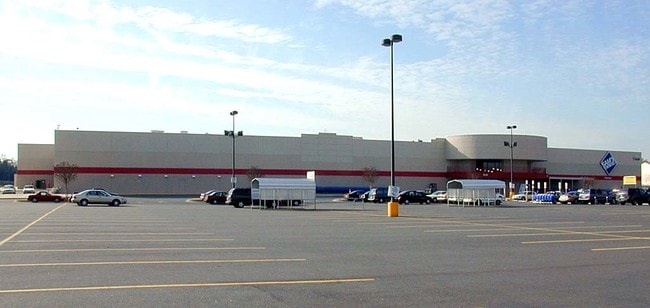
7100 Forest Point Blvd, Charlotte, NC 28217


NEARBY LISTINGS FOR SALE OR LEASE
Property Detail
7100 Forest Point Blvd
Charlotte-Concord-Gastonia, NC-SC
Forest Park North Rev
167-193-04
L4 M24-934
Industrialgeneral
Mecklenburg
X
North Carolina
3710453100K
4
2022
18.56 AC
2025
State Line
003807
Charlotte
149,762 SF
DEMOGRAPHICS near 7100 Forest Point Blvd
1 mile
3 mile
5 mile
2024 Total Population
12,966
71,155
191,446
2029 Population
13,917
75,589
203,317
Pop Growth 2024-2029
+ 7.33%
+ 6.23%
+ 6.20%
Average Age
33
35
37
2024 Total Households
4,455
30,348
83,450
HH Growth 2024-2029
+ 7.34%
+ 6.19%
+ 6.22%
Median Household Inc
$46,357
$65,840
$76,700
Avg Household Size
2.80
2.30
2.20
2024 Avg HH Vehicles
2.00
2.00
2.00
Median Home Value
$188,524
$298,714
$380,744
Median Year Built
1986
1990
1990
Nearby Places
Map Layers
Map Styles
 Street
 Aerial
Transit
 Traffic
 Biking
Places
Listings with unknown addresses are not visible on the map
- Restaurants
- Banks
- Shops
- Fitness
- Groceries
PUBLIC TRANSPORTATION
COMMUTER RAIL
Drive
Walk
Distance
16 min
9.6 mi
AIRPORT
Charlotte/Douglas International
Drive
Walk
Distance
Charlotte/Douglas International
17 min
7.2 mi
Concord-Padgett Regional
Drive
Walk
Distance
Concord-Padgett Regional
35 min
23.3 mi
Nearby Properties
Address
Land Use
TOTAL SIZE
Lot Size
Zoning
Address
Land Use
TOTAL SIZE
Lot Size
Zoning
605,976 SF
46.31 AC
R17MF
Address
Land Use
TOTAL SIZE
Lot Size
Zoning
646,209 SF
72.24 AC
CC
Address
Land Use
TOTAL SIZE
Lot Size
Zoning
393,779 SF
26.71 AC
R17MF
Address
Land Use
TOTAL SIZE
Lot Size
Zoning
554,176 SF
3.88 AC
I-2
Address
Land Use
TOTAL SIZE
Lot Size
Zoning
395,382 SF
9.84 AC
MUDDO
Address
Land Use
TOTAL SIZE
Lot Size
Zoning
408,632 SF
50 AC
R12MFCD
Address
Land Use
TOTAL SIZE
Lot Size
Zoning
381,729 SF
22.37 AC
R17MF
Address
Land Use
TOTAL SIZE
Lot Size
Zoning
371,416 SF
30.90 AC
BPCD
Address
Land Use
TOTAL SIZE
Lot Size
Zoning
298,298 SF
16.60 AC
R17MFCD
Address
Land Use
TOTAL SIZE
Lot Size
Zoning
1,007,888 SF
55.04 AC
G-I
Address
Land Use
TOTAL SIZE
Lot Size
Zoning
339,546 SF
7.52 AC
Address
Land Use
TOTAL SIZE
Lot Size
Zoning
307,493 SF
24.47 AC
R12MFCD
Address
Land Use
TOTAL SIZE
Lot Size
Zoning
604,827 SF
41.01 AC
O1CD
Address
Land Use
TOTAL SIZE
Lot Size
Zoning
245,979 SF
7.60 AC
Address
Land Use
TOTAL SIZE
Lot Size
Zoning
302,196 SF
6.60 AC
I2
Address
Land Use
TOTAL SIZE
Lot Size
Zoning
375,064 SF
10.87 AC
R-22MF
Address
Land Use
TOTAL SIZE
Lot Size
Zoning
289,148 SF
17.12 AC
Address
Land Use
TOTAL SIZE
Lot Size
Zoning
272,801 SF
12.90 AC
Address
Land Use
TOTAL SIZE
Lot Size
Zoning
305,078 SF
10.98 AC
Address
Land Use
TOTAL SIZE
Lot Size
Zoning
224,559 SF
5.38 AC
I2
Address
Land Use
TOTAL SIZE
Lot Size
Zoning
238,604 SF
25.85 AC
R12MF
Address
Land Use
TOTAL SIZE
Lot Size
Zoning
14,297 SF
3.32 AC
TOD-CC
Address
Land Use
TOTAL SIZE
Lot Size
Zoning
329,369 SF
23.03 AC
Address
Land Use
TOTAL SIZE
Lot Size
Zoning
267,294 SF
16.43 AC
NS
Address
Land Use
TOTAL SIZE
Lot Size
Zoning
1,396,936 SF
68.78 AC
I2
Address
Land Use
TOTAL SIZE
Lot Size
Zoning
402,998 SF
23.82 AC
RI
Address
Land Use
TOTAL SIZE
Lot Size
Zoning
136,576 SF
4.75 AC
Address
Land Use
TOTAL SIZE
Lot Size
Zoning
334,858 SF
40.40 AC
I-2
Address
Land Use
TOTAL SIZE
Lot Size
Zoning
290,427 SF
20.06 AC
R17MF
Address
Land Use
TOTAL SIZE
Lot Size
Zoning
295,441 SF
23.20 AC
O1CD
The World's #1 Commercial Real Estate Marketplace
Connect with us
© 2026 CoStar Group
The information above has been obtained from sources believed reliable. While we do not doubt its accuracy we have not verified it and make no guarantee, warranty or representation about it. It is your responsibility to independently confirm its accuracy and completeness. Any projections, opinions, assumptions, or estimates used are for example only and do not represent the current or future performance of the property. The value of this transaction to you depends on tax and other factors which should be evaluated by your tax, financial, and legal advisors. You and your advisors should conduct a careful, independent investigation of the property to determine to your satisfaction the suitability of the property for your needs.