Property Record
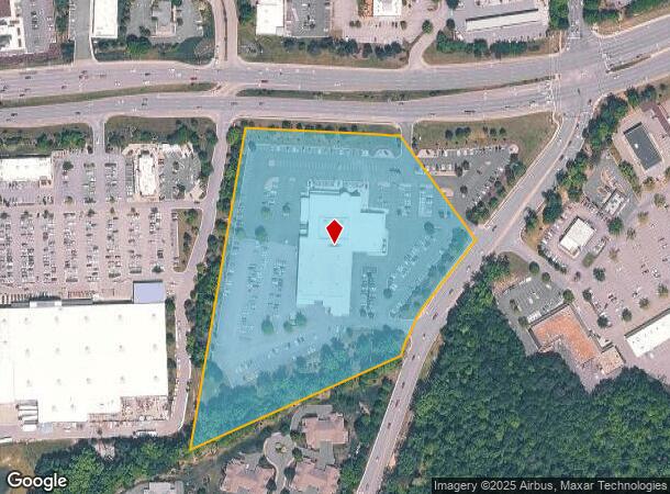
7100 N Spring Run Rd, Midlothian, VA 23112
NEARBY LISTINGS FOR SALE OR LEASE
Property Detail
7100 N Spring Run Rd
724-67-19-22-800-000
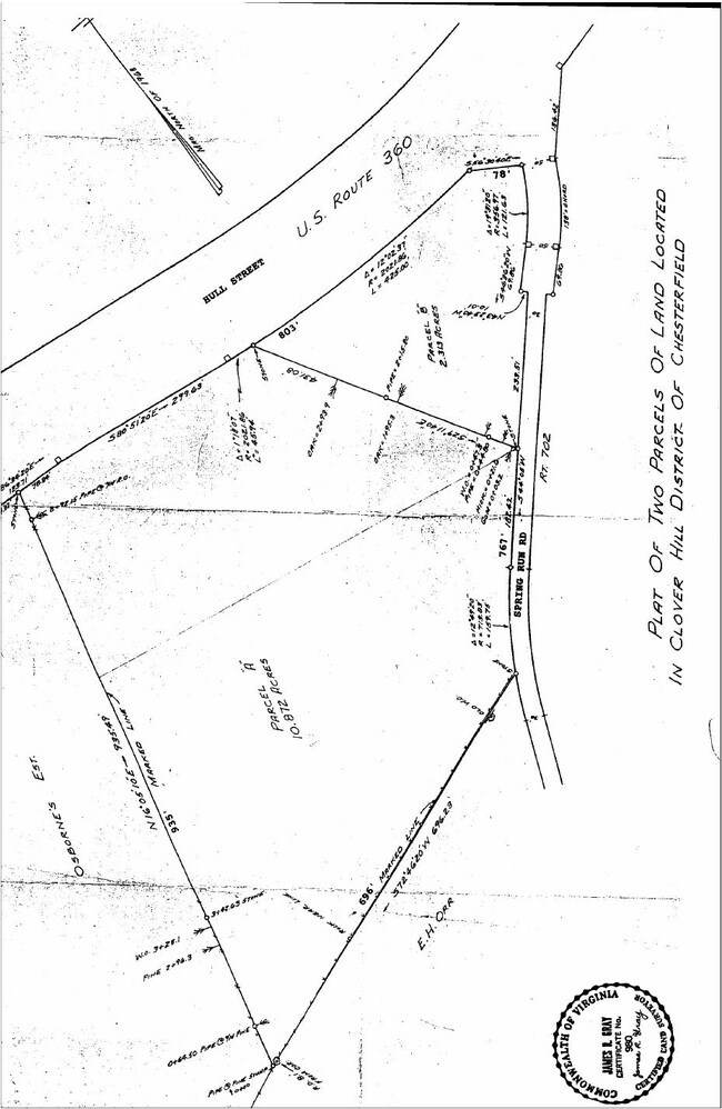
W/L N Spring Run Rd Parcel 1
Vehiclerentalsvehiclesales
W/L N SPRING RUN RD PARCEL 1
X
Chesterfield
51145C0300C
Virginia
0
9.89 AC
2025
Rt 288 Corridor
100912
Richmond VA
64,972 SF
Richmond, VA
DEMOGRAPHICS near 7100 N Spring Run Rd
1 Mile
3 Mile
5 Mile
2024 Total Population
6,275
52,401
103,387
2029 Population
6,836
57,640
114,168
Pop Growth 2024-2029
+ 8.94%
+ 10.00%
+ 10.43%
Average Age
41
40
39
2024 Total Households
2,293
19,092
37,048
HH Growth 2024-2029
+ 9.03%
+ 10.13%
+ 10.46%
Median Household Inc
$113,688
$113,385
$109,545
Avg Household Size
2.70
2.70
2.80
2024 Avg HH Vehicles
2.00
2.00
2.00
Median Home Value
$299,333
$342,805
$353,116
Median Year Built
1990
1996
1997
Nearby Places
Map Layers
Map Styles
 Street
 Aerial
- Restaurants
- Banks
- Shops
- Fitness
- Groceries
PUBLIC TRANSPORTATION
AIRPORT
Richmond International
DRIVE
WALK
Distance
Richmond International
43 min
27.2 mi
Freight Ports
Virginia Port Authority - Richmond
DRIVE
WALK
Distance
Virginia Port Authority - Richmond
31 min
16.8 mi
Nearby Properties
Address
Land Use
TOTAL SIZE
Lot Size
Zoning
Address
Land Use
TOTAL SIZE
Lot Size
Zoning
257,400 SF
85.42 AC
A - AGRICU
Address
Land Use
TOTAL SIZE
Lot Size
Zoning
144,697 SF
97.04 AC
C4 - REGIO
Address
Land Use
TOTAL SIZE
Lot Size
Zoning
137,000 SF
114.67 AC
R9 - SINGL
Address
Land Use
TOTAL SIZE
Lot Size
Zoning
318,965 SF
9.34 AC
C3 - COMMU
Address
Land Use
TOTAL SIZE
Lot Size
Zoning
151,510 SF
49.43 AC
R7 - SINGL
Address
Land Use
TOTAL SIZE
Lot Size
Zoning
111,905 SF
29.13 AC
O2 - CORP
Address
Land Use
TOTAL SIZE
Lot Size
Zoning
98,232 SF
24.69 AC
R9 - SINGL
Address
Land Use
TOTAL SIZE
Lot Size
Zoning
105,856 SF
29.30 AC
O2 - CORP
Address
Land Use
TOTAL SIZE
Lot Size
Zoning
11.22 AC
I1 - LT IN
Address
Land Use
TOTAL SIZE
Lot Size
Zoning
95,857 SF
24.56 AC
C3 - COMMU
Address
Land Use
TOTAL SIZE
Lot Size
Zoning
176,592 SF
9.70 AC
RMF - RES,
Address
Land Use
TOTAL SIZE
Lot Size
Zoning
64,809 SF
16.15 AC
O2 - CORP
Address
Land Use
TOTAL SIZE
Lot Size
Zoning
23,256 SF
21.92 AC
C4 - REGIO
Address
Land Use
TOTAL SIZE
Lot Size
Zoning
40,308 SF
27.28 AC
C3 - COMMU
Address
Land Use
TOTAL SIZE
Lot Size
Zoning
88,847 SF
23.04 AC
R12 - SING
Address
Land Use
TOTAL SIZE
Lot Size
Zoning
53,900 SF
7.70 AC
R12 - SING
Address
Land Use
TOTAL SIZE
Lot Size
Zoning
92,840 SF
21.50 AC
A - AGRICU
Address
Land Use
TOTAL SIZE
Lot Size
Zoning
188,736 SF
20.51 AC
C3 - COMMU
Address
Land Use
TOTAL SIZE
Lot Size
Zoning
58,250 SF
21.74 AC
I1 - LT IN
Address
Land Use
TOTAL SIZE
Lot Size
Zoning
116,542 SF
38.82 AC
R7 - SINGL
Address
Land Use
TOTAL SIZE
Lot Size
Zoning
54,762 SF
4.82 AC
C4 - REGIO
Address
Land Use
TOTAL SIZE
Lot Size
Zoning
30,000 SF
11.96 AC
C4 - REGIO
Address
Land Use
TOTAL SIZE
Lot Size
Zoning
10,675 SF
5.83 AC
C3 - COMMU
Address
Land Use
TOTAL SIZE
Lot Size
Zoning
50,668 SF
8.29 AC
C3 - COMMU
Address
Land Use
TOTAL SIZE
Lot Size
Zoning
71,528 SF
23.96 AC
R12 - SING
Address
Land Use
TOTAL SIZE
Lot Size
Zoning
73,969 SF
24.40 AC
R9 - SINGL
Address
Land Use
TOTAL SIZE
Lot Size
Zoning
6,320 SF
8.25 AC
C3 - COMMU
Address
Land Use
TOTAL SIZE
Lot Size
Zoning
93,442 SF
4.89 AC
C3 - COMMU
Address
Land Use
TOTAL SIZE
Lot Size
Zoning
13,310 SF
5.52 AC
C3 - COMMU
The World's #1 Commercial Real Estate Marketplace
Connect with us
© 2025 CoStar Group
The information above has been obtained from sources believed reliable. While we do not doubt its accuracy we have not verified it and make no guarantee, warranty or representation about it. It is your responsibility to independently confirm its accuracy and completeness. Any projections, opinions, assumptions, or estimates used are for example only and do not represent the current or future performance of the property. The value of this transaction to you depends on tax and other factors which should be evaluated by your tax, financial, and legal advisors. You and your advisors should conduct a careful, independent investigation of the property to determine to your satisfaction the suitability of the property for your needs.