Property Record
7100 Navarre Pky, Navarre, FL 32566


NEARBY LISTINGS FOR SALE OR LEASE
Property Detail
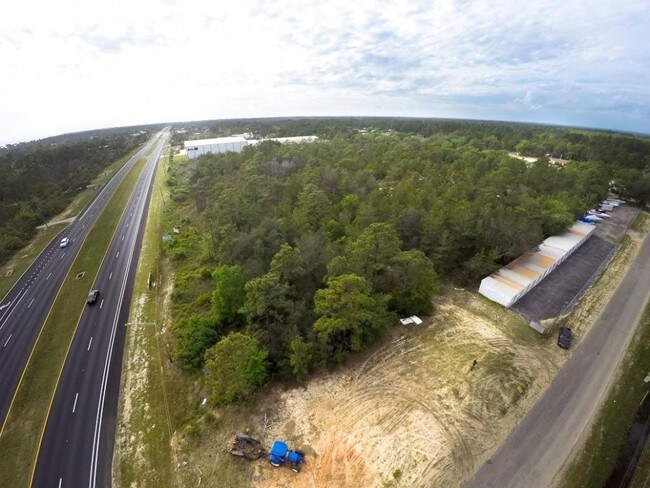
7100 Navarre Pky
Pensacola-Ferry Pass-Brent, FL
Serosa Estates
23-2S-27-0000-02700-0000
COM AT SE CORNER OF LOT 301 BLK C OF SEROSA ESTATES (PB C PG 72) OF SECTION 23 TOWNSHIP 2 SOUTH RANGE 27 WEST THN S89* 3928W ALONG S SUBDIVISION LN 50.56 FT TO POB THN S0*56 27W 613.16 FT TO N R/W OF HWY 98 THN N89*2553W ON R/W 700 FT THN N0*5722E 60
Commercialacreage
Santa Rosa
X
Florida
12113C0568H
301
2024
2.83 AC
2025
Navarre
010821
Pensacola
161,438 SF
DEMOGRAPHICS near 7100 Navarre Pky
1 Mile
3 Mile
5 Mile
2024 Total Population
4,935
28,949
52,472
2029 Population
5,642
33,439
60,936
Pop Growth 2024-2029
+ 14.33%
+ 15.51%
+ 16.13%
Average Age
39
40
40
2024 Total Households
1,829
10,841
19,928
HH Growth 2024-2029
+ 14.71%
+ 15.99%
+ 16.71%
Median Household Inc
$99,955
$95,185
$92,826
Avg Household Size
2.70
2.60
2.60
2024 Avg HH Vehicles
2.00
2.00
2.00
Median Home Value
$287,242
$317,760
$320,237
Median Year Built
2002
2003
2002
Nearby Places
Map Layers
Map Styles
 Street
 Aerial
- Restaurants
- Banks
- Shops
- Fitness
- Groceries
PUBLIC TRANSPORTATION
AIRPORT
Pensacola International
DRIVE
WALK
Distance
Pensacola International
45 min
25.8 mi
Eglin AFB/Destin-Ft Walton Beach
DRIVE
WALK
Distance
Eglin AFB/Destin-Ft Walton Beach
58 min
30.6 mi
Freight Ports
Port of Mobile
DRIVE
WALK
Distance
Port of Mobile
98 min
81.7 mi
SALE & LEASE HISTORY
LISTING DATE
SALE/LEASE

Sep 24, 2016
For Sale
Nearby Properties
Address
Land Use
TOTAL SIZE
Lot Size
Zoning
Address
Land Use
TOTAL SIZE
Lot Size
Zoning
344,974 SF
16.11 AC
R3
Address
Land Use
TOTAL SIZE
Lot Size
Zoning
375,552 SF
10.62 AC
PBD
Address
Land Use
TOTAL SIZE
Lot Size
Zoning
242,842 SF
14.77 AC
PBD
Address
Land Use
TOTAL SIZE
Lot Size
Zoning
241,693 SF
14.28 AC
PBD
Address
Land Use
TOTAL SIZE
Lot Size
Zoning
161,438 SF
5.64 AC
HCD
Address
Land Use
TOTAL SIZE
Lot Size
Zoning
68,134 SF
21.16 AC
R1
Address
Land Use
TOTAL SIZE
Lot Size
Zoning
116,452 SF
4.55 AC
HCD
Address
Land Use
TOTAL SIZE
Lot Size
Zoning
65,936 SF
1.86 AC
PBD
Address
Land Use
TOTAL SIZE
Lot Size
Zoning
51,677 SF
17.79 AC
PBD
Address
Land Use
TOTAL SIZE
Lot Size
Zoning
68,334 SF
4.45 AC
HCD
Address
Land Use
TOTAL SIZE
Lot Size
Zoning
85,562 SF
36.21 AC
PBD
Address
Land Use
TOTAL SIZE
Lot Size
Zoning
19,350 SF
9.10 AC
HCD
Address
Land Use
TOTAL SIZE
Lot Size
Zoning
60,854 SF
7.07 AC
HCD
Address
Land Use
TOTAL SIZE
Lot Size
Zoning
48,198 SF
1.76 AC
PBD
Address
Land Use
TOTAL SIZE
Lot Size
Zoning
130,030 SF
36.74 AC
R1A
Address
Land Use
TOTAL SIZE
Lot Size
Zoning
39,373 SF
185.18 AC
R1
Address
Land Use
TOTAL SIZE
Lot Size
Zoning
36,749 SF
2.75 AC
HCD
Address
Land Use
TOTAL SIZE
Lot Size
Zoning
24,180 SF
4.07 AC
HCD
Address
Land Use
TOTAL SIZE
Lot Size
Zoning
18,054 SF
1.47 AC
HCD
Address
Land Use
TOTAL SIZE
Lot Size
Zoning
40,963 SF
8.36 AC
HCD
Address
Land Use
TOTAL SIZE
Lot Size
Zoning
10,506 SF
0.67 AC
PBD
Address
Land Use
TOTAL SIZE
Lot Size
Zoning
41.24 AC
R1
Address
Land Use
TOTAL SIZE
Lot Size
Zoning
20,150 SF
4.02 AC
HCD
Address
Land Use
TOTAL SIZE
Lot Size
Zoning
17,056 SF
4.17 AC
HCD
The World's #1 Commercial Real Estate Marketplace
Connect with us
© 2026 CoStar Group
The information above has been obtained from sources believed reliable. While we do not doubt its accuracy we have not verified it and make no guarantee, warranty or representation about it. It is your responsibility to independently confirm its accuracy and completeness. Any projections, opinions, assumptions, or estimates used are for example only and do not represent the current or future performance of the property. The value of this transaction to you depends on tax and other factors which should be evaluated by your tax, financial, and legal advisors. You and your advisors should conduct a careful, independent investigation of the property to determine to your satisfaction the suitability of the property for your needs.