Property Record
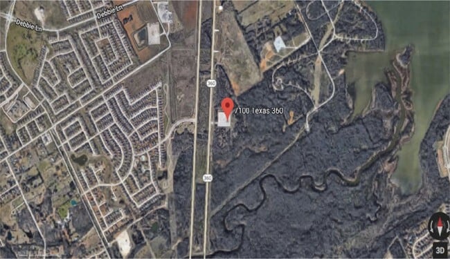
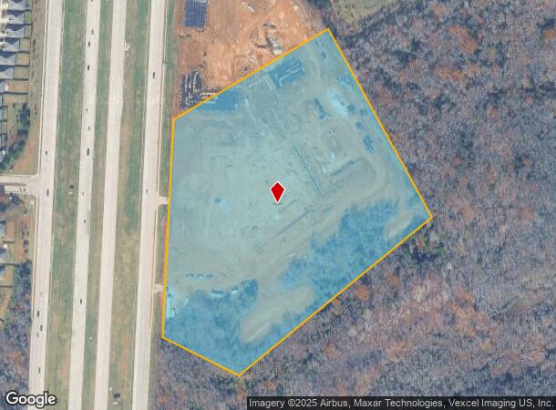
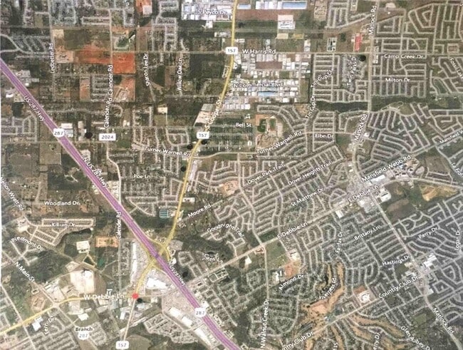
7100 S State Highway 360, Grand Prairie, TX 75054
NEARBY LISTINGS FOR SALE OR LEASE
Property Detail
7100 S State Highway 360
Dallas-Fort Worth-Arlington, TX
Graves, Ralph Survey
03895181
GRAVES, RALPH SURVEY ABSTRACT 569 TRACT 4C
Residentialacreage
Tarrant
X
Texas
48139C0025G
17.16 AC
2023
Grand Prairie
2024
Dallas/Ft Worth
111566
DEMOGRAPHICS near 7100 S State Highway 360
1 Mile
3 Mile
5 Mile
2024 Total Population
8,721
88,977
201,017
2029 Population
9,193
93,500
212,147
Pop Growth 2024-2029
+ 5.41%
+ 5.08%
+ 5.54%
Average Age
34
36
36
2024 Total Households
2,840
27,710
62,955
HH Growth 2024-2029
+ 5.53%
+ 5.19%
+ 5.68%
Median Household Inc
$91,603
$111,582
$96,753
Avg Household Size
3.00
3.20
3.10
2024 Avg HH Vehicles
2.00
2.00
2.00
Median Home Value
$285,849
$319,126
$278,554
Median Year Built
2007
2006
2001
Nearby Places
Map Layers
Map Styles
 Street
 Aerial
- Restaurants
- Banks
- Shops
- Fitness
- Groceries
PUBLIC TRANSPORTATION
AIRPORT
Dallas-Fort Worth International
DRIVE
WALK
Distance
Dallas-Fort Worth International
31 min
22.8 mi
Dallas Love Field
DRIVE
WALK
Distance
Dallas Love Field
41 min
31.4 mi
Freight Ports
Port of Shreveport
DRIVE
WALK
Distance
Port of Shreveport
232 min
217.1 mi
SALE & LEASE HISTORY
LISTING DATE
SALE/LEASE

Jul 14, 2020
For Sale
Nearby Properties
Address
Land Use
TOTAL SIZE
Lot Size
Zoning
Address
Land Use
TOTAL SIZE
Lot Size
Zoning
565,115 SF
27.71 AC
Address
Land Use
TOTAL SIZE
Lot Size
Zoning
399,570 SF
75.21 AC
Address
Land Use
TOTAL SIZE
Lot Size
Zoning
447,960 SF
29.42 AC
Address
Land Use
TOTAL SIZE
Lot Size
Zoning
512,471 SF
69.41 AC
Address
Land Use
TOTAL SIZE
Lot Size
Zoning
443,700 SF
15.69 AC
Z05
Address
Land Use
TOTAL SIZE
Lot Size
Zoning
324,849 SF
13.52 AC
Address
Land Use
TOTAL SIZE
Lot Size
Zoning
453,257 SF
121.21 AC
Address
Land Use
TOTAL SIZE
Lot Size
Zoning
426,667 SF
12.87 AC
Address
Land Use
TOTAL SIZE
Lot Size
Zoning
339,196 SF
12.48 AC
Address
Land Use
TOTAL SIZE
Lot Size
Zoning
326,267 SF
13.11 AC
Address
Land Use
TOTAL SIZE
Lot Size
Zoning
352,649 SF
17.16 AC
Address
Land Use
TOTAL SIZE
Lot Size
Zoning
312,848 SF
17.20 AC
Address
Land Use
TOTAL SIZE
Lot Size
Zoning
260,008 SF
139.37 AC
Address
Land Use
TOTAL SIZE
Lot Size
Zoning
419,875 SF
108.14 AC
Address
Land Use
TOTAL SIZE
Lot Size
Zoning
383,484 SF
10.97 AC
Address
Land Use
TOTAL SIZE
Lot Size
Zoning
270,214 SF
17.85 AC
Address
Land Use
TOTAL SIZE
Lot Size
Zoning
268,520 SF
10.12 AC
Z236
Address
Land Use
TOTAL SIZE
Lot Size
Zoning
273,381 SF
8.32 AC
Address
Land Use
TOTAL SIZE
Lot Size
Zoning
302,022 SF
15.37 AC
Address
Land Use
TOTAL SIZE
Lot Size
Zoning
246,204 SF
15.16 AC
Address
Land Use
TOTAL SIZE
Lot Size
Zoning
258,908 SF
22.41 AC
Address
Land Use
TOTAL SIZE
Lot Size
Zoning
255,134 SF
21.62 AC
Address
Land Use
TOTAL SIZE
Lot Size
Zoning
79,330 SF
23.78 AC
Address
Land Use
TOTAL SIZE
Lot Size
Zoning
353,016 SF
8.08 AC
Address
Land Use
TOTAL SIZE
Lot Size
Zoning
209,307 SF
15.34 AC
Address
Land Use
TOTAL SIZE
Lot Size
Zoning
77,038 SF
11.46 AC
Address
Land Use
TOTAL SIZE
Lot Size
Zoning
250,928 SF
12.44 AC
Z05
Address
Land Use
TOTAL SIZE
Lot Size
Zoning
98,664 SF
5.47 AC
Address
Land Use
TOTAL SIZE
Lot Size
Zoning
165,932 SF
10.70 AC
Address
Land Use
TOTAL SIZE
Lot Size
Zoning
200,443 SF
14.01 AC
The World's #1 Commercial Real Estate Marketplace
Connect with us
© 2025 CoStar Group
The information above has been obtained from sources believed reliable. While we do not doubt its accuracy we have not verified it and make no guarantee, warranty or representation about it. It is your responsibility to independently confirm its accuracy and completeness. Any projections, opinions, assumptions, or estimates used are for example only and do not represent the current or future performance of the property. The value of this transaction to you depends on tax and other factors which should be evaluated by your tax, financial, and legal advisors. You and your advisors should conduct a careful, independent investigation of the property to determine to your satisfaction the suitability of the property for your needs.