Property Record
7100 U S Highway 29, Blairs, VA 24527

NEARBY LISTINGS FOR SALE OR LEASE
-
-
View all Blairs listings for sale on LoopNet.com
Property Detail
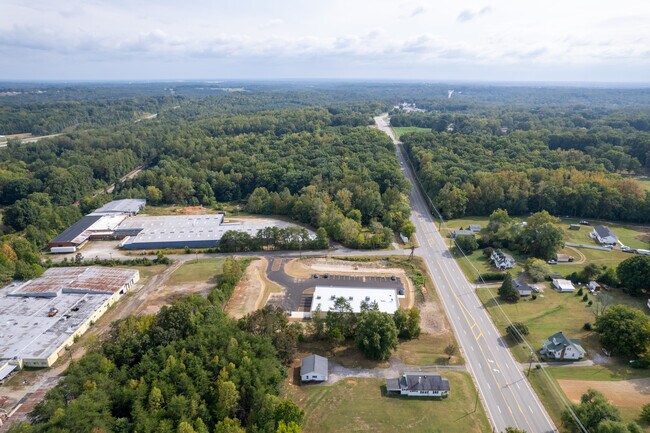
7100 U S Highway 29
Danville, VA
Farm View Estates (0217)
2421-77-7741
LEARNER LN 1090 7.99 ACDB417-505
Taxexempt
Pittsylvania
X
Virginia
51143C0530E
12.21 AC
2025
Virginia South Central
2025
Other Market Areas
011400
DEMOGRAPHICS near 7100 U S Highway 29
1 Mile
3 Mile
5 Mile
2024 Total Population
1,049
8,017
23,344
2029 Population
1,040
7,848
22,791
Pop Growth 2024-2029
(0.86%)
(2.11%)
(2.37%)
Average Age
44
43
43
2024 Total Households
437
3,305
9,886
HH Growth 2024-2029
(0.92%)
(2.18%)
(2.44%)
Median Household Inc
$50,312
$58,100
$51,386
Avg Household Size
2.40
2.40
2.30
2024 Avg HH Vehicles
2.00
2.00
2.00
Median Home Value
$170,097
$196,616
$159,097
Median Year Built
1978
1983
1974
Nearby Places
Map Layers
Map Styles
 Street
 Aerial
- Restaurants
- Banks
- Shops
- Fitness
- Groceries
SALE & LEASE HISTORY
LISTING DATE
SALE/LEASE

Sep 26, 2024
For Sale
Nearby Properties
Address
Land Use
TOTAL SIZE
Lot Size
Zoning
Address
Land Use
TOTAL SIZE
Lot Size
Zoning
712,590 SF
163.02 AC
M-1
Address
Land Use
TOTAL SIZE
Lot Size
Zoning
53.70 AC
M-1
Address
Land Use
TOTAL SIZE
Lot Size
Zoning
73,290 SF
5.94 AC
RMF
Address
Land Use
TOTAL SIZE
Lot Size
Zoning
9.25 AC
B-2
Address
Land Use
TOTAL SIZE
Lot Size
Zoning
21.40 AC
A-1
Address
Land Use
TOTAL SIZE
Lot Size
Zoning
129,864 SF
14.35 AC
M-1
Address
Land Use
TOTAL SIZE
Lot Size
Zoning
5.28 AC
M-1
Address
Land Use
TOTAL SIZE
Lot Size
Zoning
11,470 SF
2 AC
M-1
Address
Land Use
TOTAL SIZE
Lot Size
Zoning
5,980 SF
2.58 AC
B-2
Address
Land Use
TOTAL SIZE
Lot Size
Zoning
2,128 SF
9.59 AC
B-2
Address
Land Use
TOTAL SIZE
Lot Size
Zoning
5 AC
M-1
Address
Land Use
TOTAL SIZE
Lot Size
Zoning
9,015 SF
1.92 AC
R-1
Address
Land Use
TOTAL SIZE
Lot Size
Zoning
97,425 SF
10 AC
M-1
Address
Land Use
TOTAL SIZE
Lot Size
Zoning
3.15 AC
B-2
Address
Land Use
TOTAL SIZE
Lot Size
Zoning
9,401 SF
2.49 AC
R-1
Address
Land Use
TOTAL SIZE
Lot Size
Zoning
4,320 SF
1.79 AC
A-1
Address
Land Use
TOTAL SIZE
Lot Size
Zoning
9,100 SF
1.38 AC
B-2
Address
Land Use
TOTAL SIZE
Lot Size
Zoning
51.64 AC
MHP
Address
Land Use
TOTAL SIZE
Lot Size
Zoning
15.43 AC
B-2
Address
Land Use
TOTAL SIZE
Lot Size
Zoning
1.43 AC
M-1
Address
Land Use
TOTAL SIZE
Lot Size
Zoning
22,800 SF
5 AC
M-1
Address
Land Use
TOTAL SIZE
Lot Size
Zoning
8,304 SF
1.50 AC
A-1
Address
Land Use
TOTAL SIZE
Lot Size
Zoning
6.77 AC
B-2
Address
Land Use
TOTAL SIZE
Lot Size
Zoning
6.16 AC
M-2
Address
Land Use
TOTAL SIZE
Lot Size
Zoning
8.13 AC
M-2
Address
Land Use
TOTAL SIZE
Lot Size
Zoning
2,992 SF
30.79 AC
B-1
Address
Land Use
TOTAL SIZE
Lot Size
Zoning
3,456 SF
5.08 AC
RMF
Address
Land Use
TOTAL SIZE
Lot Size
Zoning
5 AC
B-2
Address
Land Use
TOTAL SIZE
Lot Size
Zoning
0.12 AC
A-1
The World's #1 Commercial Real Estate Marketplace
Connect with us
© 2026 CoStar Group
The information above has been obtained from sources believed reliable. While we do not doubt its accuracy we have not verified it and make no guarantee, warranty or representation about it. It is your responsibility to independently confirm its accuracy and completeness. Any projections, opinions, assumptions, or estimates used are for example only and do not represent the current or future performance of the property. The value of this transaction to you depends on tax and other factors which should be evaluated by your tax, financial, and legal advisors. You and your advisors should conduct a careful, independent investigation of the property to determine to your satisfaction the suitability of the property for your needs.