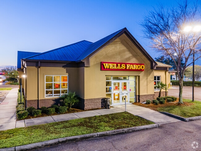
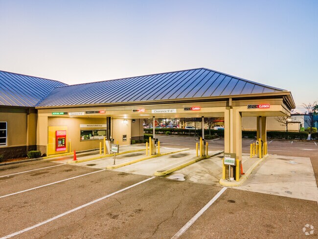
Property Record
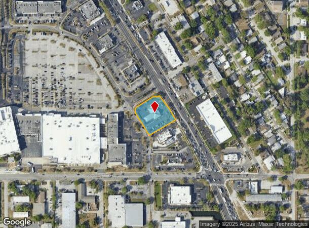
7100 Us Highway 19 N, Pinellas Park, FL 33781
NEARBY LISTINGS FOR SALE OR LEASE
Property Detail
7100 Us Highway 19 N
Tampa-St. Petersburg-Clearwater, FL
Shoppes At Park Place
27-30-16-81205-001-0100
SHOPPES AT PARK PLACE BLK 1, LOT 10
Financialbuilding
Pinellas
X
Florida
12103C0208J
10
2024
0.98 AC
2025
South Pinellas
024908
Tampa/St Petersburg
6,374 SF
DEMOGRAPHICS near 7100 Us Highway 19 N
1 Mile
3 Mile
5 Mile
2024 Total Population
13,668
112,502
268,566
2029 Population
13,962
112,641
269,035
Pop Growth 2024-2029
+ 2.15%
+ 0.12%
+ 0.17%
Average Age
44
43
43
2024 Total Households
6,321
49,573
123,166
HH Growth 2024-2029
+ 2.39%
+ 0.07%
+ 0.03%
Median Household Inc
$47,906
$53,998
$61,000
Avg Household Size
2.10
2.20
2.10
2024 Avg HH Vehicles
1.00
2.00
2.00
Median Home Value
$145,061
$206,262
$249,856
Median Year Built
1975
1970
1971
Nearby Places
Map Layers
Map Styles
 Street
 Aerial
- Restaurants
- Banks
- Shops
- Fitness
- Groceries
PUBLIC TRANSPORTATION
AIRPORT
St Pete-Clearwater International
DRIVE
WALK
Distance
St Pete-Clearwater International
19 min
8.0 mi
Tampa International
DRIVE
WALK
Distance
Tampa International
26 min
17.0 mi
Freight Ports
Port Manatee
DRIVE
WALK
Distance
Port Manatee
40 min
29.8 mi
Nearby Properties
Address
Land Use
TOTAL SIZE
Lot Size
Zoning
Address
Land Use
TOTAL SIZE
Lot Size
Zoning
372,013 SF
10.10 AC
Address
Land Use
TOTAL SIZE
Lot Size
Zoning
447,664 SF
34.44 AC
Address
Land Use
TOTAL SIZE
Lot Size
Zoning
171,420 SF
300.24 AC
M1
Address
Land Use
TOTAL SIZE
Lot Size
Zoning
346,420 SF
17.95 AC
Address
Land Use
TOTAL SIZE
Lot Size
Zoning
372,436 SF
22.30 AC
Address
Land Use
TOTAL SIZE
Lot Size
Zoning
404,063 SF
12.98 AC
Address
Land Use
TOTAL SIZE
Lot Size
Zoning
404,899 SF
35.35 AC
Address
Land Use
TOTAL SIZE
Lot Size
Zoning
358,681 SF
11.70 AC
Address
Land Use
TOTAL SIZE
Lot Size
Zoning
240,736 SF
58.40 AC
Address
Land Use
TOTAL SIZE
Lot Size
Zoning
402,681 SF
18.40 AC
Address
Land Use
TOTAL SIZE
Lot Size
Zoning
359,527 SF
19.65 AC
Address
Land Use
TOTAL SIZE
Lot Size
Zoning
324,579 SF
16.97 AC
Address
Land Use
TOTAL SIZE
Lot Size
Zoning
309,526 SF
36.85 AC
C2
Address
Land Use
TOTAL SIZE
Lot Size
Zoning
444,770 SF
14.95 AC
Address
Land Use
TOTAL SIZE
Lot Size
Zoning
464,493 SF
17.41 AC
Address
Land Use
TOTAL SIZE
Lot Size
Zoning
572,006 SF
13.01 AC
Address
Land Use
TOTAL SIZE
Lot Size
Zoning
300,546 SF
6.49 AC
Address
Land Use
TOTAL SIZE
Lot Size
Zoning
423,776 SF
20.91 AC
Address
Land Use
TOTAL SIZE
Lot Size
Zoning
170,146 SF
17.78 AC
Address
Land Use
TOTAL SIZE
Lot Size
Zoning
240,392 SF
58.32 AC
Address
Land Use
TOTAL SIZE
Lot Size
Zoning
267,649 SF
17.86 AC
Address
Land Use
TOTAL SIZE
Lot Size
Zoning
288,272 SF
12.34 AC
Address
Land Use
TOTAL SIZE
Lot Size
Zoning
298,116 SF
12.34 AC
Address
Land Use
TOTAL SIZE
Lot Size
Zoning
258,722 SF
11.04 AC
Address
Land Use
TOTAL SIZE
Lot Size
Zoning
281,993 SF
85.13 AC
Address
Land Use
TOTAL SIZE
Lot Size
Zoning
193,194 SF
13.53 AC
Address
Land Use
TOTAL SIZE
Lot Size
Zoning
360,137 SF
37.64 AC
AE
Address
Land Use
TOTAL SIZE
Lot Size
Zoning
244,896 SF
28.70 AC
Address
Land Use
TOTAL SIZE
Lot Size
Zoning
172,600 SF
20.57 AC
Address
Land Use
TOTAL SIZE
Lot Size
Zoning
172,768 SF
15.05 AC
RPD20
The World's #1 Commercial Real Estate Marketplace
Connect with us
© 2025 CoStar Group
The information above has been obtained from sources believed reliable. While we do not doubt its accuracy we have not verified it and make no guarantee, warranty or representation about it. It is your responsibility to independently confirm its accuracy and completeness. Any projections, opinions, assumptions, or estimates used are for example only and do not represent the current or future performance of the property. The value of this transaction to you depends on tax and other factors which should be evaluated by your tax, financial, and legal advisors. You and your advisors should conduct a careful, independent investigation of the property to determine to your satisfaction the suitability of the property for your needs.