Property Record
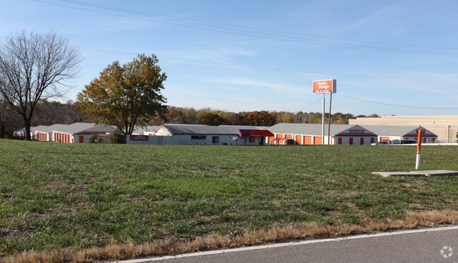
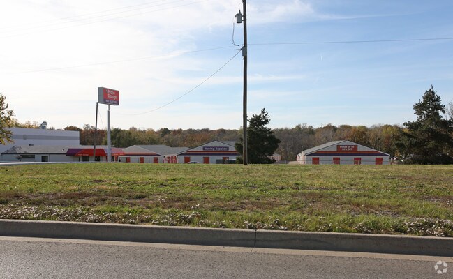
7100 W Frontage Rd, Shawnee, KS 66203

Property Detail
7100 W Frontage Rd
JP71000000-000B
SHERIDAN ACRES N 698.34 LT B EX S 382.65 SUBJ TO PT IN HWYMEC
Publicstorage
JOHNSON
I-1
Kansas
B and X Area of moderate flood hazard, usually the area between the limits of the 100-year and 500-year floods.
b
2024
4.05 AC
2025
Northwest Johnson County
052004
Kansas City
26,240 SF
Kansas City, MO-KS
NEARBY LISTINGS FOR SALE OR LEASE
DEMOGRAPHICS near 7100 W Frontage Rd
1 mile
3 mile
5 mile
2025 Total Population
11,128
104,812
243,324
2030 Population
11,521
108,066
249,997
Pop Growth 2025-2030
+ 3.53%
+ 3.10%
+ 2.74%
Average Age
39
40
41
2025 Total Households
5,208
46,768
105,966
HH Growth 2025-2030
+ 3.71%
+ 3.26%
+ 2.92%
Median Household Inc
$65,872
$77,130
$85,056
Avg Household Size
2.10
2.20
2.20
2025 Avg HH Vehicles
2.00
2.00
2.00
Median Home Value
$264,357
$290,284
$332,300
Median Year Built
1969
1969
1970
Nearby Places
Map Layers
Map Styles
 Street
 Aerial
Layers
 Traffic
 Biking
Places
Listings with unknown addresses are not visible on the map
- Restaurants
- Banks
- Shops
- Fitness
- Groceries
PUBLIC TRANSPORTATION
AIRPORT
Kansas City International
Drive
Walk
Distance
Kansas City International
38 min
28.1 mi
Freight Ports
Tulsa Port Of Catoosa
Drive
Walk
Distance
Tulsa Port Of Catoosa
256 min
228.4 mi
Nearby Properties
Address
Land Use
TOTAL SIZE
Lot Size
Zoning
Address
Land Use
TOTAL SIZE
Lot Size
Zoning
857,568 SF
38.48 AC
PUD-G
Address
Land Use
TOTAL SIZE
Lot Size
Zoning
203,079 SF
8.10 AC
BP2
Address
Land Use
TOTAL SIZE
Lot Size
Zoning
202,842 SF
10.20 AC
PD
Address
Land Use
TOTAL SIZE
Lot Size
Zoning
312,446 SF
39.35 AC
R-1
Address
Land Use
TOTAL SIZE
Lot Size
Zoning
238,812 SF
37.40 AC
R-1
Address
Land Use
TOTAL SIZE
Lot Size
Zoning
133,505 SF
16.41 AC
R-1
Address
Land Use
TOTAL SIZE
Lot Size
Zoning
96,501 SF
6.49 AC
Address
Land Use
TOTAL SIZE
Lot Size
Zoning
81,762 SF
9.66 AC
R-1
Address
Land Use
TOTAL SIZE
Lot Size
Zoning
89,477 SF
16.45 AC
R-1
Address
Land Use
TOTAL SIZE
Lot Size
Zoning
63,471 SF
7.36 AC
PARK
Address
Land Use
TOTAL SIZE
Lot Size
Zoning
42,597 SF
4.39 AC
MS2
Address
Land Use
TOTAL SIZE
Lot Size
Zoning
75,010 SF
5.53 AC
PD
Address
Land Use
TOTAL SIZE
Lot Size
Zoning
90,774 SF
1.73 AC
MS2
Address
Land Use
TOTAL SIZE
Lot Size
Zoning
85,703 SF
7.84 AC
R-1
Address
Land Use
TOTAL SIZE
Lot Size
Zoning
79,437 SF
4.12 AC
DFD
Address
Land Use
TOTAL SIZE
Lot Size
Zoning
85,940 SF
9.08 AC
RGA
Address
Land Use
TOTAL SIZE
Lot Size
Zoning
139,880 SF
17.18 AC
R1
Address
Land Use
TOTAL SIZE
Lot Size
Zoning
96,856 SF
15.76 AC
R-1
Address
Land Use
TOTAL SIZE
Lot Size
Zoning
89,002 SF
8.77 AC
R-1
Address
Land Use
TOTAL SIZE
Lot Size
Zoning
65,932 SF
3.72 AC
PUD-G
Address
Land Use
TOTAL SIZE
Lot Size
Zoning
88,866 SF
21.54 AC
RS
Address
Land Use
TOTAL SIZE
Lot Size
Zoning
93,418 SF
12.07 AC
R-1
Address
Land Use
TOTAL SIZE
Lot Size
Zoning
85,469 SF
10.32 AC
CPO
Address
Land Use
TOTAL SIZE
Lot Size
Zoning
81,361 SF
3.81 AC
AG
Address
Land Use
TOTAL SIZE
Lot Size
Zoning
70,952 SF
9.98 AC
R-1
Address
Land Use
TOTAL SIZE
Lot Size
Zoning
100,784 SF
4.68 AC
C-2B
Address
Land Use
TOTAL SIZE
Lot Size
Zoning
35,848 SF
74.74 AC
R1
Address
Land Use
TOTAL SIZE
Lot Size
Zoning
279,588 SF
19.50 AC
RP5
Address
Land Use
TOTAL SIZE
Lot Size
Zoning
74,802 SF
10.55 AC
CP-O
Address
Land Use
TOTAL SIZE
Lot Size
Zoning
36,769 SF
17.41 AC
R-1
The World's #1 Commercial Real Estate Marketplace
Connect with us
© 2026 CoStar Group
The information above has been obtained from sources believed reliable. While we do not doubt its accuracy we have not verified it and make no guarantee, warranty or representation about it. It is your responsibility to independently confirm its accuracy and completeness. Any projections, opinions, assumptions, or estimates used are for example only and do not represent the current or future performance of the property. The value of this transaction to you depends on tax and other factors which should be evaluated by your tax, financial, and legal advisors. You and your advisors should conduct a careful, independent investigation of the property to determine to your satisfaction the suitability of the property for your needs.