Property Record
7101 N 102Nd Cir, Omaha, NE 68122


NEARBY LISTINGS FOR SALE OR LEASE
-
-
View all Omaha listings for sale on LoopNet.com
Property Detail
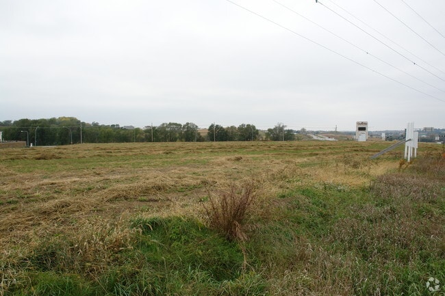
7101 N 102Nd Cir
Omaha-Council Bluffs, NE-IA
Cherry Hills Village
0802-0300-08
CHERRY HILLS VILLAGE REPLAT 4 LOT 1 BLOCK 0 LT 1 1.80 AC
Hotel
Douglas
X
Nebraska
31055C0204H
1
2024
1.80 AC
2025
Northwest Omaha
007311
Omaha/Council Bluffs
46,621 SF
DEMOGRAPHICS near 7101 N 102Nd Cir
1 Mile
3 Mile
5 Mile
2024 Total Population
9,273
59,614
166,473
2029 Population
9,364
60,461
168,811
Pop Growth 2024-2029
+ 0.98%
+ 1.42%
+ 1.40%
Average Age
35
38
38
2024 Total Households
3,480
24,061
68,113
HH Growth 2024-2029
+ 1.06%
+ 1.46%
+ 1.41%
Median Household Inc
$77,469
$73,391
$71,189
Avg Household Size
2.60
2.40
2.40
2024 Avg HH Vehicles
2.00
2.00
2.00
Median Home Value
$191,592
$187,905
$214,790
Median Year Built
1994
1984
1980
Nearby Places
Map Layers
Map Styles
 Street
 Aerial
- Restaurants
- Banks
- Shops
- Fitness
- Groceries
PUBLIC TRANSPORTATION
AIRPORT
Eppley Airfield
DRIVE
WALK
Distance
Eppley Airfield
24 min
12.2 mi
Nearby Properties
Address
Land Use
TOTAL SIZE
Lot Size
Zoning
Address
Land Use
TOTAL SIZE
Lot Size
Zoning
564,031 SF
119.20 AC
Address
Land Use
TOTAL SIZE
Lot Size
Zoning
548,510 SF
36.78 AC
Address
Land Use
TOTAL SIZE
Lot Size
Zoning
141,816 SF
24.91 AC
Address
Land Use
TOTAL SIZE
Lot Size
Zoning
301,341 SF
15.04 AC
R6
Address
Land Use
TOTAL SIZE
Lot Size
Zoning
428,342 SF
18.62 AC
Address
Land Use
TOTAL SIZE
Lot Size
Zoning
329,565 SF
7.72 AC
Address
Land Use
TOTAL SIZE
Lot Size
Zoning
460,264 SF
20.87 AC
Address
Land Use
TOTAL SIZE
Lot Size
Zoning
420,264 SF
23.97 AC
R6
Address
Land Use
TOTAL SIZE
Lot Size
Zoning
243,750 SF
15.46 AC
Address
Land Use
TOTAL SIZE
Lot Size
Zoning
288,432 SF
12.98 AC
Address
Land Use
TOTAL SIZE
Lot Size
Zoning
251,394 SF
14.71 AC
Address
Land Use
TOTAL SIZE
Lot Size
Zoning
255,205 SF
9.41 AC
R6
Address
Land Use
TOTAL SIZE
Lot Size
Zoning
248,169 SF
10.39 AC
Address
Land Use
TOTAL SIZE
Lot Size
Zoning
230,952 SF
8.56 AC
Address
Land Use
TOTAL SIZE
Lot Size
Zoning
264,371 SF
20.18 AC
Address
Land Use
TOTAL SIZE
Lot Size
Zoning
125,945 SF
Address
Land Use
TOTAL SIZE
Lot Size
Zoning
216,823 SF
13.05 AC
Address
Land Use
TOTAL SIZE
Lot Size
Zoning
143,575 SF
7.58 AC
Address
Land Use
TOTAL SIZE
Lot Size
Zoning
156,276 SF
7.70 AC
R6
Address
Land Use
TOTAL SIZE
Lot Size
Zoning
186,710 SF
12.63 AC
R6
Address
Land Use
TOTAL SIZE
Lot Size
Zoning
175,582 SF
8.40 AC
Address
Land Use
TOTAL SIZE
Lot Size
Zoning
166,080 SF
6.25 AC
R6
Address
Land Use
TOTAL SIZE
Lot Size
Zoning
159,065 SF
8.25 AC
Address
Land Use
TOTAL SIZE
Lot Size
Zoning
173,593 SF
5.70 AC
R6PUD
Address
Land Use
TOTAL SIZE
Lot Size
Zoning
122,276 SF
13.01 AC
Address
Land Use
TOTAL SIZE
Lot Size
Zoning
149,539 SF
7.96 AC
R7
Address
Land Use
TOTAL SIZE
Lot Size
Zoning
228,860 SF
11.68 AC
Address
Land Use
TOTAL SIZE
Lot Size
Zoning
169,654 SF
8.02 AC
Address
Land Use
TOTAL SIZE
Lot Size
Zoning
190,645 SF
17.99 AC
CC
Address
Land Use
TOTAL SIZE
Lot Size
Zoning
230,827 SF
15.11 AC
R6
The World's #1 Commercial Real Estate Marketplace
Connect with us
© 2025 CoStar Group
The information above has been obtained from sources believed reliable. While we do not doubt its accuracy we have not verified it and make no guarantee, warranty or representation about it. It is your responsibility to independently confirm its accuracy and completeness. Any projections, opinions, assumptions, or estimates used are for example only and do not represent the current or future performance of the property. The value of this transaction to you depends on tax and other factors which should be evaluated by your tax, financial, and legal advisors. You and your advisors should conduct a careful, independent investigation of the property to determine to your satisfaction the suitability of the property for your needs.