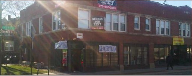
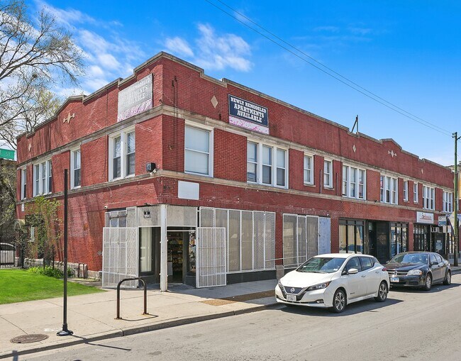
Property Record
7108 S Euclid Ave, Chicago, IL 60649
NEARBY LISTINGS FOR SALE OR LEASE
Property Detail
7108 S Euclid Ave
Chicago-Naperville-Elgin, IL-IN-WI
South Kenwood
20-25-108-009-0000
Cook
Commercialnec
Illinois
X
1-3
17031C0539K
0.12 AC
2023
South Shore
2024
Chicago
430800
DEMOGRAPHICS near 7108 S Euclid Ave
1 Mile
3 Mile
5 Mile
2024 Total Population
45,490
238,272
456,734
2029 Population
44,337
231,672
442,122
Pop Growth 2024-2029
(2.53%)
(2.77%)
(3.20%)
Average Age
40
40
40
2024 Total Households
21,381
106,949
193,126
HH Growth 2024-2029
(2.82%)
(3.06%)
(3.45%)
Median Household Inc
$36,002
$39,533
$38,385
Avg Household Size
2.00
2.10
2.30
2024 Avg HH Vehicles
1.00
1.00
1.00
Median Home Value
$218,047
$210,101
$182,906
Median Year Built
1948
1948
1948
Nearby Places
Map Layers
Map Styles
 Street
 Aerial
- Restaurants
- Banks
- Shops
- Fitness
- Groceries
PUBLIC TRANSPORTATION
TRANSIT/SUBWAY
Bryn Mawr Station (Metra Electric Line - Northeast Illinois Regional Commuter Railroad (Metra))
DRIVE
WALK
Distance
Bryn Mawr Station (Metra Electric Line - Northeast Illinois Regional Commuter Railroad (Metra))
0 min
1 min
0.1 mi
Stony Island Station (Metra Electric Line - Northeast Illinois Regional Commuter Railroad (Metra))
DRIVE
WALK
Distance
Stony Island Station (Metra Electric Line - Northeast Illinois Regional Commuter Railroad (Metra))
2 min
9 min
0.4 mi
South Shore Station (Metra Electric Line - Northeast Illinois Regional Commuter Railroad (Metra))
DRIVE
WALK
Distance
South Shore Station (Metra Electric Line - Northeast Illinois Regional Commuter Railroad (Metra))
1 min
14 min
0.7 mi
COMMUTER RAIL
Bryn Mawr Station (Metra Electric Line - Northeast Illinois Regional Commuter Railroad (Metra))
DRIVE
WALK
Distance
Bryn Mawr Station (Metra Electric Line - Northeast Illinois Regional Commuter Railroad (Metra))
1 min
2 min
0.1 mi
Stony Island Station (Metra Electric Line - Northeast Illinois Regional Commuter Railroad (Metra))
DRIVE
WALK
Distance
Stony Island Station (Metra Electric Line - Northeast Illinois Regional Commuter Railroad (Metra))
2 min
9 min
0.4 mi
AIRPORT
Chicago Midway International
DRIVE
WALK
Distance
Chicago Midway International
21 min
10.2 mi
Chicago O'Hare International
DRIVE
WALK
Distance
Chicago O'Hare International
68 min
30.4 mi
SALE & LEASE HISTORY
LISTING DATE
SALE/LEASE

Sep 23, 2016
For Sale
May 16, 2023
For Sale
Jun 28, 2017
For Sale
Aug 03, 2021
For Sale
Nearby Properties
Address
Land Use
TOTAL SIZE
Lot Size
Zoning
Address
Land Use
TOTAL SIZE
Lot Size
Zoning
0.49 AC
SLI
Address
Land Use
TOTAL SIZE
Lot Size
Zoning
1,302,463 SF
3.14 AC
PD 1211
Address
Land Use
TOTAL SIZE
Lot Size
Zoning
3.14 AC
PD 1211
Address
Land Use
TOTAL SIZE
Lot Size
Zoning
115,000 SF
1.97 AC
C1-2
Address
Land Use
TOTAL SIZE
Lot Size
Zoning
Address
Land Use
TOTAL SIZE
Lot Size
Zoning
2.65 AC
PD 38
Address
Land Use
TOTAL SIZE
Lot Size
Zoning
304,685 SF
1.11 AC
PD 1218
Address
Land Use
TOTAL SIZE
Lot Size
Zoning
115,000 SF
1.12 AC
C1-2
Address
Land Use
TOTAL SIZE
Lot Size
Zoning
7,200 SF
0.22 AC
B3-3
Address
Land Use
TOTAL SIZE
Lot Size
Zoning
156,800 SF
2.65 AC
PD 38
Address
Land Use
TOTAL SIZE
Lot Size
Zoning
PD 43
Address
Land Use
TOTAL SIZE
Lot Size
Zoning
451,349 SF
1.62 AC
PD 1062
Address
Land Use
TOTAL SIZE
Lot Size
Zoning
PD 43
Address
Land Use
TOTAL SIZE
Lot Size
Zoning
769,600 SF
PD 282
Address
Land Use
TOTAL SIZE
Lot Size
Zoning
23,799 SF
0.91 AC
PD 571
Address
Land Use
TOTAL SIZE
Lot Size
Zoning
78,000 SF
0.62 AC
RM-5
Address
Land Use
TOTAL SIZE
Lot Size
Zoning
7.47 AC
RT-4
Address
Land Use
TOTAL SIZE
Lot Size
Zoning
134,655 SF
2.40 AC
B3-3
Address
Land Use
TOTAL SIZE
Lot Size
Zoning
0.84 AC
RM-5
Address
Land Use
TOTAL SIZE
Lot Size
Zoning
130,785 SF
2.27 AC
PD 1174
Address
Land Use
TOTAL SIZE
Lot Size
Zoning
156,249 SF
0.57 AC
B3-5
Address
Land Use
TOTAL SIZE
Lot Size
Zoning
293,461 SF
1.19 AC
PD 282
Address
Land Use
TOTAL SIZE
Lot Size
Zoning
117,557 SF
2.69 AC
B3-3
Address
Land Use
TOTAL SIZE
Lot Size
Zoning
15,052 SF
1.03 AC
PQ
Address
Land Use
TOTAL SIZE
Lot Size
Zoning
214,720 SF
0.92 AC
RM-6.5
Address
Land Use
TOTAL SIZE
Lot Size
Zoning
Address
Land Use
TOTAL SIZE
Lot Size
Zoning
145,291 SF
7.85 AC
B3-2
Address
Land Use
TOTAL SIZE
Lot Size
Zoning
289,850 SF
1.46 AC
RM-6
Address
Land Use
TOTAL SIZE
Lot Size
Zoning
25,977 SF
0.46 AC
RM-5
Address
Land Use
TOTAL SIZE
Lot Size
Zoning
184,487 SF
0.66 AC
RM-5,RS-3
The World's #1 Commercial Real Estate Marketplace
Connect with us
© 2025 CoStar Group
The information above has been obtained from sources believed reliable. While we do not doubt its accuracy we have not verified it and make no guarantee, warranty or representation about it. It is your responsibility to independently confirm its accuracy and completeness. Any projections, opinions, assumptions, or estimates used are for example only and do not represent the current or future performance of the property. The value of this transaction to you depends on tax and other factors which should be evaluated by your tax, financial, and legal advisors. You and your advisors should conduct a careful, independent investigation of the property to determine to your satisfaction the suitability of the property for your needs.