Property Record
7107 Old York Rd, Philadelphia, PA 19126


NEARBY LISTINGS FOR SALE OR LEASE
Property Detail
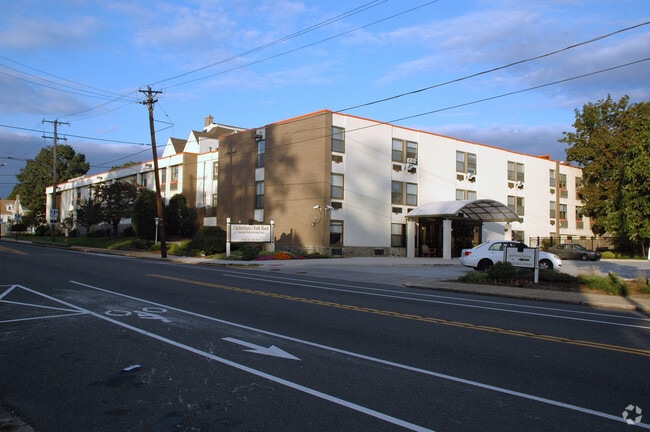
7107 Old York Rd
Philadelphia-Camden-Wilmington, PA-NJ-DE-MD
Harvey Shapiro
881447800
SEC CHELTENHAM AVE
Medicalbuilding
Philadelphia
X
Pennsylvania
42091C0395G
234
2024
2.37 AC
2026
Northeast Philadelphia
026800
Philadelphia
60,330 SF
DEMOGRAPHICS near 7107 Old York Rd
1 Mile
3 Mile
5 Mile
2024 Total Population
34,580
289,742
720,566
2029 Population
33,870
281,585
699,047
Pop Growth 2024-2029
(2.05%)
(2.82%)
(2.99%)
Average Age
42
40
39
2024 Total Households
14,072
113,624
275,018
HH Growth 2024-2029
(2.12%)
(2.91%)
(3.10%)
Median Household Inc
$53,916
$52,063
$51,690
Avg Household Size
2.30
2.40
2.50
2024 Avg HH Vehicles
1.00
1.00
1.00
Median Home Value
$197,060
$189,047
$207,177
Median Year Built
1949
1949
1949
Nearby Places
Map Layers
Map Styles
 Street
 Aerial
- Restaurants
- Banks
- Shops
- Fitness
- Groceries
PUBLIC TRANSPORTATION
COMMUTER RAIL
Melrose Park (R1 - Southeastern Pennsylvania Transportation Authority Regional Rail (SEPTA Regional Rail), R2 - Southeastern Pennsylvania Transportation Authority Regional Rail (SEPTA Regional Rail), R3 - Southeastern Pennsylvania Transportation Authority Regional Rail (SEPTA Regional Rail), R5 - Southeastern Pennsylvania Transportation Authority Regional Rail (SEPTA Regional Rail))
DRIVE
WALK
Distance
Melrose Park (R1 - Southeastern Pennsylvania Transportation Authority Regional Rail (SEPTA Regional Rail), R2 - Southeastern Pennsylvania Transportation Authority Regional Rail (SEPTA Regional Rail), R3 - Southeastern Pennsylvania Transportation Authority Regional Rail (SEPTA Regional Rail), R5 - Southeastern Pennsylvania Transportation Authority Regional Rail (SEPTA Regional Rail))
2 min
12 min
0.5 mi
Elkins Park (R1 - Southeastern Pennsylvania Transportation Authority Regional Rail (SEPTA Regional Rail), R2 - Southeastern Pennsylvania Transportation Authority Regional Rail (SEPTA Regional Rail), R3 - Southeastern Pennsylvania Transportation Authority Regional Rail (SEPTA Regional Rail), R5 - Southeastern Pennsylvania Transportation Authority Regional Rail (SEPTA Regional Rail))
DRIVE
WALK
Distance
Elkins Park (R1 - Southeastern Pennsylvania Transportation Authority Regional Rail (SEPTA Regional Rail), R2 - Southeastern Pennsylvania Transportation Authority Regional Rail (SEPTA Regional Rail), R3 - Southeastern Pennsylvania Transportation Authority Regional Rail (SEPTA Regional Rail), R5 - Southeastern Pennsylvania Transportation Authority Regional Rail (SEPTA Regional Rail))
4 min
1.6 mi
AIRPORT
Philadelphia International
DRIVE
WALK
Distance
Philadelphia International
35 min
21.6 mi
Trenton Mercer
DRIVE
WALK
Distance
Trenton Mercer
46 min
27.9 mi
Freight Ports
Port of Philadelphia
DRIVE
WALK
Distance
Port of Philadelphia
12 min
7.3 mi
Nearby Properties
Address
Land Use
TOTAL SIZE
Lot Size
Zoning
Address
Land Use
TOTAL SIZE
Lot Size
Zoning
2,146,150 SF
119.95 AC
M1
Address
Land Use
TOTAL SIZE
Lot Size
Zoning
121,578 SF
3.13 AC
RSA3
Address
Land Use
TOTAL SIZE
Lot Size
Zoning
587,330 SF
34.37 AC
SPINS
Address
Land Use
TOTAL SIZE
Lot Size
Zoning
287,286 SF
1.26 AC
CMX5
Address
Land Use
TOTAL SIZE
Lot Size
Zoning
290,454 SF
58.56 AC
RSA1
Address
Land Use
TOTAL SIZE
Lot Size
Zoning
107,391 SF
13.68 AC
SPINS
Address
Land Use
TOTAL SIZE
Lot Size
Zoning
425,128 SF
23 AC
RSA5
Address
Land Use
TOTAL SIZE
Lot Size
Zoning
649,400 SF
55.03 AC
R1
Address
Land Use
TOTAL SIZE
Lot Size
Zoning
504,972 SF
16.30 AC
RM2
Address
Land Use
TOTAL SIZE
Lot Size
Zoning
238,378 SF
18 AC
CA1
Address
Land Use
TOTAL SIZE
Lot Size
Zoning
2,500,000 SF
134.14 AC
I2
Address
Land Use
TOTAL SIZE
Lot Size
Zoning
1,316,610 SF
46.73 AC
I2
Address
Land Use
TOTAL SIZE
Lot Size
Zoning
208,620 SF
19.71 AC
I2
Address
Land Use
TOTAL SIZE
Lot Size
Zoning
210,964 SF
21.28 AC
CMX3
Address
Land Use
TOTAL SIZE
Lot Size
Zoning
526,165 SF
12.68 AC
RSA3
Address
Land Use
TOTAL SIZE
Lot Size
Zoning
28,239 SF
1.48 AC
SPINS
Address
Land Use
TOTAL SIZE
Lot Size
Zoning
300 AC
RSD1
Address
Land Use
TOTAL SIZE
Lot Size
Zoning
16,832 SF
65.87 AC
SPPOA
Address
Land Use
TOTAL SIZE
Lot Size
Zoning
363,136 SF
16.47 AC
RSA3
Address
Land Use
TOTAL SIZE
Lot Size
Zoning
233,143 SF
24.24 AC
SPINS
Address
Land Use
TOTAL SIZE
Lot Size
Zoning
329,300 SF
6.98 AC
RSA5
Address
Land Use
TOTAL SIZE
Lot Size
Zoning
281,012 SF
32.58 AC
RSA5
Address
Land Use
TOTAL SIZE
Lot Size
Zoning
705,687 SF
19.89 AC
C1
Address
Land Use
TOTAL SIZE
Lot Size
Zoning
263,000 SF
5.31 AC
RM2
Address
Land Use
TOTAL SIZE
Lot Size
Zoning
635,387 SF
10.12 AC
C1
Address
Land Use
TOTAL SIZE
Lot Size
Zoning
3,104 SF
0.09 AC
RSA2
Address
Land Use
TOTAL SIZE
Lot Size
Zoning
116,124 SF
7.70 AC
CMX3
Address
Land Use
TOTAL SIZE
Lot Size
Zoning
171,000 SF
23 AC
RM1
Address
Land Use
TOTAL SIZE
Lot Size
Zoning
582,294 SF
9.07 AC
C1
Address
Land Use
TOTAL SIZE
Lot Size
Zoning
103,131 SF
0.19 AC
CMX3
The World's #1 Commercial Real Estate Marketplace
Connect with us
© 2026 CoStar Group
The information above has been obtained from sources believed reliable. While we do not doubt its accuracy we have not verified it and make no guarantee, warranty or representation about it. It is your responsibility to independently confirm its accuracy and completeness. Any projections, opinions, assumptions, or estimates used are for example only and do not represent the current or future performance of the property. The value of this transaction to you depends on tax and other factors which should be evaluated by your tax, financial, and legal advisors. You and your advisors should conduct a careful, independent investigation of the property to determine to your satisfaction the suitability of the property for your needs.