Property Record
711 E Carefree Hwy, Phoenix, AZ 85085


Save to a Folder
{{folder.Name}}
{{folder.ListingIds.length}} Properties
{{folder.ListingIds.length}} Property
Create a New Folder
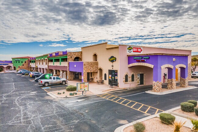
Property Detail
711 E Carefree Hwy
211-74-018N
PT NW4 NW4 NW4 SEC 9 DAF COM NW COR SD SEC TH E 360.44F TH S 100F TPOB TH E 299.45F TH S 554.11F TH W 598.98F TH N 296.65F TH E 300.25F TH N 256.40F TPOB EX R/W DAF COM NW COR OF SEC 9 TH E 360.44F TH S 100F TH S 256.40F TH W 300.25F TPOB TH S 296.65
Storebuilding
Maricopa
C-C
Arizona
C and X Area of minimal flood hazard, usually depicted on FIRMs as above the 500-year flood level.
5.82 AC
2025
Anthem
2025
Phoenix
612000
Phoenix-Mesa-Chandler, AZ
69,514 SF
NEARBY LISTINGS FOR SALE OR LEASE
-
-
View all Phoenix listings for lease on LoopNet.com
DEMOGRAPHICS near 711 E Carefree Hwy
1 mile
3 mile
5 mile
2025 Total Population
1,293
12,553
52,298
2030 Population
1,289
12,740
53,671
Pop Growth 2025-2030
(0.31%)
+ 1.49%
+ 2.63%
Average Age
47
43
41
2025 Total Households
488
4,622
19,518
HH Growth 2025-2030
(0.41%)
+ 1.43%
+ 2.56%
Median Household Inc
$127,123
$143,911
$130,863
Avg Household Size
2.60
2.70
2.60
2025 Avg HH Vehicles
3.00
3.00
2.00
Median Home Value
$730,704
$723,799
$675,607
Median Year Built
1999
2003
2005
Nearby Places
Map Layers
Map Styles
 Street
 Aerial
Layers
 Traffic
 Biking
Places
Listings with unknown addresses are not visible on the map
- Restaurants
- Banks
- Shops
- Fitness
- Groceries
PUBLIC TRANSPORTATION
AIRPORT
Phoenix Sky Harbor International
Drive
Walk
Distance
Phoenix Sky Harbor International
50 min
36.0 mi
Freight Ports
Port of San Diego
Drive
Walk
Distance
Port of San Diego
422 min
374.6 mi
SALE & LEASE HISTORY
LISTING DATE
SALE/LEASE

Sep 23, 2024
For Lease
May 28, 2025
For Lease
Dec 12, 2022
For Lease
Dec 09, 2022
For Sale
Aug 12, 2019
For Sale
Apr 23, 2019
For Lease
Nearby Properties
Address
Land Use
TOTAL SIZE
Lot Size
Zoning
Address
Land Use
TOTAL SIZE
Lot Size
Zoning
113,123 SF
62.17 AC
R-43
Address
Land Use
TOTAL SIZE
Lot Size
Zoning
82,674 SF
14.61 AC
PAD
Address
Land Use
TOTAL SIZE
Lot Size
Zoning
67,261 SF
22.86 AC
RU43
Address
Land Use
TOTAL SIZE
Lot Size
Zoning
254 SF
527.88 AC
R-35
Address
Land Use
TOTAL SIZE
Lot Size
Zoning
160.38 AC
R-43AG
Address
Land Use
TOTAL SIZE
Lot Size
Zoning
132,593 SF
6.69 AC
Address
Land Use
TOTAL SIZE
Lot Size
Zoning
315.05 AC
R-43
Address
Land Use
TOTAL SIZE
Lot Size
Zoning
38,585 SF
6.84 AC
RU43
Address
Land Use
TOTAL SIZE
Lot Size
Zoning
22,818 SF
4.47 AC
C-C
Address
Land Use
TOTAL SIZE
Lot Size
Zoning
248 SF
343.16 AC
R-43AG
Address
Land Use
TOTAL SIZE
Lot Size
Zoning
6,781 SF
2.26 AC
C-C
Address
Land Use
TOTAL SIZE
Lot Size
Zoning
6,744 SF
4.51 AC
C-C
Address
Land Use
TOTAL SIZE
Lot Size
Zoning
9,230 SF
2.80 AC
C-N
Address
Land Use
TOTAL SIZE
Lot Size
Zoning
7,434 SF
1.02 AC
C-C
Address
Land Use
TOTAL SIZE
Lot Size
Zoning
6,679 SF
1.27 AC
C-C
Address
Land Use
TOTAL SIZE
Lot Size
Zoning
27,044 SF
14.82 AC
R-43
Address
Land Use
TOTAL SIZE
Lot Size
Zoning
1.50 AC
Address
Land Use
TOTAL SIZE
Lot Size
Zoning
Address
Land Use
TOTAL SIZE
Lot Size
Zoning
1.47 AC
Address
Land Use
TOTAL SIZE
Lot Size
Zoning
1.17 AC
Address
Land Use
TOTAL SIZE
Lot Size
Zoning
1.17 AC
Address
Land Use
TOTAL SIZE
Lot Size
Zoning
1.17 AC
Address
Land Use
TOTAL SIZE
Lot Size
Zoning
1.17 AC
Address
Land Use
TOTAL SIZE
Lot Size
Zoning
1.23 AC
Address
Land Use
TOTAL SIZE
Lot Size
Zoning
1,261 SF
1.18 AC
R-43
Address
Land Use
TOTAL SIZE
Lot Size
Zoning
18.70 AC
PCD
Address
Land Use
TOTAL SIZE
Lot Size
Zoning
1.21 AC
The World's #1 Commercial Real Estate Marketplace
Connect with us
© 2026 CoStar Group
The information above has been obtained from sources believed reliable. While we do not doubt its accuracy we have not verified it and make no guarantee, warranty or representation about it. It is your responsibility to independently confirm its accuracy and completeness. Any projections, opinions, assumptions, or estimates used are for example only and do not represent the current or future performance of the property. The value of this transaction to you depends on tax and other factors which should be evaluated by your tax, financial, and legal advisors. You and your advisors should conduct a careful, independent investigation of the property to determine to your satisfaction the suitability of the property for your needs.