Property Record
711 E Main St, Orange, MA 01364


Save to a Folder
{{folder.Name}}
{{folder.ListingIds.length}} Properties
{{folder.ListingIds.length}} Property
Create a New Folder
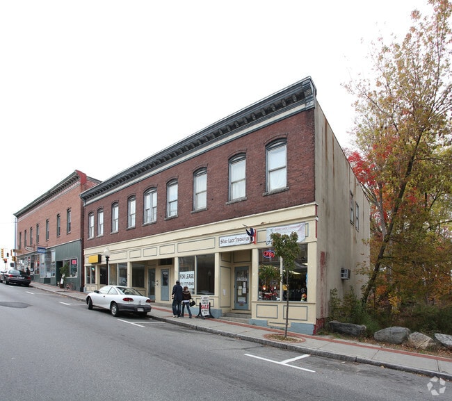
Property Detail
711 E Main St
ORAN-000107-000000-000029
FRANKLIN
Commercialofficeresidentialmixeduse
Massachusetts
A
29
2025
0.10 AC
2025
Franklin County
040501
Hartford
6,609 SF
Greenfield, MA
NEARBY LISTINGS FOR SALE OR LEASE
DEMOGRAPHICS near 711 E Main St
1 mile
3 mile
5 mile
2025 Total Population
3,868
8,011
20,019
2030 Population
3,894
8,102
20,485
Pop Growth 2025-2030
+ 0.67%
+ 1.14%
+ 2.33%
Average Age
43
45
44
2025 Total Households
1,628
3,451
8,370
HH Growth 2025-2030
+ 0.74%
+ 1.19%
+ 2.38%
Median Household Inc
$51,029
$51,696
$61,533
Avg Household Size
2.30
2.30
2.30
2025 Avg HH Vehicles
2.00
2.00
2.00
Median Home Value
$239,690
$238,455
$271,404
Median Year Built
1949
1962
1957
Nearby Places
Map Layers
Map Styles
 Street
 Aerial
Layers
 Traffic
 Biking
Places
Listings with unknown addresses are not visible on the map
- Restaurants
- Banks
- Shops
- Fitness
- Groceries
PUBLIC TRANSPORTATION
AIRPORT
Worcester Regional
Drive
Walk
Distance
Worcester Regional
66 min
37.7 mi
SALE & LEASE HISTORY
LISTING DATE
SALE/LEASE

Sep 25, 2016
For Lease
Sep 23, 2016
For Sale
Nearby Properties
Address
Land Use
TOTAL SIZE
Lot Size
Zoning
Address
Land Use
TOTAL SIZE
Lot Size
Zoning
102,280 SF
30 AC
D
Address
Land Use
TOTAL SIZE
Lot Size
Zoning
390.20 AC
B
Address
Land Use
TOTAL SIZE
Lot Size
Zoning
77,887 SF
40 AC
D
Address
Land Use
TOTAL SIZE
Lot Size
Zoning
8.78 AC
B
Address
Land Use
TOTAL SIZE
Lot Size
Zoning
193,872 SF
22.63 AC
A
Address
Land Use
TOTAL SIZE
Lot Size
Zoning
134,851 SF
7.36 AC
B
Address
Land Use
TOTAL SIZE
Lot Size
Zoning
5.10 AC
A
Address
Land Use
TOTAL SIZE
Lot Size
Zoning
9.30 AC
B
Address
Land Use
TOTAL SIZE
Lot Size
Zoning
6.85 AC
Address
Land Use
TOTAL SIZE
Lot Size
Zoning
43,043 SF
7.41 AC
A
Address
Land Use
TOTAL SIZE
Lot Size
Zoning
110,928 SF
10.21 AC
B
Address
Land Use
TOTAL SIZE
Lot Size
Zoning
10.61 AC
Address
Land Use
TOTAL SIZE
Lot Size
Zoning
37 AC
A
Address
Land Use
TOTAL SIZE
Lot Size
Zoning
72.73 AC
B
Address
Land Use
TOTAL SIZE
Lot Size
Zoning
240,650 SF
36.98 AC
A
Address
Land Use
TOTAL SIZE
Lot Size
Zoning
145,916 SF
1.67 AC
A
Address
Land Use
TOTAL SIZE
Lot Size
Zoning
1,407 SF
1,895.04 AC
RR
Address
Land Use
TOTAL SIZE
Lot Size
Zoning
164,998 SF
9.59 AC
B
Address
Land Use
TOTAL SIZE
Lot Size
Zoning
3 AC
A
Address
Land Use
TOTAL SIZE
Lot Size
Zoning
26,162 SF
0.89 AC
A
Address
Land Use
TOTAL SIZE
Lot Size
Zoning
24,971 SF
3.52 AC
A
Address
Land Use
TOTAL SIZE
Lot Size
Zoning
8.70 AC
B
Address
Land Use
TOTAL SIZE
Lot Size
Zoning
3.87 AC
A
Address
Land Use
TOTAL SIZE
Lot Size
Zoning
5 AC
A
Address
Land Use
TOTAL SIZE
Lot Size
Zoning
6,926 SF
27.70 AC
Address
Land Use
TOTAL SIZE
Lot Size
Zoning
4,530 SF
1.97 AC
A
Address
Land Use
TOTAL SIZE
Lot Size
Zoning
27.40 AC
Address
Land Use
TOTAL SIZE
Lot Size
Zoning
4.40 AC
A
Address
Land Use
TOTAL SIZE
Lot Size
Zoning
19.93 AC
A
Address
Land Use
TOTAL SIZE
Lot Size
Zoning
17,647 SF
0.80 AC
A
The World's #1 Commercial Real Estate Marketplace
Connect with us
© 2026 CoStar Group
The information above has been obtained from sources believed reliable. While we do not doubt its accuracy we have not verified it and make no guarantee, warranty or representation about it. It is your responsibility to independently confirm its accuracy and completeness. Any projections, opinions, assumptions, or estimates used are for example only and do not represent the current or future performance of the property. The value of this transaction to you depends on tax and other factors which should be evaluated by your tax, financial, and legal advisors. You and your advisors should conduct a careful, independent investigation of the property to determine to your satisfaction the suitability of the property for your needs.