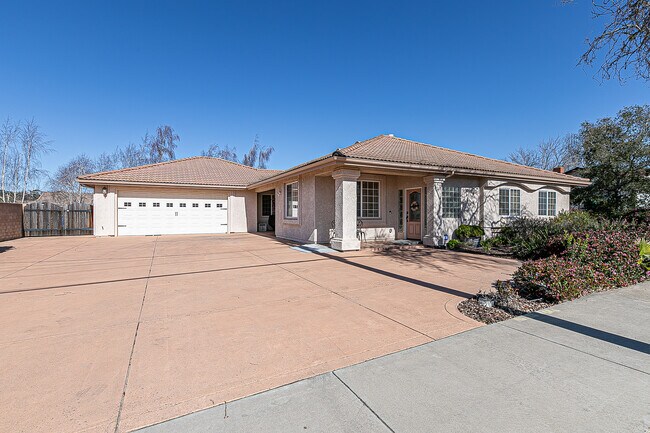
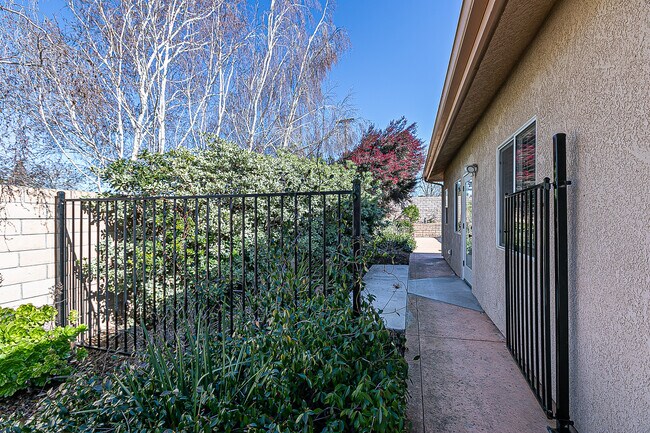
Property Record
711 E Rice Ranch Rd, Santa Maria, CA 93455

NEARBY LISTINGS FOR SALE OR LEASE
-
-
View all Santa Maria listings for sale on LoopNet.com
Property Detail
711 E Rice Ranch Rd
Santa Maria-Santa Barbara, CA
Parcel Map No 14021
103-394-021
Santa Barbara
Sfr
California
X
0.22 AC
06083C0456G
North SB County
2,248 SF
Santa Barbara/Sta Maria/Goleta
DEMOGRAPHICS near 711 E Rice Ranch Rd
1 Mile
3 Mile
5 Mile
2024 Total Population
8,366
31,205
54,067
2029 Population
8,365
30,909
53,721
Pop Growth 2024-2029
(0.01%)
(0.95%)
(0.64%)
Average Age
40
41
39
2024 Total Households
2,943
11,297
18,209
HH Growth 2024-2029
(0.14%)
(1.09%)
(0.75%)
Median Household Inc
$115,782
$101,315
$96,185
Avg Household Size
2.80
2.70
2.90
2024 Avg HH Vehicles
2.00
2.00
2.00
Median Home Value
$553,676
$564,867
$495,745
Median Year Built
1974
1978
1983
Nearby Places
Map Layers
Map Styles
 Street
 Aerial
- Restaurants
- Banks
- Shops
- Fitness
- Groceries
PUBLIC TRANSPORTATION
AIRPORT
Santa Maria Public-Captain G. Allan Hancock Field
DRIVE
WALK
Distance
Santa Maria Public-Captain G. Allan Hancock Field
9 min
4.5 mi
San Luis County Regional
DRIVE
WALK
Distance
San Luis County Regional
49 min
35.2 mi
Freight Ports
The Port of Hueneme
DRIVE
WALK
Distance
The Port of Hueneme
137 min
109.8 mi
SALE & LEASE HISTORY
LISTING DATE
SALE/LEASE

Feb 02, 2023
For Sale
Nearby Properties
Address
Land Use
TOTAL SIZE
Lot Size
Zoning
Address
Land Use
TOTAL SIZE
Lot Size
Zoning
4.05 AC
Address
Land Use
TOTAL SIZE
Lot Size
Zoning
0.60 AC
1E1
Address
Land Use
TOTAL SIZE
Lot Size
Zoning
71,487 SF
4.41 AC
DR123
Address
Land Use
TOTAL SIZE
Lot Size
Zoning
3.99 AC
Address
Land Use
TOTAL SIZE
Lot Size
Zoning
13.36 AC
Address
Land Use
TOTAL SIZE
Lot Size
Zoning
3.49 AC
Address
Land Use
TOTAL SIZE
Lot Size
Zoning
24.71 AC
C2
Address
Land Use
TOTAL SIZE
Lot Size
Zoning
2.71 AC
Address
Land Use
TOTAL SIZE
Lot Size
Zoning
7.80 AC
OTR14GC
Address
Land Use
TOTAL SIZE
Lot Size
Zoning
12.97 AC
DR33
Address
Land Use
TOTAL SIZE
Lot Size
Zoning
4.90 AC
SC
Address
Land Use
TOTAL SIZE
Lot Size
Zoning
5.35 AC
Address
Land Use
TOTAL SIZE
Lot Size
Zoning
Address
Land Use
TOTAL SIZE
Lot Size
Zoning
2.26 AC
C2
Address
Land Use
TOTAL SIZE
Lot Size
Zoning
1,188 SF
4.98 AC
DR46
Address
Land Use
TOTAL SIZE
Lot Size
Zoning
3.86 AC
DR123
Address
Land Use
TOTAL SIZE
Lot Size
Zoning
50,409 SF
7.68 AC
SC
Address
Land Use
TOTAL SIZE
Lot Size
Zoning
3,336 SF
3.69 AC
C2
Address
Land Use
TOTAL SIZE
Lot Size
Zoning
29,220 SF
2.24 AC
SC
Address
Land Use
TOTAL SIZE
Lot Size
Zoning
28,730 SF
2.15 AC
SC
Address
Land Use
TOTAL SIZE
Lot Size
Zoning
327.52 AC
AGII100
Address
Land Use
TOTAL SIZE
Lot Size
Zoning
1.25 AC
Address
Land Use
TOTAL SIZE
Lot Size
Zoning
165.38 AC
AGII100
Address
Land Use
TOTAL SIZE
Lot Size
Zoning
1.43 AC
C2
Address
Land Use
TOTAL SIZE
Lot Size
Zoning
4.47 AC
DR46
Address
Land Use
TOTAL SIZE
Lot Size
Zoning
0.40 AC
CH
Address
Land Use
TOTAL SIZE
Lot Size
Zoning
1.31 AC
PI
Address
Land Use
TOTAL SIZE
Lot Size
Zoning
The World's #1 Commercial Real Estate Marketplace
Connect with us
© 2025 CoStar Group
The information above has been obtained from sources believed reliable. While we do not doubt its accuracy we have not verified it and make no guarantee, warranty or representation about it. It is your responsibility to independently confirm its accuracy and completeness. Any projections, opinions, assumptions, or estimates used are for example only and do not represent the current or future performance of the property. The value of this transaction to you depends on tax and other factors which should be evaluated by your tax, financial, and legal advisors. You and your advisors should conduct a careful, independent investigation of the property to determine to your satisfaction the suitability of the property for your needs.