Property Record
711 N Armstrong Ave, Fresno, CA 93727
NEARBY LISTINGS FOR SALE OR LEASE
Property Detail
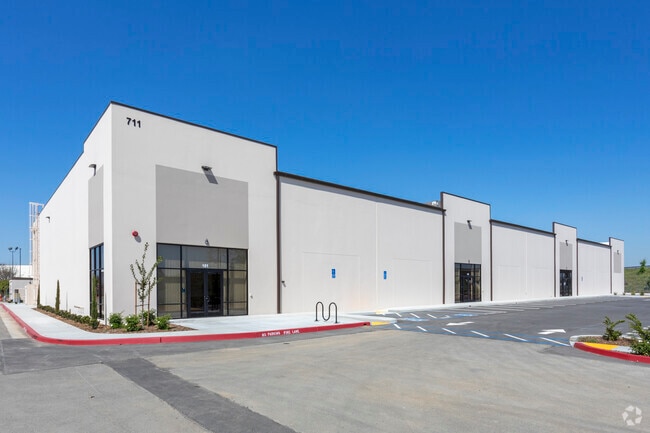
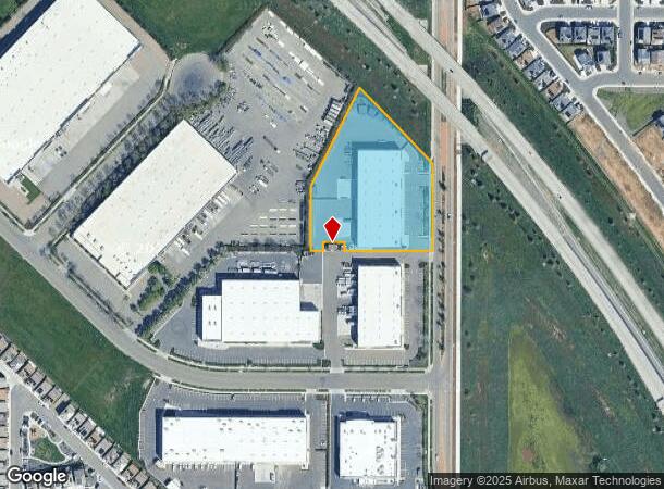
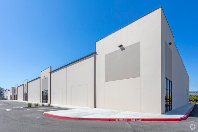
711 N Armstrong Ave
313-890-26S
Parcel Map No 2004 036
Warehouse
Fresno
X
California
06019C2135H
2.77 AC
2025
Outlying Fresno Cnty
2025
Fresno
001412
Fresno, CA
35,000 SF
DEMOGRAPHICS near 711 N Armstrong Ave
1 Mile
3 Mile
5 Mile
2024 Total Population
8,747
78,386
224,764
2029 Population
9,166
81,024
230,347
Pop Growth 2024-2029
+ 4.79%
+ 3.37%
+ 2.48%
Average Age
35
34
35
2024 Total Households
2,442
22,481
67,473
HH Growth 2024-2029
+ 4.79%
+ 3.35%
+ 2.51%
Median Household Inc
$90,079
$83,669
$65,368
Avg Household Size
3.50
3.40
3.20
2024 Avg HH Vehicles
2.00
2.00
2.00
Median Home Value
$347,406
$357,151
$335,411
Median Year Built
2001
1994
1980
Nearby Places
Map Layers
Map Styles
 Street
 Aerial
- Restaurants
- Banks
- Shops
- Fitness
- Groceries
PUBLIC TRANSPORTATION
COMMUTER RAIL
DRIVE
WALK
Distance
13 min
7.9 mi
AIRPORT
Fresno Yosemite International
DRIVE
WALK
Distance
Fresno Yosemite International
10 min
4.9 mi
SALE & LEASE HISTORY
LISTING DATE
SALE/LEASE

Sep 25, 2016
For Lease
May 07, 2020
For Lease
Nearby Properties
Address
Land Use
TOTAL SIZE
Lot Size
Zoning
Address
Land Use
TOTAL SIZE
Lot Size
Zoning
74,499 SF
17.48 AC
M3
Address
Land Use
TOTAL SIZE
Lot Size
Zoning
2,008 SF
20.14 AC
M1
Address
Land Use
TOTAL SIZE
Lot Size
Zoning
202,149 SF
27.56 AC
SPLIT
Address
Land Use
TOTAL SIZE
Lot Size
Zoning
216,342 SF
28.49 AC
Address
Land Use
TOTAL SIZE
Lot Size
Zoning
385,529 SF
29.36 AC
R2
Address
Land Use
TOTAL SIZE
Lot Size
Zoning
372,862 SF
42.43 AC
R1
Address
Land Use
TOTAL SIZE
Lot Size
Zoning
60,227 SF
4.72 AC
M1
Address
Land Use
TOTAL SIZE
Lot Size
Zoning
175,310 SF
19.22 AC
CMX
Address
Land Use
TOTAL SIZE
Lot Size
Zoning
94,584 SF
10.93 AC
M1
Address
Land Use
TOTAL SIZE
Lot Size
Zoning
93,172 SF
4.97 AC
Address
Land Use
TOTAL SIZE
Lot Size
Zoning
249,126 SF
17.33 AC
SPLIT
Address
Land Use
TOTAL SIZE
Lot Size
Zoning
190,006 SF
19.35 AC
RM1
Address
Land Use
TOTAL SIZE
Lot Size
Zoning
102,765 SF
8.90 AC
M1
Address
Land Use
TOTAL SIZE
Lot Size
Zoning
119,914 SF
4.50 AC
CMX
Address
Land Use
TOTAL SIZE
Lot Size
Zoning
226,937 SF
20.15 AC
SPLIT
Address
Land Use
TOTAL SIZE
Lot Size
Zoning
226,937 SF
11.52 AC
Address
Land Use
TOTAL SIZE
Lot Size
Zoning
59,073 SF
2.66 AC
CM
Address
Land Use
TOTAL SIZE
Lot Size
Zoning
76,720 SF
10.78 AC
Address
Land Use
TOTAL SIZE
Lot Size
Zoning
97,174 SF
10.17 AC
C2
Address
Land Use
TOTAL SIZE
Lot Size
Zoning
53,878 SF
1.99 AC
CM
Address
Land Use
TOTAL SIZE
Lot Size
Zoning
69,015 SF
8.15 AC
C1
Address
Land Use
TOTAL SIZE
Lot Size
Zoning
20,038 SF
2 AC
CP
Address
Land Use
TOTAL SIZE
Lot Size
Zoning
95,792 SF
2.31 AC
Address
Land Use
TOTAL SIZE
Lot Size
Zoning
135,000 SF
7.47 AC
M1
Address
Land Use
TOTAL SIZE
Lot Size
Zoning
71,377 SF
4.37 AC
RS1
Address
Land Use
TOTAL SIZE
Lot Size
Zoning
62,400 SF
5.82 AC
C3
Address
Land Use
TOTAL SIZE
Lot Size
Zoning
59,442 SF
2.65 AC
R3
Address
Land Use
TOTAL SIZE
Lot Size
Zoning
52,776 SF
0.79 AC
CR/CZ
Address
Land Use
TOTAL SIZE
Lot Size
Zoning
33,350 SF
3.15 AC
C2
The World's #1 Commercial Real Estate Marketplace
Connect with us
© 2026 CoStar Group
The information above has been obtained from sources believed reliable. While we do not doubt its accuracy we have not verified it and make no guarantee, warranty or representation about it. It is your responsibility to independently confirm its accuracy and completeness. Any projections, opinions, assumptions, or estimates used are for example only and do not represent the current or future performance of the property. The value of this transaction to you depends on tax and other factors which should be evaluated by your tax, financial, and legal advisors. You and your advisors should conduct a careful, independent investigation of the property to determine to your satisfaction the suitability of the property for your needs.