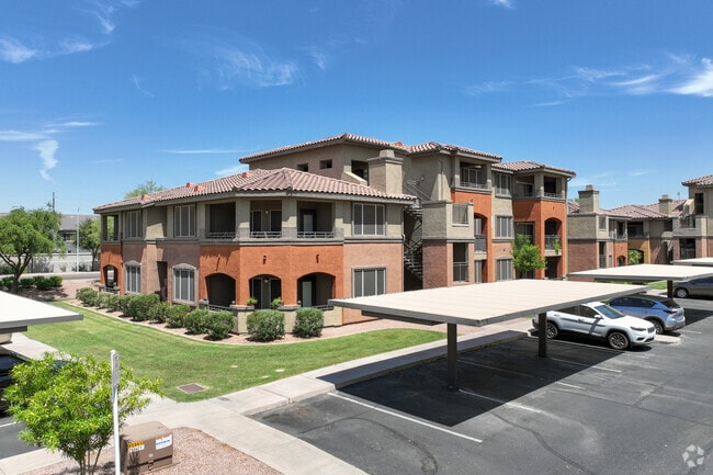
Property Record
711 N Evergreen Rd, Mesa, AZ 85201

Property Detail
711 N Evergreen Rd
135-37-003J
PT SE4 SEC DAF BEG AT CEN SEC TH E 727.40F TO A PT FR WH E4 COR SEC BEARS E 1865.92F TH S 243.46F TO CUR CONC ELY HAV RAD OF 602.26F TH SELY ALG SD CUR 379.22F TH S 53D 31M W 30F TO CUR CONC WLY HAV RAD OF 12F TH SWLY ALG SD CUR 17.74F TO REV CUR CON
Apartment
Maricopa
M-H
Arizona
C and X Area of minimal flood hazard, usually depicted on FIRMs as above the 500-year flood level.
16.29 AC
2025
Riverview
2025
Phoenix
421201
Phoenix-Mesa-Chandler, AZ
307,038 SF
NEARBY LISTINGS FOR SALE OR LEASE
DEMOGRAPHICS near 711 N Evergreen Rd
1 mile
3 mile
5 mile
2025 Total Population
15,675
148,572
372,601
2030 Population
16,303
155,241
387,811
Pop Growth 2025-2030
+ 4.01%
+ 4.49%
+ 4.08%
Average Age
35
35
36
2025 Total Households
6,745
62,205
151,710
HH Growth 2025-2030
+ 4.24%
+ 4.74%
+ 4.33%
Median Household Inc
$68,224
$59,936
$70,500
Avg Household Size
2.20
2.20
2.30
2025 Avg HH Vehicles
2.00
1.00
2.00
Median Home Value
$323,214
$371,408
$435,064
Median Year Built
1985
1983
1980
Nearby Places
Map Layers
Map Styles
 Street
 Aerial
Layers
 Traffic
 Biking
Places
Listings with unknown addresses are not visible on the map
- Restaurants
- Banks
- Shops
- Fitness
- Groceries
PUBLIC TRANSPORTATION
AIRPORT
Phoenix Sky Harbor International
Drive
Walk
Distance
Phoenix Sky Harbor International
15 min
8.1 mi
Phoenix-Mesa Gateway
Drive
Walk
Distance
Phoenix-Mesa Gateway
33 min
20.9 mi
Freight Ports
Port of San Diego
Drive
Walk
Distance
Port of San Diego
409 min
372.7 mi
Nearby Properties
Address
Land Use
TOTAL SIZE
Lot Size
Zoning
Address
Land Use
TOTAL SIZE
Lot Size
Zoning
4.59 AC
I-1
Address
Land Use
TOTAL SIZE
Lot Size
Zoning
1,870,689 SF
46.77 AC
I-P
Address
Land Use
TOTAL SIZE
Lot Size
Zoning
439,211 SF
77.92 AC
C-G
Address
Land Use
TOTAL SIZE
Lot Size
Zoning
918,576 SF
22.96 AC
C-N
Address
Land Use
TOTAL SIZE
Lot Size
Zoning
401,544 SF
64.59 AC
GID
Address
Land Use
TOTAL SIZE
Lot Size
Zoning
1,227,029 SF
7.39 AC
R-6
Address
Land Use
TOTAL SIZE
Lot Size
Zoning
1,102,629 SF
12.33 AC
R-3
Address
Land Use
TOTAL SIZE
Lot Size
Zoning
2.54 AC
Address
Land Use
TOTAL SIZE
Lot Size
Zoning
805,814 SF
115.19 AC
C-G
Address
Land Use
TOTAL SIZE
Lot Size
Zoning
571,804 SF
0.98 AC
CSS
Address
Land Use
TOTAL SIZE
Lot Size
Zoning
58,061 SF
5.43 AC
C-C
Address
Land Use
TOTAL SIZE
Lot Size
Zoning
8.79 AC
PF
Address
Land Use
TOTAL SIZE
Lot Size
Zoning
197,454 SF
18.97 AC
PF
Address
Land Use
TOTAL SIZE
Lot Size
Zoning
352,244 SF
5.55 AC
R-6
Address
Land Use
TOTAL SIZE
Lot Size
Zoning
368,727 SF
12.77 AC
R1-6
Address
Land Use
TOTAL SIZE
Lot Size
Zoning
544,646 SF
1.65 AC
MU4
Address
Land Use
TOTAL SIZE
Lot Size
Zoning
401,437 SF
17.70 AC
C-R
Address
Land Use
TOTAL SIZE
Lot Size
Zoning
474,335 SF
9.54 AC
R-3
Address
Land Use
TOTAL SIZE
Lot Size
Zoning
640,230 SF
3.94 AC
MU4
Address
Land Use
TOTAL SIZE
Lot Size
Zoning
683,623 SF
1.80 AC
PAD
Address
Land Use
TOTAL SIZE
Lot Size
Zoning
469,012 SF
11.39 AC
I-1
Address
Land Use
TOTAL SIZE
Lot Size
Zoning
937,488 SF
40.63 AC
R-4
Address
Land Use
TOTAL SIZE
Lot Size
Zoning
420,534 SF
1.62 AC
PAD
Address
Land Use
TOTAL SIZE
Lot Size
Zoning
564,649 SF
7.19 AC
RCC
Address
Land Use
TOTAL SIZE
Lot Size
Zoning
448,308 SF
6.30 AC
GID
Address
Land Use
TOTAL SIZE
Lot Size
Zoning
1,107,057 SF
2.38 AC
PAD
The World's #1 Commercial Real Estate Marketplace
Connect with us
© 2026 CoStar Group
The information above has been obtained from sources believed reliable. While we do not doubt its accuracy we have not verified it and make no guarantee, warranty or representation about it. It is your responsibility to independently confirm its accuracy and completeness. Any projections, opinions, assumptions, or estimates used are for example only and do not represent the current or future performance of the property. The value of this transaction to you depends on tax and other factors which should be evaluated by your tax, financial, and legal advisors. You and your advisors should conduct a careful, independent investigation of the property to determine to your satisfaction the suitability of the property for your needs.