Property Record
711 N Orlando Ave, Maitland, FL 32751

NEARBY LISTINGS FOR SALE OR LEASE
Property Detail
711 N Orlando Ave
Orlando-Kissimmee-Sanford, FL
Acreage & Unrec
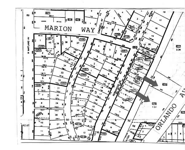
25-2129-0000-00-076
FROM THE NW COR OF THE SW 1/4 OF THE NW 1/4 OF 30-21-29, RUN 289-52-30E 431.92 FT ALONG N LINE THEREOF TO W R/W LINE SR 15/600, TH S35-57-30W 805.75 FT ALONG R/W TO POB; TH CONT S3
Officebuilding
Orange
X
Florida
12095C0165F
16
2024
1.27 AC
2025
Maitland
015501
Orlando
30,964 SF
DEMOGRAPHICS near 711 N Orlando Ave
1 Mile
3 Mile
5 Mile
2024 Total Population
8,693
100,816
276,670
2029 Population
8,963
105,106
288,137
Pop Growth 2024-2029
+ 3.11%
+ 4.26%
+ 4.14%
Average Age
43
41
41
2024 Total Households
3,863
45,004
118,871
HH Growth 2024-2029
+ 3.16%
+ 4.50%
+ 4.31%
Median Household Inc
$94,917
$62,305
$63,939
Avg Household Size
2.20
2.20
2.30
2024 Avg HH Vehicles
2.00
2.00
2.00
Median Home Value
$482,384
$340,270
$325,988
Median Year Built
1976
1978
1980
Nearby Places
Map Layers
Map Styles
 Street
 Aerial
- Restaurants
- Banks
- Shops
- Fitness
- Groceries
PUBLIC TRANSPORTATION
COMMUTER RAIL
DRIVE
WALK
Distance
1 min
3 min
0.1 mi
DRIVE
WALK
Distance
7 min
3.3 mi
AIRPORT
Orlando Sanford International
DRIVE
WALK
Distance
Orlando Sanford International
26 min
14.3 mi
Orlando International
DRIVE
WALK
Distance
Orlando International
31 min
17.2 mi
Freight Ports
Port Canaveral
DRIVE
WALK
Distance
Port Canaveral
77 min
59.6 mi
Nearby Properties
Address
Land Use
TOTAL SIZE
Lot Size
Zoning
Address
Land Use
TOTAL SIZE
Lot Size
Zoning
1,283,799 SF
51.47 AC
PQP
Address
Land Use
TOTAL SIZE
Lot Size
Zoning
502,971 SF
30.54 AC
C-1
Address
Land Use
TOTAL SIZE
Lot Size
Zoning
1,009,074 SF
37.77 AC
PD
Address
Land Use
TOTAL SIZE
Lot Size
Zoning
88,256 SF
39.64 AC
MOC3
Address
Land Use
TOTAL SIZE
Lot Size
Zoning
507,541 SF
49.48 AC
I-1
Address
Land Use
TOTAL SIZE
Lot Size
Zoning
423,270 SF
3.45 AC
MOC3
Address
Land Use
TOTAL SIZE
Lot Size
Zoning
467,832 SF
20.10 AC
PD
Address
Land Use
TOTAL SIZE
Lot Size
Zoning
538,389 SF
3.25 AC
OC-PD
Address
Land Use
TOTAL SIZE
Lot Size
Zoning
464,785 SF
2.19 AC
R-MF
Address
Land Use
TOTAL SIZE
Lot Size
Zoning
1,158 SF
17.22 AC
Address
Land Use
TOTAL SIZE
Lot Size
Zoning
508,923 SF
41.05 AC
C2
Address
Land Use
TOTAL SIZE
Lot Size
Zoning
1,400 SF
31.20 AC
A1
Address
Land Use
TOTAL SIZE
Lot Size
Zoning
482,097 SF
2.42 AC
OC-PD
Address
Land Use
TOTAL SIZE
Lot Size
Zoning
468,719 SF
45.46 AC
PD
Address
Land Use
TOTAL SIZE
Lot Size
Zoning
656,009 SF
5.59 AC
DM
Address
Land Use
TOTAL SIZE
Lot Size
Zoning
Address
Land Use
TOTAL SIZE
Lot Size
Zoning
563,546 SF
0.61 AC
DM
Address
Land Use
TOTAL SIZE
Lot Size
Zoning
122,491 SF
3.35 AC
R-4
Address
Land Use
TOTAL SIZE
Lot Size
Zoning
381,557 SF
10.09 AC
PD
Address
Land Use
TOTAL SIZE
Lot Size
Zoning
555,833 SF
3.65 AC
DM
Address
Land Use
TOTAL SIZE
Lot Size
Zoning
400 SF
13.82 AC
R1AA
Address
Land Use
TOTAL SIZE
Lot Size
Zoning
505,902 SF
4.69 AC
DM
Address
Land Use
TOTAL SIZE
Lot Size
Zoning
277,160 SF
2.38 AC
R-MF
Address
Land Use
TOTAL SIZE
Lot Size
Zoning
231,070 SF
35.59 AC
MOR2
Address
Land Use
TOTAL SIZE
Lot Size
Zoning
11,392 SF
8.44 AC
Address
Land Use
TOTAL SIZE
Lot Size
Zoning
396,016 SF
4.45 AC
R-4
Address
Land Use
TOTAL SIZE
Lot Size
Zoning
631,978 SF
7 AC
PD
Address
Land Use
TOTAL SIZE
Lot Size
Zoning
135,028 SF
27.59 AC
PR
Address
Land Use
TOTAL SIZE
Lot Size
Zoning
385,111 SF
12.39 AC
PD
Address
Land Use
TOTAL SIZE
Lot Size
Zoning
456 SF
9.56 AC
The World's #1 Commercial Real Estate Marketplace
Connect with us
© 2026 CoStar Group
The information above has been obtained from sources believed reliable. While we do not doubt its accuracy we have not verified it and make no guarantee, warranty or representation about it. It is your responsibility to independently confirm its accuracy and completeness. Any projections, opinions, assumptions, or estimates used are for example only and do not represent the current or future performance of the property. The value of this transaction to you depends on tax and other factors which should be evaluated by your tax, financial, and legal advisors. You and your advisors should conduct a careful, independent investigation of the property to determine to your satisfaction the suitability of the property for your needs.