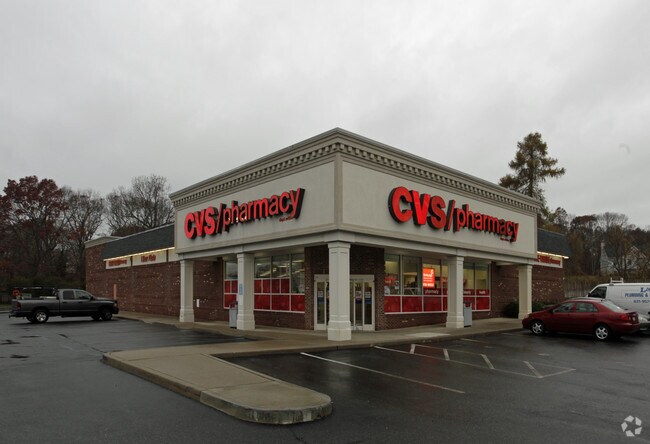
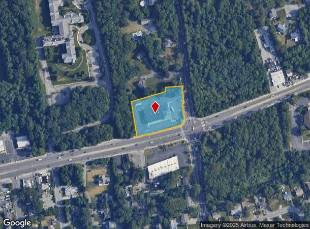
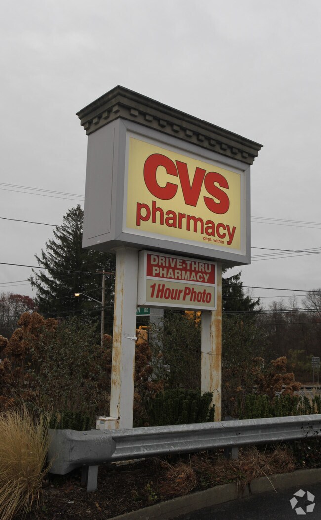
Property Record
711 Portion Rd, Ronkonkoma, NY 11779
NEARBY LISTINGS FOR SALE OR LEASE
Property Detail
711 Portion Rd
0200-650-00-01-00-002-002
Suffolk
Regionalshoppingcenterormallwithanchorstore
New York
X
2
36103C0680H
1.56 AC
2024
Central Suffolk
2024
Long Island (New York)
158608
Nassau County-Suffolk County, NY
DEMOGRAPHICS near 711 Portion Rd
1 Mile
3 Mile
5 Mile
2024 Total Population
11,213
94,228
237,453
2029 Population
10,969
92,718
233,783
Pop Growth 2024-2029
(2.18%)
(1.60%)
(1.55%)
Average Age
43
41
42
2024 Total Households
3,903
31,047
81,691
HH Growth 2024-2029
(2.31%)
(1.80%)
(1.71%)
Median Household Inc
$107,857
$117,788
$114,779
Avg Household Size
2.80
2.90
2.80
2024 Avg HH Vehicles
2.00
2.00
2.00
Median Home Value
$432,293
$441,640
$450,955
Median Year Built
1970
1970
1972
Nearby Places
Map Layers
Map Styles
 Street
 Aerial
- Restaurants
- Banks
- Shops
- Fitness
- Groceries
PUBLIC TRANSPORTATION
COMMUTER RAIL
Ronkonkoma Station (Greenport Branch - Long Island Rail Road, Ronkonkoma Branch - Long Island Rail Road)
DRIVE
WALK
Distance
Ronkonkoma Station (Greenport Branch - Long Island Rail Road, Ronkonkoma Branch - Long Island Rail Road)
9 min
3.6 mi
Medford Station (Greenport Branch - Long Island Rail Road)
DRIVE
WALK
Distance
Medford Station (Greenport Branch - Long Island Rail Road)
12 min
6.1 mi
AIRPORT
Long Island MacArthur
DRIVE
WALK
Distance
Long Island MacArthur
15 min
6.2 mi
Tweed/New Haven
DRIVE
WALK
Distance
Tweed/New Haven
133 min
49.6 mi
Nearby Properties
Address
Land Use
TOTAL SIZE
Lot Size
Zoning
Address
Land Use
TOTAL SIZE
Lot Size
Zoning
95.19 AC
Address
Land Use
TOTAL SIZE
Lot Size
Zoning
23.50 AC
AA
Address
Land Use
TOTAL SIZE
Lot Size
Zoning
25.90 AC
Address
Land Use
TOTAL SIZE
Lot Size
Zoning
140.10 AC
Address
Land Use
TOTAL SIZE
Lot Size
Zoning
19.70 AC
AA
Address
Land Use
TOTAL SIZE
Lot Size
Zoning
Address
Land Use
TOTAL SIZE
Lot Size
Zoning
6,486 SF
0.55 AC
VILLA
Address
Land Use
TOTAL SIZE
Lot Size
Zoning
8.60 AC
IND1
Address
Land Use
TOTAL SIZE
Lot Size
Zoning
6.12 AC
AA
Address
Land Use
TOTAL SIZE
Lot Size
Zoning
0.55 AC
VILLA
Address
Land Use
TOTAL SIZE
Lot Size
Zoning
7.33 AC
Address
Land Use
TOTAL SIZE
Lot Size
Zoning
10.60 AC
A
Address
Land Use
TOTAL SIZE
Lot Size
Zoning
32.41 AC
AA
Address
Land Use
TOTAL SIZE
Lot Size
Zoning
21.20 AC
AA
Address
Land Use
TOTAL SIZE
Lot Size
Zoning
0.49 AC
VILLA
Address
Land Use
TOTAL SIZE
Lot Size
Zoning
17.76 AC
Address
Land Use
TOTAL SIZE
Lot Size
Zoning
Address
Land Use
TOTAL SIZE
Lot Size
Zoning
2.10 AC
CAA
Address
Land Use
TOTAL SIZE
Lot Size
Zoning
7.10 AC
IND1
Address
Land Use
TOTAL SIZE
Lot Size
Zoning
Address
Land Use
TOTAL SIZE
Lot Size
Zoning
32.41 AC
AA
Address
Land Use
TOTAL SIZE
Lot Size
Zoning
9.80 AC
Address
Land Use
TOTAL SIZE
Lot Size
Zoning
2,515 SF
0.13 AC
B1
Address
Land Use
TOTAL SIZE
Lot Size
Zoning
4.75 AC
BUS3
Address
Land Use
TOTAL SIZE
Lot Size
Zoning
4.48 AC
IND1
Address
Land Use
TOTAL SIZE
Lot Size
Zoning
0.12 AC
HC
Address
Land Use
TOTAL SIZE
Lot Size
Zoning
44.94 AC
Address
Land Use
TOTAL SIZE
Lot Size
Zoning
1.46 AC
IND1
Address
Land Use
TOTAL SIZE
Lot Size
Zoning
36 AC
AA
Address
Land Use
TOTAL SIZE
Lot Size
Zoning
3.52 AC
IND1
The World's #1 Commercial Real Estate Marketplace
Connect with us
© 2026 CoStar Group
The information above has been obtained from sources believed reliable. While we do not doubt its accuracy we have not verified it and make no guarantee, warranty or representation about it. It is your responsibility to independently confirm its accuracy and completeness. Any projections, opinions, assumptions, or estimates used are for example only and do not represent the current or future performance of the property. The value of this transaction to you depends on tax and other factors which should be evaluated by your tax, financial, and legal advisors. You and your advisors should conduct a careful, independent investigation of the property to determine to your satisfaction the suitability of the property for your needs.