Property Record
711 W Independence Blvd, Mount Airy, NC 27030


NEARBY LISTINGS FOR SALE OR LEASE
Property Detail
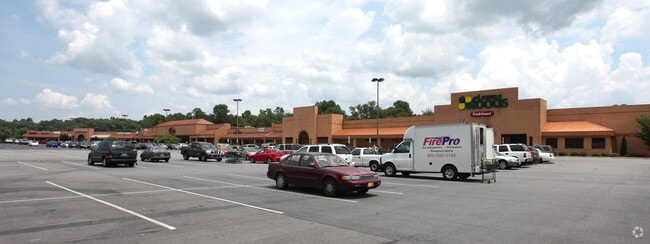
711 W Independence Blvd
5020-14-44-3726
West Pine St
Realpropertynec
PB12 PG100
AE
Surry
3711502000K
North Carolina
2025
10.33 AC
2025
Hickory/Morganton
930502
Other Market Areas
112,521 SF
Mount Airy, NC
DEMOGRAPHICS near 711 W Independence Blvd
1 Mile
3 Mile
5 Mile
2024 Total Population
4,840
18,023
28,434
2029 Population
4,940
18,253
28,657
Pop Growth 2024-2029
+ 2.07%
+ 1.28%
+ 0.78%
Average Age
42
44
43
2024 Total Households
2,247
7,990
12,280
HH Growth 2024-2029
+ 2.05%
+ 1.29%
+ 0.78%
Median Household Inc
$34,225
$45,938
$47,119
Avg Household Size
2.10
2.20
2.20
2024 Avg HH Vehicles
2.00
2.00
2.00
Median Home Value
$152,078
$157,352
$151,755
Median Year Built
1963
1972
1975
Nearby Places
Map Layers
Map Styles
 Street
 Aerial
- Restaurants
- Banks
- Shops
- Fitness
- Groceries
SALE & LEASE HISTORY
LISTING DATE
SALE/LEASE

Jan 17, 2017
For Lease
Nearby Properties
Address
Land Use
TOTAL SIZE
Lot Size
Zoning
Address
Land Use
TOTAL SIZE
Lot Size
Zoning
240,171 SF
12 AC
B5
Address
Land Use
TOTAL SIZE
Lot Size
Zoning
200,663 SF
10.49 AC
R8
Address
Land Use
TOTAL SIZE
Lot Size
Zoning
86,738 SF
29.44 AC
R6
Address
Land Use
TOTAL SIZE
Lot Size
Zoning
93,565 SF
23.80 AC
R8
Address
Land Use
TOTAL SIZE
Lot Size
Zoning
198,395 SF
20.80 AC
B4
Address
Land Use
TOTAL SIZE
Lot Size
Zoning
1,428 SF
45.45 AC
M1
Address
Land Use
TOTAL SIZE
Lot Size
Zoning
12,088 SF
37.77 AC
RL
Address
Land Use
TOTAL SIZE
Lot Size
Zoning
80,883 SF
56.99 AC
RA
Address
Land Use
TOTAL SIZE
Lot Size
Zoning
10,592 SF
18.17 AC
CU-B5
Address
Land Use
TOTAL SIZE
Lot Size
Zoning
29,624 SF
12.70 AC
B4
Address
Land Use
TOTAL SIZE
Lot Size
Zoning
77,952 SF
48 AC
HB
Address
Land Use
TOTAL SIZE
Lot Size
Zoning
52,080 SF
12.90 AC
B4
Address
Land Use
TOTAL SIZE
Lot Size
Zoning
39,024 SF
3.04 AC
B2
Address
Land Use
TOTAL SIZE
Lot Size
Zoning
79,958 SF
20.05 AC
R8
Address
Land Use
TOTAL SIZE
Lot Size
Zoning
9,180 SF
214 AC
MI
Address
Land Use
TOTAL SIZE
Lot Size
Zoning
60,016 SF
10.16 AC
R8
Address
Land Use
TOTAL SIZE
Lot Size
Zoning
108,476 SF
14.17 AC
B4
Address
Land Use
TOTAL SIZE
Lot Size
Zoning
39,656 SF
11.65 AC
B2
Address
Land Use
TOTAL SIZE
Lot Size
Zoning
162,322 SF
35 AC
M1
Address
Land Use
TOTAL SIZE
Lot Size
Zoning
60,252 SF
8.34 AC
B4
Address
Land Use
TOTAL SIZE
Lot Size
Zoning
24,213 SF
4.08 AC
B5
Address
Land Use
TOTAL SIZE
Lot Size
Zoning
48,486 SF
3.78 AC
B2
Address
Land Use
TOTAL SIZE
Lot Size
Zoning
51,045 SF
2.60 AC
R6
Address
Land Use
TOTAL SIZE
Lot Size
Zoning
32,734 SF
5.35 AC
B5
Address
Land Use
TOTAL SIZE
Lot Size
Zoning
26,394 SF
3.62 AC
M1
Address
Land Use
TOTAL SIZE
Lot Size
Zoning
36,664 SF
5.36 AC
B5
Address
Land Use
TOTAL SIZE
Lot Size
Zoning
171,232 SF
22.65 AC
M1
Address
Land Use
TOTAL SIZE
Lot Size
Zoning
43,628 SF
4.66 AC
B4
Address
Land Use
TOTAL SIZE
Lot Size
Zoning
40,840 SF
43.01 AC
M1
The World's #1 Commercial Real Estate Marketplace
Connect with us
© 2026 CoStar Group
The information above has been obtained from sources believed reliable. While we do not doubt its accuracy we have not verified it and make no guarantee, warranty or representation about it. It is your responsibility to independently confirm its accuracy and completeness. Any projections, opinions, assumptions, or estimates used are for example only and do not represent the current or future performance of the property. The value of this transaction to you depends on tax and other factors which should be evaluated by your tax, financial, and legal advisors. You and your advisors should conduct a careful, independent investigation of the property to determine to your satisfaction the suitability of the property for your needs.