Property Record
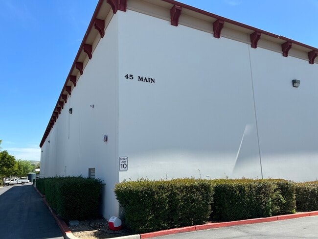
45 N Main St, Templeton, CA 93465

Property Detail
45 N Main St
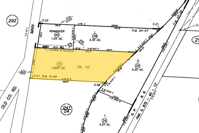
040-291-005
RHO PR PTN LT 10
Industrialacreage
SAN LUIS OBISPO
IND
California
B and X Area of moderate flood hazard, usually the area between the limits of the 100-year and 500-year floods.
10
2024
4.82 AC
2025
North 101 Corridor
013100
San Luis Obispo/Paso Robles
1,168 SF
San Luis Obispo-Paso Robles, CA
NEARBY LISTINGS FOR SALE OR LEASE
-
-
View all Templeton listings for lease on LoopNet.com
DEMOGRAPHICS near 45 N Main St
1 mile
3 mile
5 mile
2025 Total Population
3,581
10,643
38,975
2030 Population
3,544
10,490
38,399
Pop Growth 2025-2030
(1.03%)
(1.44%)
(1.48%)
Average Age
39
43
42
2025 Total Households
1,279
3,974
14,516
HH Growth 2025-2030
(1.33%)
(1.76%)
(1.74%)
Median Household Inc
$106,432
$111,033
$100,639
Avg Household Size
2.70
2.60
2.60
2025 Avg HH Vehicles
2.00
2.00
2.00
Median Home Value
$766,902
$791,269
$755,881
Median Year Built
1989
1992
1985
Nearby Places
Map Layers
Map Styles
 Street
 Aerial
Transit
 Traffic
 Biking
Places
Listings with unknown addresses are not visible on the map
- Restaurants
- Banks
- Shops
- Fitness
- Groceries
PUBLIC TRANSPORTATION
COMMUTER RAIL
Paso Robles Amtrak Station (Coast Starlight - Amtrak)
Drive
Walk
Distance
Paso Robles Amtrak Station (Coast Starlight - Amtrak)
8 min
4.9 mi
AIRPORT
San Luis County Regional
Drive
Walk
Distance
San Luis County Regional
41 min
29.5 mi
Freight Ports
The Port of Hueneme
Drive
Walk
Distance
The Port of Hueneme
198 min
156.6 mi
SALE & LEASE HISTORY
LISTING DATE
SALE/LEASE

Apr 10, 2025
For Lease
Nearby Properties
Address
Land Use
TOTAL SIZE
Lot Size
Zoning
Address
Land Use
TOTAL SIZE
Lot Size
Zoning
23,092 SF
1.38 AC
Address
Land Use
TOTAL SIZE
Lot Size
Zoning
16 AC
PF
Address
Land Use
TOTAL SIZE
Lot Size
Zoning
138.68 AC
AG
Address
Land Use
TOTAL SIZE
Lot Size
Zoning
88,191 SF
4.01 AC
CPK
Address
Land Use
TOTAL SIZE
Lot Size
Zoning
1.78 AC
CPK
Address
Land Use
TOTAL SIZE
Lot Size
Zoning
221,386 SF
10.45 AC
M
Address
Land Use
TOTAL SIZE
Lot Size
Zoning
25,298 SF
1.84 AC
RSF
Address
Land Use
TOTAL SIZE
Lot Size
Zoning
49,520 SF
1.57 AC
C2
Address
Land Use
TOTAL SIZE
Lot Size
Zoning
3.26 AC
OP
Address
Land Use
TOTAL SIZE
Lot Size
Zoning
1,448 SF
3.17 AC
C2
Address
Land Use
TOTAL SIZE
Lot Size
Zoning
46,269 SF
2.30 AC
C2
Address
Land Use
TOTAL SIZE
Lot Size
Zoning
26,256 SF
1.19 AC
OP
Address
Land Use
TOTAL SIZE
Lot Size
Zoning
64,748 SF
5.41 AC
RMF
Address
Land Use
TOTAL SIZE
Lot Size
Zoning
12 AC
CPK
Address
Land Use
TOTAL SIZE
Lot Size
Zoning
26,866 SF
2.01 AC
OP
Address
Land Use
TOTAL SIZE
Lot Size
Zoning
46,942 SF
2.82 AC
IND
Address
Land Use
TOTAL SIZE
Lot Size
Zoning
8.75 AC
Address
Land Use
TOTAL SIZE
Lot Size
Zoning
4.45 AC
OP
Address
Land Use
TOTAL SIZE
Lot Size
Zoning
7,114 SF
32.04 AC
AG
Address
Land Use
TOTAL SIZE
Lot Size
Zoning
228.80 AC
AG
Address
Land Use
TOTAL SIZE
Lot Size
Zoning
2,080 SF
2.76 AC
OP
Address
Land Use
TOTAL SIZE
Lot Size
Zoning
21,230 SF
2.36 AC
CR
Address
Land Use
TOTAL SIZE
Lot Size
Zoning
41,800 SF
3 AC
IND
Address
Land Use
TOTAL SIZE
Lot Size
Zoning
18,765 SF
1.30 AC
OP
Address
Land Use
TOTAL SIZE
Lot Size
Zoning
5.40 AC
RMF
Address
Land Use
TOTAL SIZE
Lot Size
Zoning
58,871 SF
2.95 AC
M
Address
Land Use
TOTAL SIZE
Lot Size
Zoning
11,317 SF
1.62 AC
CR
Address
Land Use
TOTAL SIZE
Lot Size
Zoning
3.94 AC
CR
Address
Land Use
TOTAL SIZE
Lot Size
Zoning
151.15 AC
AG
Address
Land Use
TOTAL SIZE
Lot Size
Zoning
1,951 SF
51.57 AC
AG
The World's #1 Commercial Real Estate Marketplace
Connect with us
© 2026 CoStar Group
The information above has been obtained from sources believed reliable. While we do not doubt its accuracy we have not verified it and make no guarantee, warranty or representation about it. It is your responsibility to independently confirm its accuracy and completeness. Any projections, opinions, assumptions, or estimates used are for example only and do not represent the current or future performance of the property. The value of this transaction to you depends on tax and other factors which should be evaluated by your tax, financial, and legal advisors. You and your advisors should conduct a careful, independent investigation of the property to determine to your satisfaction the suitability of the property for your needs.