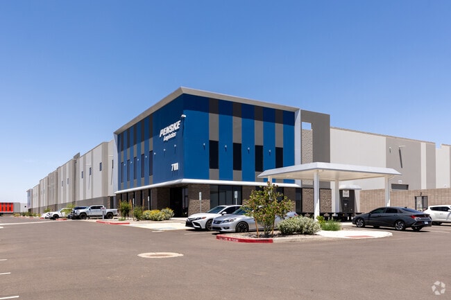
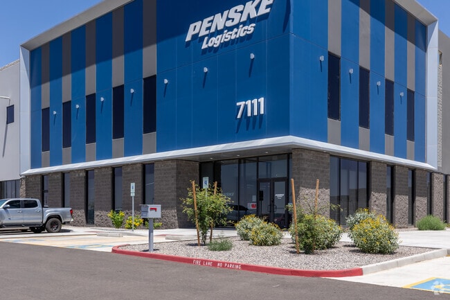
Property Record
7111 S Crismon Rd, Mesa, AZ 85212

NEARBY LISTINGS FOR SALE OR LEASE
Property Detail
7111 S Crismon Rd
Phoenix
Cubes At Mesa Gateway
Phoenix-Mesa-Chandler, AZ
CUBES AT MESA GATEWAY MCR 1654-15
304-63-977B
Maricopa
Warehouse
Arizona
2025
3
2025
85.82 AC
817600
Chandler N/Gilbert
1,200,340 SF
DEMOGRAPHICS near 7111 S Crismon Rd
1 mile
3 mile
5 mile
2024 Total Population
19
38,434
129,582
2029 Population
21
43,446
146,371
Pop Growth 2024-2029
+ 10.53%
+ 13.04%
+ 12.96%
Average Age
39
36
35
2024 Total Households
6
12,002
39,301
HH Growth 2024-2029
+ 16.67%
+ 13.34%
+ 13.19%
Median Household Inc
$175,000
$131,937
$116,592
Avg Household Size
2.30
3.20
3.20
2024 Avg HH Vehicles
2.00
2.00
2.00
Median Home Value
$466,666
$481,863
$457,467
Median Year Built
2011
2011
2010
Nearby Places
Map Layers
Map Styles
 Street
 Aerial
Transit
 Traffic
 Biking
Places
Listings with unknown addresses are not visible on the map
- Restaurants
- Banks
- Shops
- Fitness
- Groceries
PUBLIC TRANSPORTATION
AIRPORT
Phoenix-Mesa Gateway
Drive
Walk
Distance
Phoenix-Mesa Gateway
12 min
5.7 mi
Phoenix Sky Harbor International
Drive
Walk
Distance
Phoenix Sky Harbor International
49 min
33.9 mi
Freight Ports
Port of San Diego
Drive
Walk
Distance
Port of San Diego
422 min
378.9 mi
Nearby Properties
Address
Land Use
TOTAL SIZE
Lot Size
Zoning
Address
Land Use
TOTAL SIZE
Lot Size
Zoning
284.14 AC
Address
Land Use
TOTAL SIZE
Lot Size
Zoning
3,034 SF
70.88 AC
Address
Land Use
TOTAL SIZE
Lot Size
Zoning
64.72 AC
LI
Address
Land Use
TOTAL SIZE
Lot Size
Zoning
15.22 AC
Address
Land Use
TOTAL SIZE
Lot Size
Zoning
75,378 SF
10.36 AC
Address
Land Use
TOTAL SIZE
Lot Size
Zoning
39.46 AC
Address
Land Use
TOTAL SIZE
Lot Size
Zoning
37.68 AC
Address
Land Use
TOTAL SIZE
Lot Size
Zoning
161,001 SF
1.15 AC
R5
Address
Land Use
TOTAL SIZE
Lot Size
Zoning
1,342,987 SF
225.90 AC
I-2
Address
Land Use
TOTAL SIZE
Lot Size
Zoning
20.68 AC
Address
Land Use
TOTAL SIZE
Lot Size
Zoning
1,069,038 SF
69.72 AC
Address
Land Use
TOTAL SIZE
Lot Size
Zoning
477,934 SF
24.18 AC
MU
Address
Land Use
TOTAL SIZE
Lot Size
Zoning
227,555 SF
53.44 AC
R-43
Address
Land Use
TOTAL SIZE
Lot Size
Zoning
21,010 SF
2.72 AC
I-1
Address
Land Use
TOTAL SIZE
Lot Size
Zoning
19.83 AC
Address
Land Use
TOTAL SIZE
Lot Size
Zoning
463,567 SF
135.55 AC
I-2
Address
Land Use
TOTAL SIZE
Lot Size
Zoning
152,549 SF
60 AC
PC
Address
Land Use
TOTAL SIZE
Lot Size
Zoning
278,147 SF
49.82 AC
I-2
Address
Land Use
TOTAL SIZE
Lot Size
Zoning
614,544 SF
35.40 AC
Address
Land Use
TOTAL SIZE
Lot Size
Zoning
269,550 SF
63.63 AC
Address
Land Use
TOTAL SIZE
Lot Size
Zoning
420,631 SF
23.19 AC
Address
Land Use
TOTAL SIZE
Lot Size
Zoning
218,680 SF
8.50 AC
PC
Address
Land Use
TOTAL SIZE
Lot Size
Zoning
178,266 SF
16.32 AC
Address
Land Use
TOTAL SIZE
Lot Size
Zoning
121,297 SF
27.91 AC
Address
Land Use
TOTAL SIZE
Lot Size
Zoning
270,126 SF
12.65 AC
C-TC
Address
Land Use
TOTAL SIZE
Lot Size
Zoning
163,373 SF
16.44 AC
MDR
Address
Land Use
TOTAL SIZE
Lot Size
Zoning
127,184 SF
14.80 AC
R-43
Address
Land Use
TOTAL SIZE
Lot Size
Zoning
228,634 SF
154.38 AC
I-1
Address
Land Use
TOTAL SIZE
Lot Size
Zoning
216,568 SF
22.18 AC
C-G
The World's #1 Commercial Real Estate Marketplace
Connect with us
© 2026 CoStar Group
The information above has been obtained from sources believed reliable. While we do not doubt its accuracy we have not verified it and make no guarantee, warranty or representation about it. It is your responsibility to independently confirm its accuracy and completeness. Any projections, opinions, assumptions, or estimates used are for example only and do not represent the current or future performance of the property. The value of this transaction to you depends on tax and other factors which should be evaluated by your tax, financial, and legal advisors. You and your advisors should conduct a careful, independent investigation of the property to determine to your satisfaction the suitability of the property for your needs.