Property Record
7114 Winchester Rd, Memphis, TN 38125

NEARBY LISTINGS FOR SALE OR LEASE
Property Detail
7114 Winchester Rd
09-3500-0-0566
Market Of Riverdale Bend Pd Phase 1
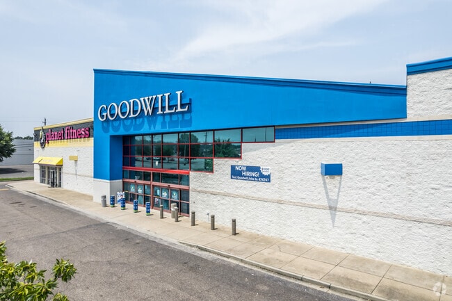
Departmentstore
PRIOR REF: 1270/4750
X
Shelby
47157C0465F
Tennessee
2024
14.30 AC
2025
Southeast
021724
Memphis
152,735 SF
Memphis, TN-MS-AR
DEMOGRAPHICS near 7114 Winchester Rd
1 Mile
3 Mile
5 Mile
2024 Total Population
7,669
93,810
185,133
2029 Population
7,442
91,642
181,569
Pop Growth 2024-2029
(2.96%)
(2.31%)
(1.93%)
Average Age
37
37
38
2024 Total Households
3,061
36,901
72,410
HH Growth 2024-2029
(3.01%)
(2.25%)
(1.93%)
Median Household Inc
$55,811
$61,012
$69,240
Avg Household Size
2.40
2.50
2.50
2024 Avg HH Vehicles
2.00
2.00
2.00
Median Home Value
$165,643
$196,677
$250,117
Median Year Built
1982
1984
1983
Nearby Places
Map Layers
Map Styles
 Street
 Aerial
- Restaurants
- Banks
- Shops
- Fitness
- Groceries
PUBLIC TRANSPORTATION
AIRPORT
Memphis International
DRIVE
WALK
Distance
Memphis International
17 min
9.9 mi
Freight Ports
Port of Shreveport
DRIVE
WALK
Distance
Port of Shreveport
421 min
384.0 mi
SALE & LEASE HISTORY
LISTING DATE
SALE/LEASE

Sep 25, 2016
For Lease
Jun 11, 2025
For Lease
Jul 26, 2022
For Lease
Nearby Properties
Address
Land Use
TOTAL SIZE
Lot Size
Zoning
Address
Land Use
TOTAL SIZE
Lot Size
Zoning
73.56 AC
CA
Address
Land Use
TOTAL SIZE
Lot Size
Zoning
451,249 SF
24.28 AC
RU-2
Address
Land Use
TOTAL SIZE
Lot Size
Zoning
704,564 SF
28.30 AC
EMP
Address
Land Use
TOTAL SIZE
Lot Size
Zoning
184,120 SF
11.11 AC
EMP
Address
Land Use
TOTAL SIZE
Lot Size
Zoning
419,065 SF
19.92 AC
EMP
Address
Land Use
TOTAL SIZE
Lot Size
Zoning
52,688 SF
24.38 AC
CA
Address
Land Use
TOTAL SIZE
Lot Size
Zoning
262,984 SF
8.09 AC
R-TH
Address
Land Use
TOTAL SIZE
Lot Size
Zoning
251,597 SF
26.90 AC
EMP
Address
Land Use
TOTAL SIZE
Lot Size
Zoning
350,298 SF
12.68 AC
EMP
Address
Land Use
TOTAL SIZE
Lot Size
Zoning
330,758 SF
12.09 AC
EMP
Address
Land Use
TOTAL SIZE
Lot Size
Zoning
239,276 SF
17.72 AC
EMP
Address
Land Use
TOTAL SIZE
Lot Size
Zoning
51,600 SF
24.06 AC
RU-3
Address
Land Use
TOTAL SIZE
Lot Size
Zoning
67,052 SF
21.65 AC
R-15
Address
Land Use
TOTAL SIZE
Lot Size
Zoning
38,566 SF
27.90 AC
CA
Address
Land Use
TOTAL SIZE
Lot Size
Zoning
64,994 SF
19.07 AC
RU-2
Address
Land Use
TOTAL SIZE
Lot Size
Zoning
48,768 SF
7.51 AC
R-8
Address
Land Use
TOTAL SIZE
Lot Size
Zoning
142,971 SF
29.84 AC
R-15
Address
Land Use
TOTAL SIZE
Lot Size
Zoning
813,591 SF
37.02 AC
EMP
Address
Land Use
TOTAL SIZE
Lot Size
Zoning
91,664 SF
9.57 AC
SC-1
Address
Land Use
TOTAL SIZE
Lot Size
Zoning
176,176 SF
26.62 AC
R-8
Address
Land Use
TOTAL SIZE
Lot Size
Zoning
259,286 SF
12.76 AC
RU-3
Address
Land Use
TOTAL SIZE
Lot Size
Zoning
592,766 SF
26.76 AC
EMP
Address
Land Use
TOTAL SIZE
Lot Size
Zoning
500,000 SF
22.75 AC
EMP
Address
Land Use
TOTAL SIZE
Lot Size
Zoning
224,407 SF
23.22 AC
R-8
Address
Land Use
TOTAL SIZE
Lot Size
Zoning
34,700 SF
5.83 AC
R-10
Address
Land Use
TOTAL SIZE
Lot Size
Zoning
113,990 SF
9.07 AC
R-15
Address
Land Use
TOTAL SIZE
Lot Size
Zoning
88,484 SF
15.28 AC
RU-3
Address
Land Use
TOTAL SIZE
Lot Size
Zoning
79,884 SF
16.73 AC
CMU-2
Address
Land Use
TOTAL SIZE
Lot Size
Zoning
35,001 SF
33.60 AC
R-10
Address
Land Use
TOTAL SIZE
Lot Size
Zoning
414,374 SF
19.74 AC
EMP
The World's #1 Commercial Real Estate Marketplace
Connect with us
© 2026 CoStar Group
The information above has been obtained from sources believed reliable. While we do not doubt its accuracy we have not verified it and make no guarantee, warranty or representation about it. It is your responsibility to independently confirm its accuracy and completeness. Any projections, opinions, assumptions, or estimates used are for example only and do not represent the current or future performance of the property. The value of this transaction to you depends on tax and other factors which should be evaluated by your tax, financial, and legal advisors. You and your advisors should conduct a careful, independent investigation of the property to determine to your satisfaction the suitability of the property for your needs.