Property Record
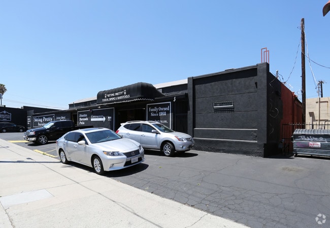
7115 Darby Ave, Reseda, CA 91335


This Property Is For Sale
Current Lease Availabilities
Property Detail
7115 Darby Ave
2125-002-007
MARIAN LOT 4 BLK 10
Warehouse
Los Angeles
LAM1
California
B and X Area of moderate flood hazard, usually the area between the limits of the 100-year and 500-year floods.
4
2024
0.77 AC
2025
West San Fernando Valley
132301
Los Angeles
22,913 SF
Los Angeles-Long Beach-Glendale, CA
NEARBY LISTINGS FOR SALE OR LEASE
DEMOGRAPHICS near 7115 Darby Ave
1 mile
3 mile
5 mile
2025 Total Population
40,411
243,709
618,730
2030 Population
40,430
243,822
620,373
Pop Growth 2025-2030
+ 0.05%
+ 0.05%
+ 0.27%
Average Age
40
41
40
2025 Total Households
12,600
82,316
212,542
HH Growth 2025-2030
(0.23%)
(0.14%)
+ 0.14%
Median Household Inc
$73,042
$85,433
$85,042
Avg Household Size
3.00
2.80
2.80
2025 Avg HH Vehicles
2.00
2.00
2.00
Median Home Value
$736,179
$788,413
$828,988
Median Year Built
1968
1967
1971
Nearby Places
Map Layers
Map Styles
 Street
 Aerial
Layers
 Traffic
 Biking
Places
Listings with unknown addresses are not visible on the map
- Restaurants
- Banks
- Shops
- Fitness
- Groceries
PUBLIC TRANSPORTATION
COMMUTER RAIL
Northridge (Ventura County Line - Southern California Regional Rail Authority (Metrolink))
Drive
Walk
Distance
Northridge (Ventura County Line - Southern California Regional Rail Authority (Metrolink))
8 min
2.8 mi
Drive
Walk
Distance
7 min
2.8 mi
AIRPORT
Bob Hope
Drive
Walk
Distance
Bob Hope
21 min
10.1 mi
Los Angeles International
Drive
Walk
Distance
Los Angeles International
35 min
23.7 mi
Long Beach (Daugherty Field)
Drive
Walk
Distance
Long Beach (Daugherty Field)
54 min
41.2 mi
Freight Ports
Port of Long Beach
Drive
Walk
Distance
Port of Long Beach
56 min
43.1 mi
Nearby Properties
Address
Land Use
TOTAL SIZE
Lot Size
Zoning
Address
Land Use
TOTAL SIZE
Lot Size
Zoning
461,531 SF
11.22 AC
LAC2
Address
Land Use
TOTAL SIZE
Lot Size
Zoning
300,266 SF
7.29 AC
LAR4
Address
Land Use
TOTAL SIZE
Lot Size
Zoning
546,652 SF
4.27 AC
LAC2
Address
Land Use
TOTAL SIZE
Lot Size
Zoning
439,930 SF
22.16 AC
LAM2
Address
Land Use
TOTAL SIZE
Lot Size
Zoning
257,873 SF
2.52 AC
Address
Land Use
TOTAL SIZE
Lot Size
Zoning
260,991 SF
3.32 AC
LAC2
Address
Land Use
TOTAL SIZE
Lot Size
Zoning
191,058 SF
5.31 AC
LAR3
Address
Land Use
TOTAL SIZE
Lot Size
Zoning
273,911 SF
8.40 AC
LARA
Address
Land Use
TOTAL SIZE
Lot Size
Zoning
237,082 SF
2.17 AC
LARA
Address
Land Use
TOTAL SIZE
Lot Size
Zoning
318,083 SF
2.36 AC
LAC2
Address
Land Use
TOTAL SIZE
Lot Size
Zoning
219,126 SF
6.06 AC
LAR1
Address
Land Use
TOTAL SIZE
Lot Size
Zoning
216,121 SF
6.10 AC
LAC4
Address
Land Use
TOTAL SIZE
Lot Size
Zoning
281,941 SF
9.10 AC
LAC4
Address
Land Use
TOTAL SIZE
Lot Size
Zoning
111,876 SF
3.72 AC
LAC2
Address
Land Use
TOTAL SIZE
Lot Size
Zoning
210,268 SF
3.82 AC
LAP
Address
Land Use
TOTAL SIZE
Lot Size
Zoning
117,604 SF
2.65 AC
LAR3
Address
Land Use
TOTAL SIZE
Lot Size
Zoning
173,231 SF
1.58 AC
LAR3
Address
Land Use
TOTAL SIZE
Lot Size
Zoning
657,547 SF
6.85 AC
LAC4
Address
Land Use
TOTAL SIZE
Lot Size
Zoning
138,260 SF
1.29 AC
LAC2
Address
Land Use
TOTAL SIZE
Lot Size
Zoning
353,563 SF
9.37 AC
LAC2
Address
Land Use
TOTAL SIZE
Lot Size
Zoning
323,511 SF
7.58 AC
LAC1
Address
Land Use
TOTAL SIZE
Lot Size
Zoning
250,462 SF
1.85 AC
LAP
Address
Land Use
TOTAL SIZE
Lot Size
Zoning
124,534 SF
7.47 AC
LAC2
Address
Land Use
TOTAL SIZE
Lot Size
Zoning
653,215 SF
15.49 AC
LAC4
Address
Land Use
TOTAL SIZE
Lot Size
Zoning
95,584 SF
4.27 AC
LAM1
Address
Land Use
TOTAL SIZE
Lot Size
Zoning
134,103 SF
1 AC
LAC2
Address
Land Use
TOTAL SIZE
Lot Size
Zoning
153,783 SF
5.14 AC
LAC2
Address
Land Use
TOTAL SIZE
Lot Size
Zoning
146,790 SF
1.85 AC
LAR3
The World's #1 Commercial Real Estate Marketplace
Connect with us
© 2026 CoStar Group
The information above has been obtained from sources believed reliable. While we do not doubt its accuracy we have not verified it and make no guarantee, warranty or representation about it. It is your responsibility to independently confirm its accuracy and completeness. Any projections, opinions, assumptions, or estimates used are for example only and do not represent the current or future performance of the property. The value of this transaction to you depends on tax and other factors which should be evaluated by your tax, financial, and legal advisors. You and your advisors should conduct a careful, independent investigation of the property to determine to your satisfaction the suitability of the property for your needs.