Property Record
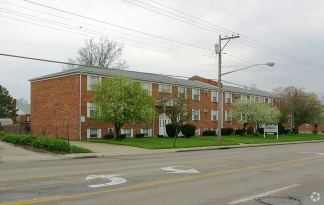
7115 Hamilton Ave, Cincinnati, OH 45231


Property Detail
7115 Hamilton Ave
Cincinnati, OH-KY-IN
REAR NORCOL LANE 10 X 140IRR PT LOTS 16-17 NO COLLHILL SUB BLK L
595-0001-0651
Hamilton
Apartment
Ohio
B and X Area of moderate flood hazard, usually the area between the limits of the 100-year and 500-year floods.
16-17
2025
0.74 AC
2025
North College Hill
021801
Cincinnati/Dayton
16,831 SF
NEARBY LISTINGS FOR SALE OR LEASE
DEMOGRAPHICS near 7115 Hamilton Ave
1 mile
3 mile
5 mile
2025 Total Population
15,344
100,211
206,213
2030 Population
15,396
101,053
207,650
Pop Growth 2025-2030
+ 0.34%
+ 0.84%
+ 0.70%
Average Age
39
40
40
2025 Total Households
6,390
40,735
83,971
HH Growth 2025-2030
+ 0.22%
+ 0.78%
+ 0.67%
Median Household Inc
$53,316
$60,351
$63,921
Avg Household Size
2.30
2.40
2.30
2025 Avg HH Vehicles
2.00
2.00
2.00
Median Home Value
$134,373
$178,059
$196,332
Median Year Built
1953
1961
1962
Nearby Places
Map Layers
Map Styles
 Street
 Aerial
Layers
 Traffic
 Biking
Places
Listings with unknown addresses are not visible on the map
- Restaurants
- Banks
- Shops
- Fitness
- Groceries
PUBLIC TRANSPORTATION
COMMUTER RAIL
Cincinnati Union Terminal (Cardinal - Amtrak)
Drive
Walk
Distance
Cincinnati Union Terminal (Cardinal - Amtrak)
20 min
8.9 mi
AIRPORT
Cincinnati/Northern Kentucky International
Drive
Walk
Distance
Cincinnati/Northern Kentucky International
44 min
22.9 mi
Freight Ports
Port of Toledo
Drive
Walk
Distance
Port of Toledo
234 min
201.2 mi
Nearby Properties
Address
Land Use
TOTAL SIZE
Lot Size
Zoning
Address
Land Use
TOTAL SIZE
Lot Size
Zoning
26.16 AC
Address
Land Use
TOTAL SIZE
Lot Size
Zoning
112.35 AC
RM20
Address
Land Use
TOTAL SIZE
Lot Size
Zoning
Address
Land Use
TOTAL SIZE
Lot Size
Zoning
11,639 SF
7.87 AC
R2
Address
Land Use
TOTAL SIZE
Lot Size
Zoning
60.86 AC
Address
Land Use
TOTAL SIZE
Lot Size
Zoning
24.69 AC
Address
Land Use
TOTAL SIZE
Lot Size
Zoning
13.08 AC
Address
Land Use
TOTAL SIZE
Lot Size
Zoning
5,984 SF
15.91 AC
Address
Land Use
TOTAL SIZE
Lot Size
Zoning
20.07 AC
B2
Address
Land Use
TOTAL SIZE
Lot Size
Zoning
30.43 AC
Address
Land Use
TOTAL SIZE
Lot Size
Zoning
41,564 SF
13.21 AC
Address
Land Use
TOTAL SIZE
Lot Size
Zoning
59,744 SF
31.77 AC
Address
Land Use
TOTAL SIZE
Lot Size
Zoning
88.15 AC
ML
Address
Land Use
TOTAL SIZE
Lot Size
Zoning
11,664 SF
29.27 AC
RM20
Address
Land Use
TOTAL SIZE
Lot Size
Zoning
103.18 AC
R1A
Address
Land Use
TOTAL SIZE
Lot Size
Zoning
52,138 SF
17.43 AC
Address
Land Use
TOTAL SIZE
Lot Size
Zoning
50.02 AC
Address
Land Use
TOTAL SIZE
Lot Size
Zoning
1,302 SF
11.62 AC
Address
Land Use
TOTAL SIZE
Lot Size
Zoning
60,614 SF
13.35 AC
SF6
Address
Land Use
TOTAL SIZE
Lot Size
Zoning
Address
Land Use
TOTAL SIZE
Lot Size
Zoning
4,800 SF
7.20 AC
Address
Land Use
TOTAL SIZE
Lot Size
Zoning
60.59 AC
Address
Land Use
TOTAL SIZE
Lot Size
Zoning
2,400 SF
0.35 AC
R1
Address
Land Use
TOTAL SIZE
Lot Size
Zoning
121,747 SF
23.05 AC
R3
Address
Land Use
TOTAL SIZE
Lot Size
Zoning
Address
Land Use
TOTAL SIZE
Lot Size
Zoning
27.60 AC
Address
Land Use
TOTAL SIZE
Lot Size
Zoning
28.25 AC
Address
Land Use
TOTAL SIZE
Lot Size
Zoning
9,982 SF
36.33 AC
Address
Land Use
TOTAL SIZE
Lot Size
Zoning
1,860 SF
12.01 AC
A2
Address
Land Use
TOTAL SIZE
Lot Size
Zoning
20.33 AC
SF6
The World's #1 Commercial Real Estate Marketplace
Connect with us
© 2026 CoStar Group
The information above has been obtained from sources believed reliable. While we do not doubt its accuracy we have not verified it and make no guarantee, warranty or representation about it. It is your responsibility to independently confirm its accuracy and completeness. Any projections, opinions, assumptions, or estimates used are for example only and do not represent the current or future performance of the property. The value of this transaction to you depends on tax and other factors which should be evaluated by your tax, financial, and legal advisors. You and your advisors should conduct a careful, independent investigation of the property to determine to your satisfaction the suitability of the property for your needs.