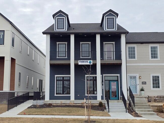
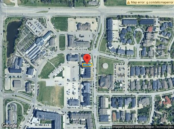
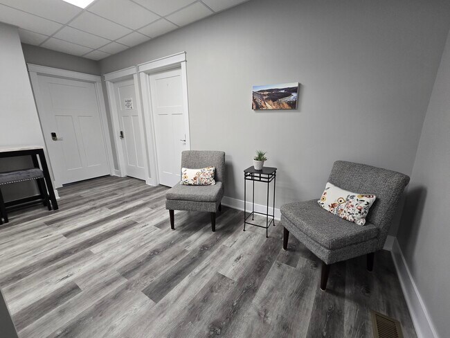
Property Record
7115 Kentwell Ln, Lincoln, NE 68516
Current Lease Availabilities
NEARBY LISTINGS FOR SALE OR LEASE
Property Detail
7115 Kentwell Ln
Lincoln, NE
Village Gardens 18Th Addition
16-21-167-004-000
VILLAGE GARDENS 18TH ADDITION, LOT 4
Commercialnec
Lancaster
X
Nebraska
31109C0432F
4
2024
0.07 AC
2025
Far South
003714
Lincoln
3,310 SF
DEMOGRAPHICS near 7115 Kentwell Ln
1 Mile
3 Mile
5 Mile
2024 Total Population
8,433
73,604
134,265
2029 Population
8,703
76,130
138,445
Pop Growth 2024-2029
+ 3.20%
+ 3.43%
+ 3.11%
Average Age
39
40
41
2024 Total Households
3,093
29,503
55,600
HH Growth 2024-2029
+ 3.27%
+ 3.36%
+ 3.10%
Median Household Inc
$121,714
$94,599
$81,460
Avg Household Size
2.70
2.50
2.40
2024 Avg HH Vehicles
2.00
2.00
2.00
Median Home Value
$345,505
$299,114
$272,880
Median Year Built
2002
1995
1981
Nearby Places
- Restaurants
- Banks
- Shops
- Fitness
- Groceries
PUBLIC TRANSPORTATION
COMMUTER RAIL
DRIVE
WALK
Distance
17 min
8.3 mi
AIRPORT
Lincoln
DRIVE
WALK
Distance
Lincoln
23 min
13.1 mi
Nearby Properties
Address
Land Use
TOTAL SIZE
Lot Size
Zoning
Address
Land Use
TOTAL SIZE
Lot Size
Zoning
329,069 SF
30 AC
R6
Address
Land Use
TOTAL SIZE
Lot Size
Zoning
121,132 SF
12.54 AC
B5
Address
Land Use
TOTAL SIZE
Lot Size
Zoning
48,378 SF
9.53 AC
R5
Address
Land Use
TOTAL SIZE
Lot Size
Zoning
213,738 SF
14.97 AC
B5
Address
Land Use
TOTAL SIZE
Lot Size
Zoning
61,818 SF
12.38 AC
B5
Address
Land Use
TOTAL SIZE
Lot Size
Zoning
185,015 SF
38.72 AC
AGR
Address
Land Use
TOTAL SIZE
Lot Size
Zoning
17,070 SF
8.95 AC
R3
Address
Land Use
TOTAL SIZE
Lot Size
Zoning
75,371 SF
12.46 AC
R3
Address
Land Use
TOTAL SIZE
Lot Size
Zoning
188,540 SF
4.57 AC
Address
Land Use
TOTAL SIZE
Lot Size
Zoning
126,172 SF
5.46 AC
B2
Address
Land Use
TOTAL SIZE
Lot Size
Zoning
172,989 SF
6.16 AC
Address
Land Use
TOTAL SIZE
Lot Size
Zoning
44,957 SF
7.93 AC
R4
Address
Land Use
TOTAL SIZE
Lot Size
Zoning
24,771 SF
11.45 AC
R5
Address
Land Use
TOTAL SIZE
Lot Size
Zoning
131,316 SF
26.31 AC
R3
Address
Land Use
TOTAL SIZE
Lot Size
Zoning
65,640 SF
7.24 AC
B5
Address
Land Use
TOTAL SIZE
Lot Size
Zoning
90,362 SF
2.53 AC
B3
Address
Land Use
TOTAL SIZE
Lot Size
Zoning
57,434 SF
15.62 AC
R4
Address
Land Use
TOTAL SIZE
Lot Size
Zoning
169,890 SF
3.05 AC
O3
Address
Land Use
TOTAL SIZE
Lot Size
Zoning
32,854 SF
22.09 AC
NULL
Address
Land Use
TOTAL SIZE
Lot Size
Zoning
81,149 SF
6.46 AC
R5
Address
Land Use
TOTAL SIZE
Lot Size
Zoning
22,324 SF
16.59 AC
NULL
Address
Land Use
TOTAL SIZE
Lot Size
Zoning
14,637 SF
18.90 AC
NULL
Address
Land Use
TOTAL SIZE
Lot Size
Zoning
68,664 SF
7 AC
NULL
Address
Land Use
TOTAL SIZE
Lot Size
Zoning
16,284 SF
8.77 AC
NULL
Address
Land Use
TOTAL SIZE
Lot Size
Zoning
39,968 SF
13.41 AC
NULL
Address
Land Use
TOTAL SIZE
Lot Size
Zoning
82,644 SF
18.57 AC
R3
Address
Land Use
TOTAL SIZE
Lot Size
Zoning
67,029 SF
17.26 AC
R3
Address
Land Use
TOTAL SIZE
Lot Size
Zoning
129,038 SF
17.43 AC
O3
Address
Land Use
TOTAL SIZE
Lot Size
Zoning
86,718 SF
7.16 AC
NULL
Address
Land Use
TOTAL SIZE
Lot Size
Zoning
78,993 SF
3.56 AC
H4
The World's #1 Commercial Real Estate Marketplace
Connect with us
© 2025 CoStar Group
The information above has been obtained from sources believed reliable. While we do not doubt its accuracy we have not verified it and make no guarantee, warranty or representation about it. It is your responsibility to independently confirm its accuracy and completeness. Any projections, opinions, assumptions, or estimates used are for example only and do not represent the current or future performance of the property. The value of this transaction to you depends on tax and other factors which should be evaluated by your tax, financial, and legal advisors. You and your advisors should conduct a careful, independent investigation of the property to determine to your satisfaction the suitability of the property for your needs.